Last week we had a short holiday to visit our daughter and grandchildren in Auckland. We decided to make a detour via
New Plymouth, so that we could ride the
Coastal Walkway. This is an 11km stretch of wide, smooth concrete path along the waterfront, specially designed for walkers and cyclists. At the city end it runs along the top of a seawall, made up of large boulders. Further north, it skirts beaches, sand hills and farmland.
 |
| The seawall is made of large boulders (photo by John) |
We had enjoyed walking much of this walkway on previous visits to New Plymouth, and thought it would be great to cycle along it. We needed just one day to cycle the track, so booked two nights in “
The Urban Bach”, a delightful cottage, where we had stayed before, and which I can heartily recommend.
I had been watching the weather forecasts all week, hoping that the heavy rain storms due to come in from the south, were not going to eventuate. We left Wellington in the pouring rain, but by the time we got to New Plymouth, in the late afternoon, it was almost fine. However, the nasty stuff returned overnight, and we woke to torrential rain. Fortunately by 11am, it had abated to intermittent showers, so we decided to brave the wet, and go riding anyway.
We parked near the port breakwater, right at the south-western end of the coastal track. As we were getting ready, a jogger coming off the track to return to his car warned us that there was a seal on the rocks by the swimming pool. He said it had given him "a hell of a fright", so we should watch out for it.
 |
| Getting the bikes ready for our ride |
The track is super-smooth concrete – a pleasure to ride on. It is wide enough for walkers and cyclists to share, though today there weren’t many of either about. Despite the weather and dark-ish skies John took a lot of pictures.
 |
| The path is super-smooth. Len Lye's Wind Wand is on the right (photo by John) |
Even with the jogger’s warning to be on the look-out for the seal, it took John completely by surprise. As we came round a corner near the swimming pool, it suddenly reared up, lunged at John as he was cycling past, and barked at him. John hadn’t seen it at all, so completely did it blend into the rocks. The boulders are dark brown and black and quite rounded – perfect camouflage for a fat, dark brown seal.
 |
| The seal is perfectly camouflaged among the rocks (photo by John) |
I was behind John, so I saw the seal wriggling back down, and steered well clear of it on the far side of the track. Of course John parked his bike, and cautiously went back to take a picture of it. Seals can be quite nasty, so you don’t want to get up too close.
When we got close to the
Wind Wand, it started to rain quite hard. John went down the ramp that leads to the underpass under the main road to cross towards
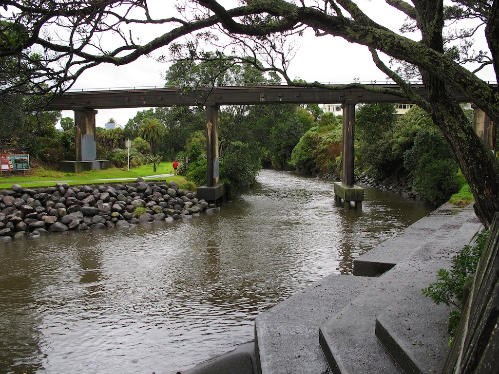
Puke Ariki (New Plymouth's museum and library complex). I didn’t know why he went there, because the track continued across a bridge over a small stream. But it turned out that he just wanted to shelter under the bridge. I figured it was only water and we were wet already, so I carried on. He soon followed me.
It really wasn’t too bad, as there was no wind, and it was not cold. The track went along in front of a cliff face with beautiful sculptural textures. Sandstone, probably of volcanic origin, shaped by the wind and the water.
 |
| Sculptural textures on the cliff face (photo by John) |
Past the Te Henui Stream, over the bridge towards the surf beach. Last summer there was a coffee-and-icecream caravan here, and a quirky row of old, but wonderfully comfortable, armchairs. No armchairs there now, of course, and no coffee caravan either.
 |
In summer, there are comfy armchairs in which to enjoy a rest, a coffee and a gaze out to sea
(photo by John, November 2012) |
On past the East End Surf Life Saving Club. When we got to the Fitzroy motorcamp, I stopped under a canopy to put my hood on under my helmet, as the rain was dripping into the slits in my helmet.
After the motorcamp, the track wound through the sand dunes – not much sand, but lots of flax and shrubs – very pretty. A few ups and downs, nothing I couldn’t cope with. Even so, my thigh muscles do find it very hard to go up any kind of slope, even a very gentle one. Maybe I should do some quad-strengthening exercises …
 |
| A wet, wriggly path in the sand dunes |
Before long we saw the stunningly beautiful
Te Rewa Rewa bridge across the Waiwhakaiho River. This is an award-winning bridge, built specially for the walkway, to connect New Plymouth with the town of Bell Block.
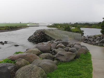 |
| A little bridge, leading to the Te Rewa Rewa Bridge, in the distance (photo by John) |
Its design is reminiscent both of an unfurling wave, and a whale skeleton. It is angled in such a way that on a cloudless day, you can see
Mt Taranaki framed by its curving ribs.
 |
| John cycling on the Te Rewa Rewa Bridge |
 |
| On a clear day, the bridge frames Mt Taranaki to perfection (photo by John, November 2012) |
The rain had stopped by this stage, and of course we took photos, but Mt Taranaki was shrouded in clouds and mist. However, even on a dull day, the bridge makes an impressive statement.
 |
| View from the Te Rewa Rewa Bridge |
We crossed the bridge and carried on along the track towards Bell Block. Through rolling paddocks, behind the sand dunes.Then along on a boardwalk amongst the flax, and to a look-out from where we could see the wide beach, and the sweep of the coast towards the city. It would have been nice to sit here and have a snack, but the seat was rather wet.
 |
| A nice place for a rest, but rather wet |
Then the track turned inland towards Bell Block, and we had to go up and down some rises, which I didn’t much like. I had to get off and walk a few times. A major hump turned out to be a bridge over an underpass for cows on their way to the milking shed. From the top, we could see the suburban houses, and also a small herd of cows. I was happy to turn around right here, but John wanted to take a closer look at the cows. They were actually heifers, I think – young animals anyway. The paddocks on each side of the track were very soggy indeed and there were quite a few puddles on the track too.
 |
| Cattle, soggy paddocks and large puddles (photo by John) |
 |
| View towards the sea from the top of the hump |
The sky kept changing from dark clouds, to actually showing some blue sky dotted with big white clouds, and back to threatening rain.
 |
| Changeable skies and threatening rain (photo by John) |
On the return trip, after crossing the Te Rewa Rewa Bridge again, we deviated from the walkway to ride halfway around Lake Rotomanu, a small lake surrounded by beautiful trees and lovely picnic spots. We saw a gaggle of ducks and geese, all gathered together on the grass.
 |
| Lake Rotomanu (photo by John) |
 |
| The jetty at Lake Rotomanu (photo by John) |
 |
| A gathering of ducks and geese, and even a stray chook (photo by John) |
Further along, back on the track, we stopped for a snack near the Surf Club, as it was sunny by now, but as soon as we sat down, we were targeted by the local
sandfly population, so we hurriedly got back on the bikes. NZ sandflies are very small, but have quite a nasty bite, and they are very sneaky, as you don’t notice them until it’s too late.
The Māori legend about sandflies tells us that
"the god Tu-te-raki-whanoa had just finished creating the landscape of Fiordland, it was absolutely stunning... so stunning that it stopped people from working. They just stood around gazing at the beauty instead. The goddess Hinenuitepo became angry at these unproductive people, so she created the sandfly to bite them and get them moving". It sure worked for us!
Near the Te Henui Stream bridge, another walkway goes inland, following the stream. We decided to see how far it would be possible to bike it.
 |
| The Te Henui Stream (photo by John) |
To begin with, it was a smooth sealed path, which soon became a gravel track. It is a very pretty area – the stream, much fuller and swifter than it was back in November, a lot of beautiful trees, camellias starting to flower, and lots of tree ferns. We played tag with a woman walking her dog – we would pass her, but every time John stopped to take a photo, she would overtake us again. He takes his time with his photos, carefully framing each shot, making sure each is a pleasing composition.
 |
| Beautiful trees along the Te Henui Stream track (photo by John) |
We rode about a kilometer before the path went over a little bridge, and then deteriorated to a muddy grass track, so we turned around. Suddenly the rain came down in buckets, but I was not game to shelter under one of the road bridges, as there was too much evidence of pigeons residing there. I would rather be rained on than “plopped” on by pigeons.
 |
| During heavy rain, water from the road above drains into the stream through a hole in the bridge (photo by John) |
As we went past the cliffs again, I noticed that there was a gate, which could be swung across the track when the weather, wind or waves made it too hazardous for people to go there. I noticed too, that the noise of the waves rolling in was louder than it had been earlier in the day. The tide was coming in. On the top of the cliff, a house with a tower grabbed our attention. I would love a house with a tower. So romantic! And what a great view it must have.
 |
| If I were ever to move to New Plymouth, I'd want to live in the house with the tower (photo by John) |
By the time we got back to the beginning of the Coastal Walkway, it had fined up again, and we thought we would ride to the end of the breakwater while the going was good. The surface was sealed but very uneven, and it was the hardest part of the day’s riding because the lumpy-bumpyness hurt my hands.
 |
| The surface on the breakwater was very uneven (photo by John) |
 |
| The port and Paritutu Rock, seen from the breakwater (photo by John) |
Then John decided we should bike to the end of the road to the port. We rode along the road for some distance, then onto a pretty little path among old pohutukawas. In the bark chips under the trees, I saw lots of strange white shapes – rather like tennis balls with bits cut out of them – which I suspect were mushrooms. Unfortunately I didn’t get a close look at them because as we got to the end of the path, it started to spit, and by the time we got back to the car, it was teeming and we were thoroughly drenched.
 |
| Pohutukawas |
We put the bikes away in the car, and went to have a rather late lunch at the “Bach on Breakwater” nearby. We had ridden 29 kms in nearly three hours. The variable weather had made it really rather interesting. Still a very enjoyable ride. The bonus of the poor weather was that we did not have to share the track with anyone. It would be a very different experience at the height of summer, with walkers, families, tourists and cyclists, even “crocodile bikes”, all out enjoying the walkway and the sights. But it would be fun to ride the track in the sunshine, so we will definitely be back.
 |
| Twin bikes on the Te Rewa Rewa Bridge |