Showing posts with label Kapiti Expressway. Show all posts

Tuesday, 24 October 2017

Paekakariki to Peka Peka – again …


Another sunny day, another ride on the Kapiti Coast. On Tuesday 10 October, we again took ourselves to Paekakariki for a ride to Peka Peka. It is one of our favourite rides, when we want to do a good long one. As per usual, we rode on Te Ara O Whareroa towards the Kapiti Expressway track.

Finally, spring is springing out all over. The hills are green, and the woody dead-looking shrubs of winter are now clothed in green, a few trees with white flowers that I do not know the name of line the track, and the broom has started to flower. And to my relief, the first of the lupins are flowering too. During the winter, I had thought that the council had eradicated all the lupins. They did clear a lot of shrubbery, and put in new plantings of natives, but luckily they have left some lupins, which will be showing off their golden glory in the next few weeks.

The hills are green … (photo by John)

… and trees with white flowers and yellow broom line the track (photo by John)

Early flowering lupins

As we were riding up the Kapiti Expressway track, I noticed that the many wetlands seemed to have less water in them than the last time we were here. It surprised me as we had had heavy rain not too many days before, and it had not been particularly hot.

Somewhere between Mazengarb and Otaihanga Roads, we saw a pair of huge yellow gantries and a couple of large cranes on the other side of the Expressway. We couldn’t figure out what they were about. But when we returned that way after lunch, one of the cranes was gone.

We wondered what these gantries and cranes were for (photo by John)

There is a piece of land with a small lake or wetland before the Waikanae River bridge, that I think is particularly appealing. I believe this is part of the land that Patricia Grace’s whānau refused to give up for the Expressway – and who can blame them …

A particularly pleasing piece of land (photo by John)

Just before we got to Peka Peka, where we were heading for lunch, John suddenly stopped and said “I’ve reached my 6,000 km milestone!” So of course I had to record that moment. He’s about 500 km ahead of me, because not long after that I reached 5,500 km on my odometer.

John’s 6,000 km milestone

On the way back after lunch, I spotted some goats in the paddock just next to the track. I had not seen these here before. They were not particularly worried when I stopped to take a photo.

Goats enjoying the sun beside the track

Lots of these yellow daisies grew alongside the track

When we got back to our car, we had biked 51 km. Just then, I received a text from my sister inviting us to come and look at her mosaic work in progress, so we dropped by on our way home.

She has a concrete wall next to her pottery workshop which she decided to decorate with pieces of her own pots – “seconds” that she had deliberately broken up for the purpose. We were most impressed and we look forward to seeing the final result.

My sister’s mosaic wall (photo by John)

Wednesday, 2 August 2017

Waikanae to Peka Peka – and an exhibition of tapestries


Last week we had a run of four fine(-ish) days in a row, yay! – no rain, no wind. So nice to see the sun after several “weather bombs”. We had to make the most of the good weather before the next deluge, so we biked four days in a row. Admittedly, two of these rides were very short – one was a “café run”, a 7 km ride to down to our local café and back, and the other was the 8 km ride on the Wellington Waterfront to test the Bickerton (described in the previous blog post).

The other two rides were 20 km. One of them was a ride to the Gear Homestead Café, during which I reached my 5,000 km milestone on my e-bike.

5,000 km on the e-bike

We rode along Te Ara Tawa. However, this beautiful track, which was only completed just over a year ago, is now again inaccessible between Kenepuru and Porirua because of the impending construction of the Kenepuru on- or off-ramp for the Transmission Gully Highway. So cyclists now have to either ride on the road again, or use the footpath.

                                                  * * * * * * * * * * * *

On Tuesday 25 July we drove to Waikanae Beach, where we parked near the Waikanae River estuary. We biked on the Kapiti Coastal Cycle Route to Harrisons at Peka Peka. There we had lunch and a wander around the garden centre at Harrisons, then returned to Waikanae on the new Expressway cycle track.

A colourlful display at Harrisons Garden Centre (photo by John)

The junction of Peka Peka Road with the old SH1 is now all tidied up, including access to the cycle track.

Because of the heavy rain we had in the past week, there were areas beside the track that still had standing water, where they wouldn’t normally have, but the track itself was mostly dry – give or take a puddle or two.

Water around fence lines following heavy rain … (photo by John)

… but the track was mostly dry (photo by John)

Some way down the track, we diverted onto a path leading to Smithfield Road. I had sailed past it but John called me back by furiously ringing his bell. The track eventually led to a very lovely stretch of road which turned out to be Ngarara Road. A narrower road went off it and we would have liked to explore further, but it was a private road, so we desisted.

A lovely spot on Ngarara Road (photo by John)

Sadly, this was a private road so we could not explore further (photo by John)

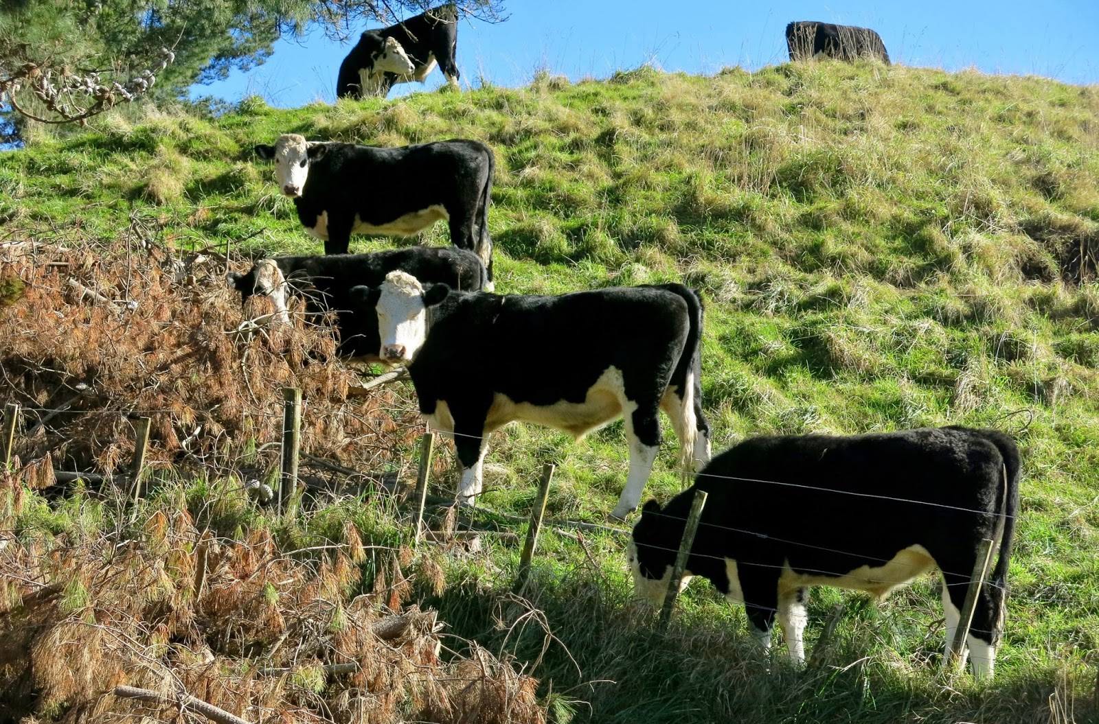
While we were taking photos of the pretty scenery and the peaceful looking cattle, a farmer appeared on the brow of the hill – probably wondering what we were up to.

The steers stopped their grazing to check us out (photo by John)

Before long, Ngarara Road became a bridge over the Expressway, and we joined the cycle track again. The road sign pointed to Ngā Manu Nature Reserve, which I think we should visit some time, maybe on another ride. We have been there once, but that was years ago when our children were still young.

At the junction with Te Moana Road, we left the Expressway track, and pedalled back to our car. Though there are still roadworks going on near the junction as a result of the Expressway, most of Te Moana Road has a nice cycle lane.

Roadworks on Te Moana Road (photo by John)

We diverted off towards the river and the Waimanu Lagoon, and sat on a bench, enjoying the sun, the view and some chocolate! While we were sitting there, the time-lapse camera on John’s bike took a picture of us, which I am now using as a computer screen saver. I call it “Retirement Bliss”.

Between the river estuary and the Waimanu Lagoon (photo by John)

The Waikanae River Estuary (photo by John)

Retirement bliss (photo by John)

                                                       * * * * * * * * * * * *

On the way home, we stopped at the Pataka Gallery in Porirua to view an exhibition of tapestries by multiple award winning Peruvian master weaver Máximo Laura. It is a stunning exhibition. Ten large tapestries are on show, all of which made me “drool”! Máximo has an amazing use of colour and his colour blending is exquisite. I love the vibrant colours and the “clean” lines of his designs.

Fruto de Abundancia del Mar IV (Abundance of the Fruit of the Sea)

Hacia la Amada (Journey to my Beloved)

I love the vibrancy of the colours!

As well as his exhibition in Pataka, Máximo Laura has been conducting workshops for NZ tapestry weavers in Wellington and Hamilton. One of my weaving friends, Trish Armour, herself an award-winning tapestry weaver, spent several weeks studying with Máximo in his Lima studio last year. She alerted me to his works, which I have been following on Facebook.

I would dearly love to own one of his tapestries, but unfortunately they are well beyond my financial reach! So I will just have to make do with the photos on my screen saver.

Saturday, 15 April 2017

Paekakariki to Paraparaumu, and Kapiti Aeromodellers Club


I’m a few blogs behind. I’ll catch up in the next day or so.

Thursday 16 March was a glorious day, fine and calm, so we drove up to Paekakariki for another ride on Te Ara o Whareroa and on part of Te Ara Kapiti (the track next to the new Kapiti Expressway).

Getting the bikes ready (photo by John)

An idyllic scene from Paekakariki’s waterfront (photo by John)

Though there wasn’t much wind, John had to attend to his eye, which must be protected from airflows to stop it drying out.

John had to stop to attend to his eye

Much of the time, the cycle track runs parallel to the Kapiti Expressway, but some distance removed from it. However, there are several bridges on the Expressway where the cycle track runs right next to it. I noticed signs before these bridges saying that horses were not allowed “beyond this point”, and I wondered why that was. Then I figured that because you are so close to traffic rushing past, a horse could easily be spooked by a passing truck, which could result in a pretty nasty accident.

Most of the time the cycle track is well away from the Expressway … (photo by John)

… but on the bridges, it runs right next to the rushing traffic (photo by John)

At the bridge over the Wharemauku Stream, we diverted from the Expressway and headed on the track towards Paraparaumu Beach.

The bridge over the Wharemauku Stream – looking towards Coastlands shopping centre
 (photo by John)

The track goes past the back of the airport, and just before getting to the beach it becomes a quite unpleasant, bumpy and narrow rut through a paddock. I don’t enjoy this bit, but fortunately it is not very long.

The track runs past the back of the airport … (photo by John)

… and then becomes a narrow rut as it goes through a paddock (photo by John)

We made our way safely to Paraparaumu Beach, where we had lunch at the 180 Degrees Café. On our way back, we stopped near the beach for a few photos.

Kapiti Island (photo by John)

The tide was in (photo by John)

Back on Te Ara Kapiti, we diverted temporarily to follow a sign pointing to Kiwi Road. Here the track went around a substantial area of wetland, and we saw that lots of waterfowl had already made it their home. We saw geese, ducks, paradise ducks, pukeko and stilts.

The track around the wetland at Kiwi Road (photo by John)

Some of the birdlife in this wetland (photo by John)
Click to enlarge

Thoughtfully provided seating ovelooks the wetland (photo by John)

In Queen Elizabeth II Park, we turned off the cycle track towards the beach. John wandered off to take some photos, while I sat on a bench and chatted to a campervan owner who had come from Upper Hutt, just to sit in the sun and enjoy the day.

The Whareroa Stream exit to the beach (photo by John)

We heard the sound of small planes buzzing overhead, so we went to have a look at the Kapiti Aeromodellers Club, which has its clubrooms and airfield nearby. We parked our bikes by the entrance, and asked one of the men if it was OK for us to come and have a look. “Yes sure”, was the answer. There was a lot of activity going on. There were more than a dozen vans and cars with large trailers, and a lot of men – mostly older, probably retired, since it was a weekday – assembling or tweaking their planes, and indulging in their hobby.

Kapiti Aeromodellers enjoying their passion on a fine calm day (photo by John)

I was amazed at the size of some of the planes – large enough and realistic enough to have a figure in the pilot’s seat. We chatted to some of the men there, and watched as people took turns in using the runway to fly their planes. One of them explained that when there is more than one plane in the air, each plane has to have two people – one piloting (i.e. working the radio controls), and the other spotting (i.e. keeping a watch that it is not on a collision course with another plane).

A Piper Pawnee (one-third scale) is readied to tow a glider (photo by John)

Getting the tow-plane and glider ready to fly. Two pilots: one for the tow-plane, the other for the glider.
(photo by John)

John was loving all this

John revelled in all this, and it brought back a few memories for him. His father was an aircraft engineer, working at one stage at Paraparaumu Airport. He remembers as a young boy being allowed to go with Dad to “put the planes to bed” when they had to be tethered to ground cables to stop them being blown about by the wind. He tells of how he sat in the co-pilot’s seat, while his Dad fired up the engines to taxi the DC3 or Lodestar to its tethering point. Once tethered, he would help his Dad to put newspapers over the wires “for the plane’s bedtime reading” (actually to stop anyone tripping over the wires).

A collection of war planes under a camouflage canopy (photo by John)

Before a plane can be launched, it is positioned behind two posts while the engine is started up. Then it is carefully manoeuvred and backed up by hand before being directed towards the runway by radio control. 

This model is a Rumpler Taube dating from 1909  (photo by John)

We spent nearly an hour at the Aeromodellers Club, before heading back to Paekakariki. A quick stop for a photo of a newly installed seat overlooking Te Ara o Whareroa, but we didn’t linger. It had been a good ride (34 km), nicely side-tracked to do some mini plane spotting.

A new and very sturdy-looking seat overlooking the track (photo by John)

Wednesday, 15 March 2017

Kapiti Expressway cycle track


Last Thursday, 9 March, we had our second try at riding the cycle track alongside the new Kapiti Expressway

The Expressway had an open day for the general public on 18 February, and the celebrations included people being allowed to walk and cycle on a 5 km stretch of the new road between Paraparaumu and Waikanae. Unfortunately we weren’t able to go, so the following Tuesday, after biking from Paekakariki to Raumati, we wanted to try out the new cycle track that runs alongside it. But it wasn't open for use yet.

Access to the new cycle track at Raumati was still blocked off (photo by John)

We talked to one of the people still working on the completion and he said it would be opening at 3am (!) the following Friday, provided the weather didn’t throw a spanner in the works.

He told us the track would be open the following Friday (photo by John)

By diverting via a couple of Raumati roads, we managed to find a few stretches that were not blocked off, but then we met a man on a tractor, who told us we really should not be there, so we decided to come back another day.

This foot/cycle bridge over the Expressway could be reached from an access road alongside the track,
 but was still blocked off too (photo by John)

So last Thursday, we had another go at it. We drove to Raumati, parked the car in Leinster Ave, just off Poplar Avenue, and biked up to the start of the cycle track.

I was disappointed to find that the track was not completely smooth. It consisted of seal but with a fine gravel surface. We stopped to talk to a couple of surveyors, and asked whether the track was like this all the way. “Yes, and a few bits are worse” they said. I wondered why the track had not been properly sealed, and the short answer was “cost”. Of course.

Two surveyors still working on the track (photo by John)

We were now able to get onto the Rongomau Footbridge. It is an impressive black construction, with a sinuously curved ramp, designed to resemble an eel. It leads to the houses along the old SH1. The signpost pointed across the bridge to “Paraparaumu Shopping Centre”, but I wouldn’t go that way, biking along the old SH1, if I could go on the cycle track instead. However the bridge provided a great view on the Expressway.

The Rongomau Footbridge over the Expressway (photo by John)

View from the bridge looking south … (photo by John)

… and looking north (photo by John)

The track is nice and wide and in most places is a respectable distance away from the Expressway. There are lots of small areas of protected wetlands. We spotted a pukeko and a few ducks already taking possession. No doubt, in time, these areas will become home to more water-loving birds.

We were impressed with the plantings all along the road and cycle track. Plants must have been put in a year ago or more, as they seemed well established. In areas near housing, there were noise reduction walls, which were very attractive too.

One of the protected wetland areas, and a fenced-off culvert.
Note the surface of the track (photo by John)

Attractive, established planting (photo by John)

Noise reduction walls (photo by John)

Seating is provided every so often (photo by John)

I was in awe of all the planning that must have gone into the whole project – road, bridges, cycle track, plantings, wetlands ... No wonder it took three years to complete. It certainly is a beautiful result.

As we approached Paraparaumu, the Expressway went across one of the many new bridges. Here, the cycle track dips below the level of the road to its own bridge across the Wharemauku Stream. The track crosses another shared path, which leads from Coastlands shopping centre to Paraparaumu Beach, past the back of the airport.

The road bridge over the Wharemauku Stream, and the track between Coastlands and the beach

The road bridge on the far left and the foot/cycle bridge in the centre right

The Expressway bridges fly over several roads – Kapiti, Mazengarb, Otaihanga, and Te Moana Roads – while the cycle track crosses them at road level. Some of the crossings have buttons to activate cycle warnings to motorists. At the Te Moana Road traffic lights, there are even separate crossing lights, with appropriate symbols, for pedestrians, cyclists and horse riders.

Push buttons are provided to ensure cyclists’ safety

Between Raumati and Otaihanga, the cycle track runs on the left of the Expressway heading north. At Otaihanga Road, the track goes under the Expressway, and continues on the right hand side.

The bridge over the Waikanae River must be the longest, and here the bike track runs right next to the Expressway. On quite a few occasions, we’ve watched progress during the building phases of this bridge from below, on the Waikanae River track. It was interesting to see it from the top this time.

The Waikanae River bridge (photo by John)

Looking down on the Waikanae River track. There is access to the tracks
on both sides of the river from each end of the bridge

On the bridge, we met a young woman taking photographs. We exchanged hellos, and she said that a bit further along, we would meet the Prime Minister and the local MP. They were cycling a stretch of the track as a “photo opportunity”. I asked who she worked for, thinking she was a newspaper or TV reporter, but she said she worked for the PM – “I’m the PM’s photographer”.

Sure enough, before long, we saw them coming towards us, looking – as one news report described them – “like a pair of Mormons spreading the good word” in their white shirts and ties. 

Bill English, Prime Minister, and Nathan Guy, MP for Otaki

Mr English saw me taking a photo and stopped to talk. He was interested in my e-bike, and asked how far we were going on the track, and how often we biked. He was very patient while I fiddled with my phone to take another photo of him.

Me and the PM – and presumably a bodyguard? (photo by John)

He stopped to chat – only in NZ ... (he probably just wants my vote!)

Just here the cycle track diverts from the Expressway and goes through a short stretch of Waikanae suburban street. I found out later that this circumvents an area of historic Māori land, a wāhi tapu, belonging to the whānau of the author Patricia Grace. She refused to give up her ancestral land for the Expressway, and in 2014, she won her case in the courts. 

Further along, there is a retaining wall, which is decorated with stylised Māori patterns.

The retaining wall below Patricia Grace’s land

Near the intersection with Te Moana Road, we met a cluster of media people, armed with TV cameras and microphones, waiting for Bill English to return. I watched the TV news that evening, and while he commented on lots of other matters, he did not say anything about the Expressway or the cycle track.

Between Te Moana Road and Peka Peka, the surface of the track became rougher. Hopefully this will be remedied as time goes on. Work on the track is still going on, as evidenced by a small digger we encountered along the way.

The track was a bit rough in places (photo by John)

Work on the track is still going on (photo by John)

We made our way to Peka Peka for lunch at Harrisons. The Expressway ends at Peka Peka and rejoins the old SH1. The cycle track stops here too. Although there is signage pointing to Otaki, there are apparently no plans at this stage to extend the cycle track to Otaki, even when the next section of Expressway is built – something which has the Kapiti cycling community up in arms.

Some stretches of the cycle track are also suitable for horse riders – with a strip of grass running alongside it.

The cycle track also functions as a bridle path in some places (photo by John)

Coming up to the Mazengarb Road intersection on our way back (photo by John)

We biked 34 km that day (17 km each way). After we got back to the car, we drove to Paraparaumu Beach for an icecream, but had to use the old SH1 from Raumati, as there is no on-ramp there. However, we enjoyed driving a short stretch of the new Expressway from Paraparaumu to McKay’s on the way home.

Note: Alastair Smith (of Folding Goldies fame) has also written an account (here) of the cycle track, which he refers to as Te Ara Kapiti.