Sunday 26 October 2014

Folding Goldies ride – the Akatarawa Road


On Thursday 23 October, we went on our fourth Folding Goldies ride.

As planned, we rode the Akatarawa Road, from Upper Hutt to Waikanae. For me, this was a really ambitious ride. If we hadn’t been involved with the Folding Goldies, I probably would never have done this. And John does a fair bit of egging me on. It was not an easy ride, and I am moderately proud of myself for having biked it, even though I did have to walk some stretches.

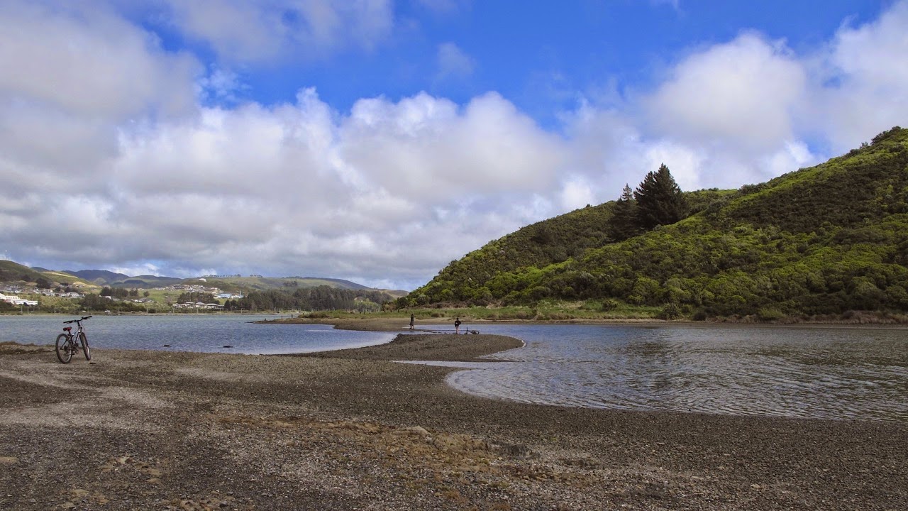
The plan was to take the train to Upper Hutt, bike the Akatarawa Road, stopping off at Staglands for lunch, and take the train back to Wellington from Waikanae. John and I boarded at Petone, as it is easier to park there than in town. Though returning on a different line meant that we would have to take another train back to Petone, to get back to the car. We weighed up the pros and cons, the other options would have meant a much earlier start, and we are not exactly “early birds”.

We were met on the train by Alastair, Russell and Daryl. Two of the folding bikes had already been folded up, to make room for our bikes. I ended up folding mine too, when another cyclist came on board at a later station. Lyn, who lives in Paraparaumu, would be biking up from the Waikanae side, and would meet us at Staglands in time for lunch.

From the Upper Hutt Station we biked to the Hutt River trail, and to Harcourt Park, at the far end of which is the start of the Akatarawa Road. There, we stopped for a group photo. Daryl, still without helmet, but not wearing his trademark suit this time – "it would be too sweaty a ride for a suit", he said.

No MAMILs here! From left: Daryl, Alastair, Russell, John, Désirée (photo by John)

The Bridge Street bridge over the Hutt River

The early stage of the Akatarawa Road is quite sedate, though I was surprised at how many cars and trucks passed us. But soon we were into the countryside, and the road started to climb.

Initially there were quite a few cars and trucks on the road (photo by John)

An old farm shed

We rode past Bill Tito’s place, and John liked the sign outside his property, especially his admonishment to the speeding “bar”stards. I’m glad we didn’t meet any of those on the road. Bill Tito is a renowned specialist in repairing/restoring old books and documents. We occasionally see his advertisements on TV, and he sounds like quite a character.

Bill Tito’s sign (photo by John)

The undulations in the road were quite manageable most of the way to Staglands, thanks to the modification John had made to my gears. The ups were not too steep, and the downs were a nice relief. Even so, I was the slowpoke of the group. Russell and Daryl were way ahead of us, and I think Alastair stuck with us out of kindness.

The road up to Staglands was not too steep (photo by John)

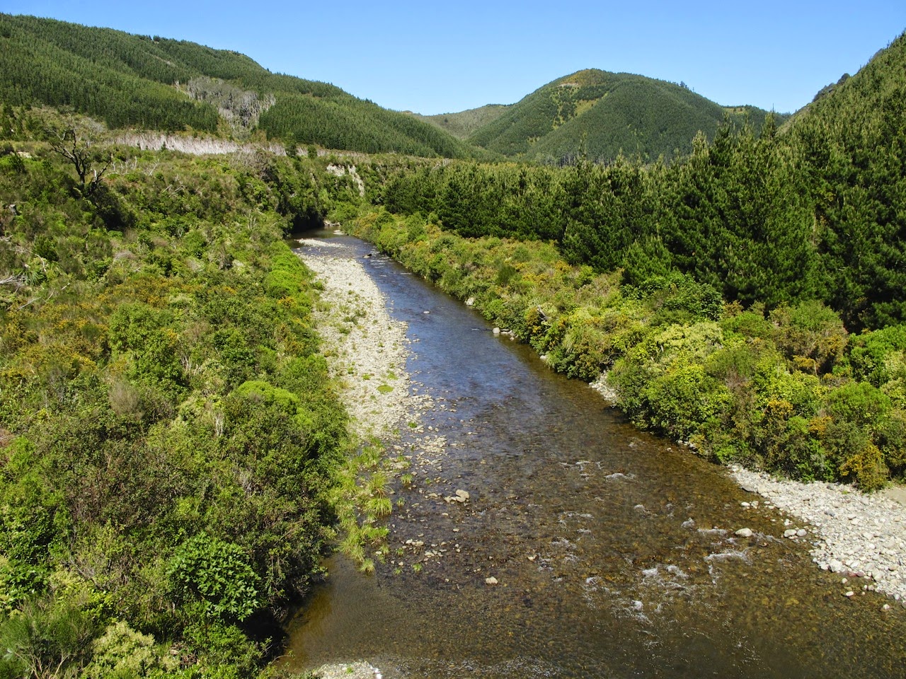
The Akatarawa River, from the bridge
We met this cheerful fellow in the middle of nowhere

It took us nearly two hours to get to Staglands, and by then I was well and truly ready for coffee and lunch. My legs were certainly feeling the effects of the climb, and I was glad to sit down on a chair rather than on a bike seat! Russel, Daryl and Lyn, who had arrived by this time too, had already had lunch and were onto their second coffees. They took off ahead of us, after we’d agreed to meet up at a café by the Waikanae Railway Station.

The driveway out of Staglands is steep enough to warrant a warning to motorists!

Before leaving Staglands we turned on our tail lights, just as a safety measure, in case of cars coming up behind us. But in fact, no cars passed us at all on this stretch.

We had to climb for another four kilometres to the highest point of the road. And this was the steepest and most testing part of the ride. My leg muscles were already fairly knackered, and even the not-quite-so-steep bits were a test of endurance for me. I had to step off and walk quite a few of the uphill stretches, as my legs simply would not do it on the bike. Ah, but the bits of downhill were lovely. John was very patient, and either rode very slowly behind me, or at intervals, rode ahead and waited for me to catch up.

I biked some of it … (photo by John)

… and had to walk some of it (photo by John)

The downhills were a soothing relief. Note my tail light for safety (photo by John)

I felt triumphant when I finally made it to the top! (photo by John)

Before tackling the even steeper downhill run to Waikanae, we donned our parkas, as it was kind of misty/drizzly at the top, and the wind was cold, soon to feel even colder with the speed of freewheeling down the hill.

I had been worried about the downhill, because I would have to tightly grip the brakes, putting pressure on my painful thumb joints. But John adjusted the angle of my handlebar so that I was able to keep my thumbs around the bar, rather than on top (which is how I usually ride on the flat), and still grip the brakes.

Wow! It was such an exhilarating ride down! It was six kilometres down to the valley floor. I didn’t quite freewheel all the way, being worried about coming a cropper, but I think we did about 30-35 km/h. Alastair must be used to such runs, as he soon whizzed past us and we didn’t see him again till we got to the station.

John loyally stayed behind me, to keep an eye on me. I know he would have loved to pass me and hurtle down like a bat out of hell. He reckons he used to do 80 km/h down Ngauranga Gorge with a strong northerly behind him in his younger days. But today he said that I was going like a rocket, and couldn't catch me up! Ha!

Actually, the strong northerly headwind that we'd had to struggle uphill against, provided quite a bit of resistance on the way down. Which was good in a way, as it kept us from careering out of control.

It was still a bit misty round the top of the hills

We stopped at a look-out point to take a photo, and when we got going again, I found that my chain had come off. I don’t know whether it had come off when I stopped, or whether I had been bombing down the hill with the chain off! John restored it, but by the time we got to the bottom of the hill, it had twice come off again.

Fortunately there was a nice wide grassy verge where John could effect repairs. It was the same problem we had on another ride – a plate on the chain was splayed – but this time, he had the right tool with him, so it was soon fixed.

John had the right tool this time

Having got to the bottom of the hill, this was not the end of the ride yet. We had another five kilometres to go before Waikanae.

It was another 5 km down this road to get to the station

From here, it became a race against time to get to the station to catch the 3:00 pm train back to Wellington. Never mind meeting the others for coffee at the agreed café. We actually didn’t see the café as we raced past, and got to the station with just a couple of minutes to spare.

But the others weren’t there! I was trying to ring Alastair, to tell him that we were on the train, and not to wait for us at the café, when they all turned up. Whew, made it in time!

Back at Wellington Railway Station, we caught the next train to Petone (we could no longer use our Gold Cards, of course), and headed home.

What a day! Forty-two kilometres all up, including 20 km during which we climbed 350 m to the top, and a crazy 6 km downhill run, dropping nearly 400 m (there is a profile at the bottom of this link, courtesy of Alastair). My quads were knackered, my calves on the verge of cramp, my hands crippled, but I was feeling very pleased that I had actually DONE IT – biked the Akatarawa Road!

Then, in the evening, I went to my regular Scottish country dancing club night. I could have done without that, feeling as I did, but as I am the only person with a key to the hall, I couldn’t get out of it. I had a good time anyway, as I always do when I go dancing.


Tuesday 21 October 2014

Whitireia Park


On Saturday 18 October, we had planned to take my sister and brother-in-law for another bike ride, but they were unable to go, so instead we rode the track around Whitireia Park. We had done this ride once before, in May last year, and I swore then, that I would never do this ride again. I relented, and thought that with my improved fitness and modified gears it might be OK.

We parked at the start of the track, near where the road forks off to the right from the main road to Titahi Bay. I started out with an open mind about the track around the base of the peninsula. Perhaps it wasn’t as bad as I remembered it.

Well actually, it was every bit as bad. It is still a horrible track, much more suited to walkers and mountain bikes with decent suspension, than to our little folders. Where the track is gravel, there are a lot of large embedded rocks, making it a very unpleasantly bumpy ride; where it is grass, it is either very deeply rutted, so your pedals catch the turf on the down stroke, or if you ride on the top, you get caught out by rabbit holes hidden by the grass.

The embedded rocks make the gravel track very rough … (photo by John)

… and the grass tracks are either deeply rutted or riddled with holes (photo by John)

But it is a beautiful area, with great views towards Papakowhai, Paremata and Plimmerton. The harbour is not very wide at this point.

Porirua Harbour is not very wide at this point. Papakowhai is the suburb in the background

Te Onepoto Bay at low tide (photo by John)

At Onehunga Bay we came to the end of the grass track. There is a carpark and picnic area, and beyond it, a sealed road, leading up the hill to the radio transmitters, and eventually back to Titahi Bay. A short stretch of sealed road goes around a rocky bay to Kaitawa Point. Here is a map of the area.

Onehunga Bay, looking out towards the Tasman (photo by John)

We rode on the sealed road to Kaitawa Point

This is where the road stops, so we turned around and prepared to climb the road back to Titahi Bay. The last time we were here, I balked at the steepness of this road, and we returned to Onepoto by climbing over the saddle, which was a much more hazardous gravel track than I had bargained on. So this time, we decided on the steep sealed road.

With supreme faith in my improved, modified gears, I started biking up the hill, but it was just too much for me. I ended up walking quite a few steep stretches, but biked the slightly less steep bits in between. Even John had to get off and walk some of the time.

Climbing up the hill from Onehunga Bay (photo by John)

Looking back at Kaitawa Point (photo by John)

I was surprised that there was quite a bit of traffic. We had at least ten cars pass us in either direction. It seems that it Onehunga Bay and Kaitawa Point are popular picnic and fishing spots on the weekend. And the views from the top of the hill are just wonderful.

It was quite a climb! (photo by John)

The top carpark with a view towards Mana Island (photo by John)

The descent into Titahi Bay down Thornley Street was quite steep. I had to keep applying the brakes, as I am not happy to hurtle down at full tilt. It didn’t take us long to get back to sea level, and down Titahi Bay Main Road, back to our car at Onepoto.

It was only a 10 km ride, and though the views are magnificent, I don't think I will want to do this again, unless they improve the track between Onepoto and Onehunga Bay. It just is not enjoyable to ride. I am up for a challenge, but I'm no masochist!

* * * * * * * * * * 

Before going home, we stopped at Pataka Museum for a quick look at the galleries, before they closed. I looked at an exhibition by glass artist Garry Nash, entitled “Neon Sign”, which contained works that were a mix of scientific-style glassware and more conventional neon signs, unconventionally shaped and colourfully lit up.

A glass and wire construction by Garry Nash. I liked the shadows it created

The other exhibition was by Peter Madden, a selection of his 2D and 3D sculptures and collages over the last decade. It was entitled “Coming from all the places you have never been”. Very intriguing, minutely detailed collages which display a fascination for butterflies, snakes, fish, chairs, eyes, mouths and shoes! You could spend hours just discovering all the details.

I liked this book of butterflies. The next exhibit was a book from which the butterflies had been meticulously cut out. What skill!

Book of butterflies, by Peter Madden


Wednesday 15 October 2014

Four go biking the Hutt River Trail


I have been perusing websites about cycling holidays in the South Island. I found a company called Pure Trails NZ, which operates out of Christchurch, and which offers fully supported four-to-six-day tours in some of the most spectacularly scenic places in the South Island.

I found one I really liked – five days’ easy riding (grade 1) in the Mackenzie Country in January. When I told my non-cycling sister about it, and suggested “do you fancy coming along?”, she came back a few days later with “yes, why not?”. The thought that the tour is fully supported, and that one can always retire to the bus/van if biking becomes too tiring or difficult, definitely appealed.

But Aimée and Neil haven’t biked for over 30 years, so they will need to do some practice rides and build up some bike fitness before then. They currently have no bikes, but John has two big bikes, as well as our folding bikes. So we arranged to take them out for a ride last Sunday.

The two big bikes fitted in their station wagon, Neil had the use of John’s old helmet, Aimée borrowed one from her daughter, and off we went to bike the easiest part of the Hutt River Trail, starting from Seaview.

We had to re-allocate the bikes: Neil and John rode the big bikes (Neil the old Tarini mountain bike, John the new Jamis Allegro), while Aimée rode my folding bike, and I rode John’s.

Setting off from Seaview (photo by John)

They tried out the bikes on the flat stretch of track along Port Road. Despite the fact that Aimée had never ridden a bike with gears and handbrakes, she got the hang of it pretty much right away.

“Riding Along On My Pushbike, Honey …” (1970 song by The Mixtures) (photo by John)

It didn’t take us very long to get to Avalon. There you have the choice between crossing the road to Avalon Park and continuing up the trail on top of the stopbank, or staying by the river and riding on a gravel path. They decided that they might as well try riding on the gravel.

Aimée tears round the corner on the gravel like a seasoned cyclist (photo by John)

After a couple of kilometres on the gravel, we turned around to go back. We diverted off the trail and made our way along quiet Lower Hutt residential streets to the Janus Bakkerij Café on the corner of High Street and Mitchell Street, for some well deserved coffee and pastries.

Coffee break at Janus Bakkerij (photo by John)

On the homestretch (photo by John)

When we got back to Seaview we had done 16.5 km, but Aimée carried on up the road past our cars, so that she could make it a round 17 km. They had enjoyed their ride, though Aimée was suffering from a fair amount of “saddle pain”. I think I will have to take her shopping for some padded bike pants before we head south!

If the weather is OK next Saturday, we may go out for another group ride – on the gravel part of the Hutt River trail from Silverstream to Upper Hutt.

Now John is having a problem with his mileage calculations. He has been meticulously recording the mileages he has done on each of his bikes. But now that some of it has been biked by others, that puts his totals out! But I’m sure he can do the maths to sort it out.


Tuesday 14 October 2014

Rimutaka Rail Trail


Thursday 9 October was a gloriously sunny day, just perfect for cycling. We tossed up whether we should ride the Rimutaka Rail Trail or ride to Pencarrow. We decided on Rimutaka, as we thought we’d better do some hills.

From previous experience, we knew that the summit plateau is a beautiful place for a picnic, so we stopped at Brown Owl to get some Subway mini subs for our lunch, before heading to the start of the trail.

We last rode this trail in June, when the sun was low and much of the track was in the shade. Now, it was beautifully sunny and along the edge of the track the rangiora shrubs were flowering. The flowers grow in clusters and are very small. Most were still in bud.

The tiny flowers of rangiora (Brachyglottis repanda) have yet to open

The leaves of the rangiora (Brachyglottis repanda) are glossy on the top, but soft and fuzzy on the back, which has earned them the name of “bushman’s friend”, as they were used as toilet paper by early settlers. Māori have also used the leaves as poultices for wounds. A very useful plant!

Some sections of the track go under the canopy of pine trees. In some places it was strewn with debris and pine cones, as we’d had galeforce winds a few days earlier, but there was a beautiful scent from the trees.

A tiny waterfall provides perfect growing conditions for many mosses (photo by John)

The Pakuratahi River, from Ladle Bend Bridge (photo by John)

The track climbs high above the river, under the pine trees. I found it a lot easier with my modified gearing, and I was able to stay in the middle gear all the way.

Much easier in the middle gear now (photo by John)

There’s a lovely view to the river through the trees (photo by John)

The ride to the summit – 10 km – takes just an hour. We did not go down the other side. We’ve tried it once before and didn’t like it because of the long, very dark tunnel, and the steepness and roughness of the track.

So we sat in the sun and ate our somewhat squashed mini subs – thanks to my jacket having been stuffed on top of them in my pannier.

As we were about to leave, a woman and her three teenagers arrived and stopped for a chat. They were going down to the Wairarapa side, where her partner would be meeting them. She offered to take a photo of us both.

At the Rimutaka Summit (photo by another cyclist, with John’s camera)

The rusting remains of train engines at the Summit

The return ride back to the car took less than an hour. We had done 20 km.


Hataitai and Wellington Waterfront


On Tuesday 7 October, we decided to bike up the hill at Hataitai, to see if I could manage it better, now that John has changed the gearing on my bike, than I did last August.

We parked on Evans Bay Parade, near NIWA, biked along to Wellington Road and went up Hamilton Road. The top end of this road is fairly steep, and though I was able to manage it better this time, I was soon overtaken by another cyclist. As she slowly pulled past me, I said to her she was doing better than me, and she replied that she was training for the Otago Central Rail Trail. When I mentioned that we had done that last April, she stayed beside me and asked me about it.

Just then, who should come up behind us but a police officer in his patrol car. He gave his bull horn a couple of short bursts and then an amplified voice said “single file please”. He waited for me to drop back and for her to move ahead, before he passed us and disappeared up the road. It was a wide road, and apart from him, there was no car traffic, but we were riding two abreast, next to parked cars, so yes, we were in the wrong (refer to the 6th bullet point in this NZTA factsheet).

In the meantime, John, who was well ahead, stopped to see what the commotion was about, and when we caught up with him we stopped – in a safe place – for a chat. Eve, a nurse, told us she was planning to ride the Otago Rail Trail next autumn, and had questions about our experiences. Before we each went on our way, I gave her one of my little cards with my blog address on it, so she could read about our Rail Trail trip. She was delighted and said she would look forward to reading it.

We proceeded along Waipapa, Arawa, and Grafton Roads, down The Crescent, and eventually down Maida Vale Road, back to Evans Bay Parade. There was only one short stretch where I had to get off and walk. I was glad we came down Maida Vale Road, which is quite pleasant, instead of down Carlton Gore Road, which is rather precipitous.

The view towards the Hutt Valley from Grafton Road (photo by John)

Down Maida Vale Road. The last bit was quite steep (photo by John)

Having “conquered” Hataitai, we headed to our favourite café, Karaka, by the Frank Kitts Lagoon. It was quite busy, but we managed to score an outside table. We were amused to watch, when the occupants of the next table left, the antics of a seagull, which brazenly wandered about the table gobbling up any crumbs, and picking the remaining butter out of a little plastic container.

A seagull with butter on its beak inspects the left-overs (photo by John)

Lunchtime in the sun – what could be better (photo by John)

We carried on towards the Westpac Stadium and cruise ship terminal, where the first of the season’s cruise shipsRadiance of the Seas – was moored. This ship is supposed to be “mid-size” by global standards, with more than 2100 passengers and 858 crew. It seems plenty big enough to me. How much bigger would one want to go?

The cruise ship Radiance of the Seas, moored at Aotea Quay

Reflected “Radiance” on the stadium windows (photo by John)

From the top of the Stadium concourse, we took some photos of the port activities around the logs waiting to be exported. A train loaded with logs was waiting on the city side of the concourse, and it soon came out from underneath it, to cross the road towards the port.

I like the red ends of these logs

Wagons loaded with logs waiting to be taken across to the port

The log train, pushed from behind, crosses the road towards the port

At the city end of the concourse, we rode down the wide spiral, which is designed to take hundreds of people down to the buses after an event at the stadium. It was fun to go round and round, and down and down – a lot of turns – but I declined to go back up it to continue our ride. Instead we rode in front of the Railway Station, and crossed the road to go back to the waterfront.

We rode onto the wharf where Wellington’s four tugboats are moored. Only the last one was a good candidate for photos, as there was fencing in front of the others. They are such a beautiful strong red, a gorgeous contrast with the day’s perfect blue sky. We took a lot of photos.

It appears that Ngahue and its sister tug Toia are up for sale. Built in New Zealand, they were commissioned by the Port of Wellington after the April 1968 storm during which the Interisland Ferry Wahine sank in Wellington Harbour. At the time, the old tug Tapuhi, which was of World War II vintage, was not strong enough to assist the foundering Wahine.

Now these brave little tugs, which have a bollard pull of 28 tonnes, will be replaced by two new tugs, Tiaki and the new Tapuhi, which have a bollard pull of 68 tonnes. They were bought to cater for large cruise liners and container ships.

The tug Ngahue is up for sale

Looking up at the bridge of the Ngahue

Primary colours - red, blue and yellow (photo by John)

We finished our ride by stopping off at Kaffee Eis on Oriental Parade, and we sat in the sun enjoying our icecream cones and watching people on the beach. By the time we got back to our car, we had biked 20 km. 

Bikes, icecream, and sunshine – summer is on its way! (photo by John)