Showing posts with label Ara Harakeke. Show all posts

Saturday, 4 October 2014

Testing – a new chain wheel and the Akatarawa Road


The Folding Goldies’ suggestion of cycling the Akatarawa Road for our next ride, and my misgivings about the hill climbs, got John thinking of how he could modify the gearing on my bike so that it would make it easier for me to bike uphill.

So he had a chat to Francis at Johnsonville Cycles and got the necessary bits. Then he spent a fair few hours in the garage tinkering. In essence, he has replaced the 52-tooth chain wheel with a 39-tooth one, which gives me greater leverage in the lowest gear, i.e. more oomph to get up the hill! But I’ll let John describe the details of what he did at the end of this post (or you can look at his website. You’ll have to scroll down to the last three paragraphs of the Technical Details section).

I had the first try of the modification on the steep dead-end road round the corner from where we live. It seemed reasonably OK to get to the top of the hill, but the bike was making some noises. John doesn’t like it when mechanical things make noises they shouldn’t, so more time was spent in the garage to remedy that. So far, so good.

The next thing to check out was the gradient and condition of the Akatarawa Road.  Since it was fine last Tuesday, we drove to Upper Hutt, and headed up the Akatarawa Road (in the car, not on the bike!). Much of it is very tortuous, with lots of twists and turns, and lots of “blind corners”. On the whole the inclines do not seem too bad, as they are short-ish, and interspersed with dips or flat stretches. And the surface is good. But the road is quite narrow. There is only just enough room for two cars to pass each other, and there is no shoulder for a cyclist to get out of the way in a hurry. I must admit that this aspect of the road worries me. What would be the chances of getting hit by a car coming up behind you around a blind bend? Then again, there is very little traffic. We met only three cars during the whole trip.

But there were dozens of cars at Staglands that got there before us. This is the first week of the school holidays – as we found out when we got to Staglands. We pulled into the carpark and had trouble finding a spot. There were two big buses – one of the drivers informed us that the passengers had been children on a school holiday programme. The valley was ringing with excited children’s voices and the calls of birds of various descriptions (peacocks, geese, tui, chickens). I hoped the kids and their minders would not all be in the café where we were planning to have lunch.

It was after 1pm, so it was relatively quiet in the café. We sat out on the deck, near a tree that was labelled “Native Bird Feeding Station”, and lots of little wax-eyes and a tui or two came to feed from a container that contained a milky-looking liquid.

Waiting for lunch on the deck at Staglands (photo by John)
Wax-eyes at the “Native Bird Feeding Station” (photo by John)

Staglands is about 16 km from Upper Hutt, then it is another 4 km to the highest point – probably the most testing uphill bit. The downhill stretch to Reikorangi is quite steep, and there is a drop on the left side of the road – you can’t afford to lose concentration, lest you tip over the edge. It will require a firm grip on the brakes too, I think, as I’m not game to go hurtling down at full speed.

Once out of the forest cover, the view opens up over a beautiful valley (photo by John)

When we got to Waikanae, we decided to try the bike out some more by cycling the Waikanae River track loop. We parked near the estuary, and headed up the north bank. We had gone only a couple of kilometres, when the chain of my bike fell off. John restored it, but it fell off again after the first couple of pedal strokes. This happened several times, much to John’s frustration. He tried taking off the new chain wheel and turning it around (outside-in), hoping to improve the chain line. That did not solve the problem. In the end he discovered what was going on: one of the chain plates was splayed, which caused the chain to keep falling off.

Trackside bike repairs

Out came the full toolkit, but what he needed – a pair of pliers – was not in it. What to do? Squeezing it by hand did not work, banging it didn’t either, but in the end, with the help of a rock and a spanner, he managed to coerce it into the correct shape, and hooray! the chain stayed put, and we were able to continue on our way.

There were quite a few people on the track, and families having picnics on the little beaches. We saw a trio of cyclists – two by the water’s edge taking their shoes off, and one emerging from the bushes – so I reckoned that they’d gone for “a pedal, a piddle, and a paddle”.

A great school holiday activity – a picnic by the river
Approaching the SH1 bridge, you go though a nice wooded area (photo by John)

We crossed the SH1 bridge, and made our way down the southern bank of the river. We stopped to take off a layer, as it was getting quite warm. In the photo below, you can see the difference in the size of the chain wheels on our bikes (click on the photo to enlarge it).

Compare the size of the chainwheels on our bikes (photo by John)

A bit further along we saw some ostriches in a paddock. I wanted to take a picture of them, and here I discovered what was wrong with my camera (it had misbehaved during our last ride). It was the zoom that didn’t work. The camera must have been knocked inadvertently, as there were a couple of small dents in the lens surround. Darn!

Four ostriches in a paddock, eating cabbage leaves (photo by John)
The estuary, with Kapiti Island in the background (photo by John)

Apart from the problem with the chain falling off, it was a very pleasant 12 km ride. But John spent more time in the garage that evening to deal to the errant chain. And today (Friday), he removed a link from it. So we had to go and give the bike another try.

We drove out to Plimmerton, from where we biked up the hill to Pukerua – the hill that had defeated me a few weeks ago. That day there had been a slight southerly, which probably helped me up the hill to nearly, but not quite, the top. Today though, there was a near-galeforce northerly, i.e. a fierce headwind as you go uphill. It would be as good a test as any.

I made it to the top without having to step off! Yay! I won’t say it was easy – but it was easier than before. The new chain wheel had definitely made a difference.


I made it! (photo by John)

The downhill, of course, was a blast! Not only did I not have to pedal at all, but we were being pushed along by the tailwind. I did find it a bit disconcerting that once at the bottom of a downhill, and starting to pedal again, in top gear, I had nothing to “push against”. John said that this was the trade-off for having the different gearing. Well, so be it. I think that with this change, I will probably do OK on the Akatarawa Road ride in a few weeks’ time.

* * * * * * * * * * * *

I asked John to write about the technical details of the changes he made to my bike.

Technical details – by John Patterson

In cycling most people have a comfortable gear which they use often. Ideally, this should be in the middle of the available range. With our bikes, that range is limited to a factor of two, when three would be ideal.

With difficulties in hill climbing the simplest way to help is to reduce the size of the chain wheel. The chain needs to be shortened to compensate. The number of inches to remove from the chain should be approximately:

(old chain wheel teeth – new chain wheel teeth)/4

Another inch may be required if smooth running is not obtained.

I replaced the 52-tooth chain wheel on Désirée's bike with a 39-tooth chain wheel. Therefore I needed to remove (52–39)/4 or 3.25 inches from the chain. In order for the chain to join up, only whole inches can be removed. I started with three inches, or six half-inch links.

My old chain tool was not very good as it was hard to get the pin and plate set right when joining up. This caused the chain to come off later, when running in the highest gear. A new Park multi-tool fixed that.

In the lowest gear, the top derailleur wheel also conflicted with the largest cog, which made a rumbling noise. As the chain is shortened, this top wheel moves in an arc upwards and then downwards. Adding an inch to the chain made it too loose in high gear. The final solution was to remove four inches of chain.

Longer term, a 44-tooth chain wheel would be ideal. In that case, two inches of chain would need to be removed.

The gear range is now from 27.2 to 54.5 gear inches, or 2.17 to 4.35 metres development, or a 2.03 to 4.07 gain ratio. The lowest gear is the same as that on my Jamis Allegro road bike. The highest gear is now similar to the set-up found on some single-speed commuter/shopping bikes. (An explanation about gear ratios can be found here.)

I also added a recycled BMX chain guard as shown below. These chain guards don't have the "right look" for BMX cyclists, so they are often removed from new bikes before sale. Enough room was left to allow a larger chain wheel to be fitted.

The new chain wheel and chain guard (photo by John)


Sunday, 26 January 2014

Plimmerton to Aotea Lagoon


Saturday was a gorgeous day! Beautifully fine, but windy. I must say, I am getting heartily sick of all this wind! It’s spoiling what little summer we are getting!

This was going to be a short ride, as John has been having a problem with his vision – one eye is causing him double vision. No, it is not a hangover; and yes, he has seen a doctor about it. But he wasn’t going to let it stop him from going for a bike ride, so he taped up one of the lenses of his sunglasses, and that seemed to work reasonably well. He wasn’t safe to drive the car, but surprisingly, he was OK on his bike.

Later, he made himself an eyepatch, and we couldn’t resist taking a picture of “Pirate John”. He wasn’t very good at doing the “Har har, me hearties!” thing though … And Polly is actually a miniature toucan!

"Pirate John"

When deciding where to ride today, John thought I should be made to do some hills, to get in training for the Otago Rail Trail (which is mostly flat, they say!). Yes, we’re in the process of planning to ride the Rail Trail in April – provided health issues don’t throw a spanner in the works!

We went to Plimmerton, to do the Ara Harakeke ride up to Pukerua. But there was quite a strong headwind and I was having a struggle even on the gentle uphill. So when we got to Whenua Tapu, I refused to go up the hill towards Pukerua, as I just knew I would have to walk it and I saw no point in doing that.

John scoffed “Do you want to do the Rail Trail or not?” But I reckon that’s different. I will do the hills – walking, if I have to – to get from A to B, but this would have been just to get to the top of the hill, only to turn around again and come back. Pretty pointless.

So we headed back to Plimmerton. We took no photos, and I thought this was going to be a bit of a “nothing ride”. But in the end, we rode 22 kms, as we kept going a bit further, and then another bit further into “new territory”.

Beyond Plimmerton, we kept going along the waterside track to Paremata. We stopped to have coffee at “Ruby’s Café”. It was just after 3pm, and I think the staff had started to relax, and was getting ready to close (they close at 4pm). Our coffees came reasonably swiftly, but they forgot about the slices of cake I had ordered. I went back inside to check, and the plates were just sitting on the counter – “Oh, are they for you?”. Duh! We were the only customers by this stage …

Ruby’s Café thoughtfully provides hats for its customers on a sunny day (photo by John)

After our coffee, we carried on, through the Ngati Toa Domain, past the marina, and over the Paremata Bridge, along to the railway station by the Paremata roundabout. We were now into “new cycling territory”. From here we rode up onto the overbridge to get to the other side of the motorway.

The Paremata roundabout, from the footbridge over the motorway

Once across, we turned right, to find our way to the Aotea Lagoon. We rode along Paremata Crescent, which soon became Papakowhai Road. Into a side street, which led us up the hill, and past the entrance to the Harbourview Rest Home, from where a narrow path led us back down to the main road.

Looking south, to the Waitangirua intersection, and Porirua beyond

Past the Police College, and into the gate of the Aotea Lagoon Reserve. It is decades since I was last at the Aotea Lagoon. We occasionally visited there when our children were small. It is now rather more extensive, and looks like a great place to bring the kids. There were several large groups of families having a picnic get-together, and kids were swarming everywhere.

The large lake is encircled by a miniature railway track, complete with a train station and ticket office. But the train was not running – apparently it only runs on Sunday afternoons. By the lake is a windmill of an interesting design, with a cladding of wooden shingles.

The windmill by the Aotea Lagoon (photo by John)

To the left of the central gate into the reserve, there is a quiet garden with a small pond, a little bridge, and some ducks. I tried to take a photo of a mother duck and her duckling. It was quite tricky to get the two in the same frame, as Junior kept paddling away from Mum, eager to explore the world, while Mum made little crooning, quacky sounds, calling him back.

Mum and Junior on the duck pond

Beyond the pond is the Rose Garden – a formal circular garden surrounded by brick walls and seats, with a central water feature, and raised rose beds. John noticed that the brickwork on every one of the raised beds was a different pattern from the next one.

The Rose Garden (photo by John)

I was really chuffed that my yellow rose photo turned out quite well. I thought I had taken note of the names of the roses I photographed, but I now don’t remember them. I’m no rose connoisseur, but I do appreciate the beauty of a perfect rose.

Yellow perfection

Coming out of the Rose Garden, the brick insets in the path took my eye. Every square was different.

Creative brick insets in the path

We cycled around the lake, and came to the “duck and wild fowl pond”, which has a small island and a boardwalk, as well as some fountains.

The island in the large duck pond

Overlooking the pond, was this old-fashioned telephone box (but no telephone – everyone has their own cell phone these days …). On the seat in front, a little girl seemed to be unwilling to join in with the other kids that were running around.

“ Nobody wants to play with me …”

We headed back to Paremata, back over the footbridge, and then down the path under the Paremata Bridge to get to Paremata Road which leads around the Pauatahanui Inlet, toward Whitby.

The path goes under the southern end of the Paremata Bridge (photo by John)

We were pleased to see that there was a shared foot-and-cycle path along the edge of Paremata Road, and we rode it for a short distance. But, being a sunny Saturday afternoon, there was a lot of traffic, so we decided that we would come back some other time, on a weekday, when it would be quieter.

Boats and boat houses on the Pauatahanui Inlet (photo by John)

We turned around, rode across the Paremata Bridge, and back past the marina. By the Mana Cruising Club, we discovered a row of colourful boatsheds, and John took a shine to a “modest little” cruiser, with the cheeky name “Liquid Assets”.

Boatsheds by the Mana Cruising Club

John with “Liquid Assets”

It was well after 5pm when we returned to our car. As we were coming down the waterside path towards Plimmerton, the beach presented a very different picture from the last time we were here – quiet little waves, and lots of people playing on the beach and in the water. The perfect sunny weekend!

Plimmerton Beach


Sunday, 13 October 2013

Ara Harakeke

Today, we managed to get a great ride in, between two lots of rather heavy rain. The last few days have been pretty wet, and when I heard the rain clattering on the roof as I went to bed last night, I didn’t think we’d get to ride today. But we did. Today was sunny and calm, and even warm enough to take my jacket off. However, we’d only been home an hour or so after our ride, when we had another heavy downpour and thunder. We were glad we didn’t get caught out in that!

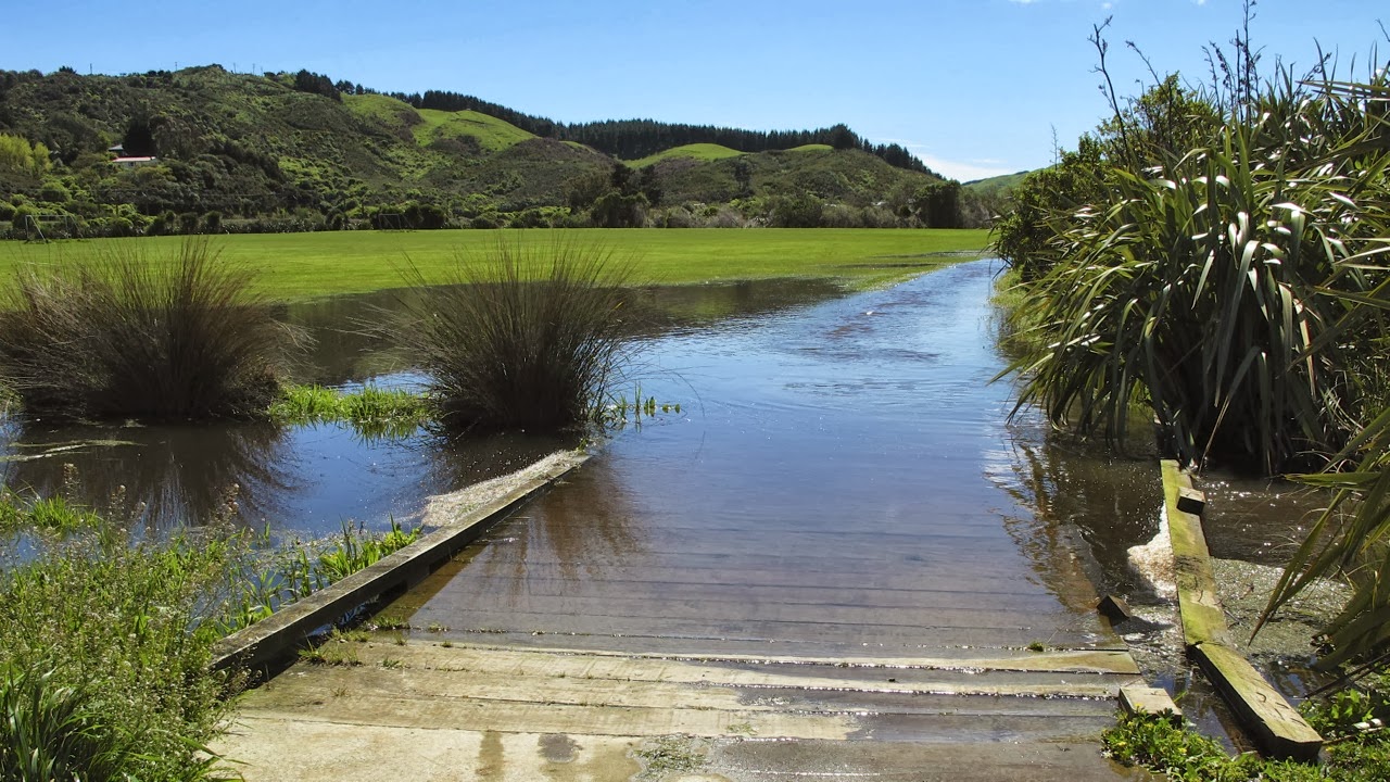
In view of the recent rain, we figured we’d better choose a sealed track, and so we decided on Ara Harakeke, the track that runs alongside SH1 from Plimmerton to Pukerua. We parked outside the Plimmerton railway station, ducked under the underpass, and tootled off onto the sealed path alongside the Domain. But, woah! We came around a bend in the track and found ... a lake!

A “lake” on the track! (photo by John)

A quick turn-around to an alternative route led across a bridge over a very swollen stream. This took us to the entrance of the Palmers Garden Centre, in front of which is a large display of Big Mac Slabs Furniture – beautiful garden furniture made from thick slabs of timber. It looks like a garden café, but there’s not a coffee cup in sight anywhere!

We crossed a very swollen stream


Not a cafe setting, but a display of garden furniture!

We rode up Ulric Street which winds through the Plimmerton Industrial Park, from the top of which there is access to the Ara Harakeke Way. It was glorious to pedal along the flat part of the track, and to see flowering broom, swathes of wild purple daisies, and even the delicate white blooms of some early flowering manuka.

Early-flowering manuka

I love it when the purple daisies cover whole hillsides on one side of the motorway, and when the manuka on the other side is in full flower, so that it looks like it’s been snowing. And at this time of the year, the hills in the distance look so soft and such a rich green, like a rumpled velvet counterpane. So beautiful!

Flowering broom and purple daisies, and velvety hills (photo by John)

Before long, we reached Whenua Tapu, from where the track started to climb. To begin with, it runs right next to the motorway, although elevated above it, then it goes through a bushy area which is really pretty.

A pretty bushy area, before the track becomes much steeper (photo by John)

The track became quite steep, but I was determined not to be a wuss this time. I was going to give it my best shot. Most of the way, I did OK. I used my lowest gear, and tried to just keep my legs pumping, while keeping my upper body as still as possible to conserve energy. It seemed to work in all but the steepest bits, where I still had to get off and walk. My legs just couldn’t do the worst of it, and the loading on my heart was just too much (I have a slightly leaky heart valve, which doesn’t help).


It was a struggle up that hill, but I made it! (photo by John)

BUT … I got to the bridge over the railway line at Pukerua without getting grumpy, and I felt pretty chuffed about that.


The bridges over the railway line – one for walkers and cyclists, the other for SH1

At the top of the Pukerua hill there are a few shops, and as always when we go past there, I shuddered at the sign advertising “Le Mer Day Spa”. The French word for “sea” is a feminine word, so it should be la mer, not le mer. And being a picky linguist, it makes me cringe every time I see it.

 
Aargh! It should be La Mer, not Le Mer!

Having reached the shops, we considered stopping for an icecream, but then decided not to. We turned around and whizzed down the hill back to Plimmerton. Wheeee!! Fabulous, the free-wheeling speed, the sun on our backs, and the wind in our hair! Oops, sorry, I just got a bit carried away there. Of course we didn’t have the wind in our hair, we were wearing helmets – but it sounded good …

When we got back to the Plimmerton Domain, there was a group from the local archery club practicing their skills. We stopped for a while to watch them. The bows are quite seriously sophisticated looking instruments. When I commented that it was something I would have been quite interested in learning when I was younger, a man in his fifties came over and said it was never too late to learn anything (I'd agree with that!). Lots of older people were wanting to learn, he said, but there was quite a waiting list to join the club.


Plimmerton archers and their targets (photo by John)


Modern-day archers


Back to Plimmerton, under the station underpass. I was quite taken by the cheerful murals in the tunnel.

Symbols and sights of Plimmerton in the station underpass


A tile and mosaic mural of the seashore in the station underpass
 
We rode past our car, and carried on towards Paremata, where we were planning to have lunch. We popped into a little side street for a look at the beach, which wasn’t there, as the tide was in, and waves covered the whole beach.


The tide was in at Plimmerton Beach (photo by John)

I thought the seats overlooking the beach were rather attractive – made of concrete, but with an artistic touch of paua. Concrete does not have to be ugly, it can be rather beautiful when polished up.


Artistic seats

We rode along the southernmost part of Ara Harakeke, between the water and the railway line, towards Paremata. At Mana Station we went through the underpass – no decorations here – and doubled back towards “Ruby’s”, a café with a nice courtyard, where we had a very satisfying lunch.


Lunch at “Ruby’s” (photo by John)

We still hadn’t had enough of cycling, so after lunch we kept going through the Ngatitoa Domain and Mana Yacht Club. Lots of yachts and pleasure boats were moored at the marina, but out towards the bridge, two fishing boats were anchored off the shore. One of them had an impressive array of masts and tackles and machinery on board, for what was actually quite a small boat.


Fishing boats anchored near the Paremata Bridge (photo by John)

Here we turned around and biked back, through Mana, and Plimmerton, past our car again, and along the foreshore at Karehana Bay. On previous rides in this area we had gone past the boating club at Karehana without stopping, as the gate across the driveway is usually closed. But this time John found a path around the side of a building which allowed us to go onto the wharf, from where there is a great view out towards Mana Island.

Mana is a strangely flat-topped island, which was a base for the Māori chief Te Rauparaha in the 1820s. A decade later, European settlement started there with a whaling station and later, sheep farming. These days the island is administered by DOC (Department of Conservation).

Mana Island (photo by John)

By now a brisk headwind had sprung up, and I thought to myself “this is good practice for when – if! – we get to ride in Holland (where the wind is ever present)”. Taking John to Holland to do some bike touring is one of the items on “my bucket list”.

When we got to the Hongoeka Marae sign, we turned around and rode all the way back to the car on the road, rather than on the foot/cycle path. This was easier, as, being the weekend, there were quite a few people walking on the footpath. Also, I need to extend my “comfort zone”, by riding on the road, rather than dedicated cycle paths, more often.

What with all this riding back and forth, we had managed to cover 25 kms by the time we got back to the car. On the way home, I noticed that the “Prestige Caravans” yard on the corner of Acheron Road had a lot of their caravans and motorhomes open for viewing, so we stopped for a nosey.


$125,000 worth of motorhome! (photo by John)

I love looking inside caravans or motorhomes. I think it would be rather fun to have a holiday in one, even though I’m not a fan of camping. It is quite amazing what they manage to fit into such a small space. All the ones we looked into had not only fully functioning kitchens with stove, microwave and fridge, but also had TV sets, and a toilet and shower squeezed into the tiniest of spaces. That is the main thing that puts me off camping – the fact that you have to tramp across a paddock to get to the ablutions block! Not much fun in the middle of the night, or in the rain!


Inspecting the top bunk (photo by John)

I remember the first time I ever saw inside a caravan. I was nine years old, and we were visiting a Home Show. At the time, my Mum, my sister and I were living in my grandmother’s house along with my uncle’s family and it was all a bit cramped. There was a severe housing shortage in the Netherlands in the 1950s, and a caravan seemed like some sort of solution. We kids thought it was a great idea. But I don’t think Mum did, as we ended up moving into another family’s attic not long after. A great move, as it turned out, as we had a fantastic year there, and our two families became great, lifelong friends.

Having decided that we were not going to sell the house, and we were not going to buy a motorhome, and we were not going to become “grey nomads”, we got back into our little car and drove home, feeling very satisfied with our day.


Saturday, 1 June 2013

Te Ara Harakeke Track


Yesterday, Thursday, was fine, but breezy. We set out to ride the Te Ara Harakeke track, starting from the Paremata Bridge this time. We left the car in a carpark overlooking the Pauatahanui inlet, just past the bridge.

The path ducked first under the Paremata road bridge, then under the rail bridge. A smooth sealed track took us past the marina, then followed the railway line past the Ngatitoa Domain.

The track ran right by the railway line (photo by John)

We took a little detour into the domain, just for the fun of it, and to take a look at the view. Just across the harbour, not very wide at this point, we could see the track we rode on our last outing, the Whitireia Park track. I still have a few mementoes of that track – in the form of some colourful bruises and scratches that I copped when I keeled off the edge of the track.

View from the Ngatitoa Domain

A gravel path between the railway and the rocky shore afforded great views towards Plimmerton beach. The tide was out, and waves gently rolled onto the wide beach. We rode down Plimmerton’s main road, then along the foreshore to Karehana Bay. At this end of the beach, we saw a small group of “pirates”, complete with skull-and-crossbones headgear, on an outing from the Kindergarten across the road.

Karehana Bay has a rocky shore to which generations of Wellington’s pre-school and primary school children have made excursions to look for limpets, little crabs, mussel shells, and generally investigate life in the many rock pools left behind at low tide. It is noticeable that these rocks are the same as the upturned sedimentary rock we saw on the other side of Porirua Harbour last week. 

Rocky shore (photo by John)

At the end of the public road, there is a sign warning people that the rest of it is a private road, and that only walkers and legitimate visitors to the Hongoeka Marae are allowed. In fact, if you continue along this road – on foot, of course – it will take you on a coastal track which ends up at Pukerua Bay (according to the map – I haven’t actually walked this). So being good and obedient citizens, we turned around at the sign, though I would have loved to carry on till the road petered out.

You'd need to be skillful to take this dinghy out for a spot of fishing! (photo by John)

Back to Plimmerton, where we stopped at “The Big Salami Café” for a coffee and a chocolate croissant. We sat outside so we could keep an eye on our bikes, and as soon as our order was brought to us, a whole lot of fat sparrows came to investigate, hoping for dropped crumbs. They sat patiently on the pavement waiting for any offerings, which, sadly for them, were not forthcoming. They were not at all concerned about the large Labrador belonging to the people at the next table. Nor did he pay any attention to them either.

Having only done nine kilometres so far, we also planned to ride the main part of the Ara Harakeke track. To get to it, we had to go through the underpass at the Plimmerton railway station.

The Taupo Swamp


After a sports ground and a light industrial area, a sealed path skirts along SH1. Near the Taupo Swamp, the track begins to climb, very gently at first, towards Pukerua. The Taupo Swamp is an extensive area covered in NZ flax, or “harakeke”, after which this track is named. We had a brisk headwind, and my progress was fairly slow. The vegetation here has a lean on it to show that the prevailing wind must rip through here rather a lot.

The lean on the vegetation shows the effect of the wind
 

We have done this track before, and I knew that after Whenua Tapu Cemetery, the track would climb more steeply, so I had warned John I would not go any further than that. Being a “flatlander” and all, and disliking hill climbing with a passion.

But rather than turning around and going back the way we had come, John suggested returning to Plimmerton on Airlie Road. I was not keen to ride on the road, but John assured me that there was hardly any traffic here. He’d not seen any cars in the five minutes or so that he had to wait for me while I struggled up the (pathetic) incline against the headwind. Gosh, don’t I sound like a feeble wuss? Ah, but wait, there is more!

Well, Airlie Road seemed to be heading downhill, so I agreed. Wrong! So, so wrong! Of course, just around the bend in the road, it began to climb. Much more steeply than I was able to manage on the bike. So again, I ended up walking my bike up a hill. “I hate this! I hate this!” I grumbled between huffs and puffs and heavy breathing. Even walking was almost too much for me. I had to stop periodically, and wait for the panting to ease. Isn't that frustrating - all this Scottish dancing and cycling and gym attendance and Zumba, and I'm still not fit enough to climb a hill!

Getting ready for the descent - John waits for me to catch up


Looking around me at these moments, I did notice that we were in a beautiful bushy area, and that the sun was still shining. Finally we got to the crest of the hill, and we were on our way down. Great! But rather hard on my hands. Because it was quite steep, my weight was being pushed forward onto my hands on the handlebar, and gripping onto the brakes for dear life was quite uncomfortable. Still, going down was a lot more fun than going up!

In no time we were back at the far end of Karehana Bay, so we rode back to Plimmerton for the second time. More time to admire rocks, and the view towards Mana Island, and the South Island in the distance.

Mana Island at the top right, and the South Island in the distance (photo by John)


As we were skirting the Porirua Harbour, I looked across to where we had ridden last week, and there, along the brow of the hill, I could have sworn I saw a procession of giant moa. Of course, it was actually just a row of trees bent into these shapes by the force of the prevailing winds. But I liked the idea of moa, and just had to take a photo.


Can you see the giant moa marching along the top of the hill?
 
On the way back to the car we lingered a bit near the Paremata marina, just so John could take a few more pictures. All those yachts and boats look so attractive in the sunshine. I had not realised how extensive the boat harbour is, there must be hundreds of vessels moored there, with dozens more on trailers parked on the shore.

The Paremata Marina (photo by John)


Apart from the hill climb, which I absolutely hated, it had been another satisfying ride. We did just under 20 kms. And John, who has been keeping a tally of our mileage (is there such a word as kilometerage?), tells me I have now biked more than 300 kms since mid March – 313.1 kms, to be precise. Note the ".1" – John is a scientist after all …

The end of the ride - overlooking the Pauatahanui Inlet (photo by John)