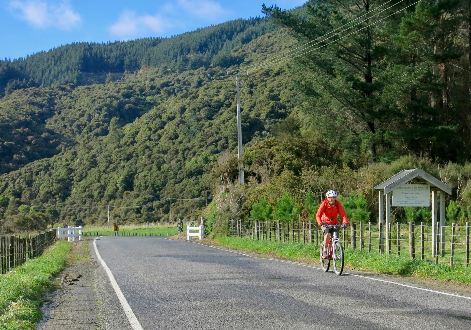
From 11 to 18 March, John and I made an “epic” road trip to the Nelson Region, without the car. Taking our electric bikes on the ferry, and cycling from Picton to Nelson was quite a feat – we think. Days 1-3 are described in my previous blog post
here.
Day 4 – Mapua to Motueka
Saturday 14 March. As we left our accommodation on Saturday morning, our hosts suggested we could keep the key to our garden room, since we were booked to come back on Monday, and they had no-one else staying in the interim. That way we would be able to let ourselves in, if we arrived back in Mapua before they got home from work. A kind and trusting offer.
From Mapua, we followed the Old Mill Walkway next to a back country road, at the end of which we arrived at a track beside a beautiful beach, leading to Ruby Bay.
 |
| The Old Mill Walkway (photo by John) |
 |
| The beach between Mapua and Ruby Bay (photo by John) |
At Ruby Bay the signposts for the
Great Taste Trail pointed us uphill on Pine Hill Road. Thinking that this was the road to Tasman View Heights, we were pleasantly surprised that it wasn’t as steep or as rough as we had read about. It took us on a steepish track with a good surface, and then on a narrow road, intriguingly called Marriages Road. My nostrils detected a sweet fragrance, rather like honey, presumably from flowery shrubs along the side of the road. I later spotted some beehives in a paddock.
 |
| The view from Marriages Road (photo by John) |
Having come down from this hill, we followed the roadside cycle track, until we arrived at the
Jester House. This is an award-winning café, and since it was morning tea time, we had to stop, of course. It is a charming café with a gorgeous garden full of whimsical features – a giant chess set, a large concrete tiger, a manuka copse with quirky wooden constructions for kids to play on, and even tame eels, that come to the water’s edge in the hope of getting fed.
 |
| The entrance to Jester House Café (photo by John) |
 |
| Jester House Café (photo by John) |
 |
| The “elephant” in the manuka copse |
After coffee and muffins, and a little while browsing the delights of the garden, we pushed on, and came across a weaving-cum-woodwork studio,
JointWorks Studio. Of course, as an ex-weaver, I had to check it out. We had a great chat with Tony, the woodworker, who told us that Jane, the weaver, was away at a Professional Weavers Weekend in Nelson. I once belonged to the Professional Weavers Network, and Tony mentioned several people whom I knew well, who would be there. It would have been nice to catch up with some of them, if I had known they were in Nelson at the same time as us.
We talked about looms – Jane has several quite sophisticated looms. One recent arrival was the loom that had belonged to her mother, Anne Field (now deceased), which had finally been able to be rescued out of the earthquake-damaged Christchurch Arts Centre. It was in a dreadful state, covered in quake debris and four years’ of dust and grime, and Tony has been restoring it. While Tony and John discussed technical details (John is quite knowledgeable about looms – he built me several), I wandered around admiring some of the exquisite woven pieces, and very lovely woodwork on display.
 |
| Talking about looms (photo by John) |
 |
| John and Tony outside the JointWorks Studio |
The
Great Taste Trail then pointed us up Harley Road. This was the over-the-hills-rather-than-the-main-road route that we had read about. It took us up a steep, but well-sealed track, before abandoning us on a very rough, up and down, poorly maintained, gravel road. In some places the road was so steep, that a separate cycle track had been built which took a slightly wider and less steep curve.
Along here, my right pedal started to misbehave. It kept wanting to flip over – a very odd sensation – and making me lose my footing. At first I thought it was just me, but on inspection it turned out there was definitely something wrong with it. However, it wasn’t something John could fix by the roadside. It would have to wait till we got to Motueka, where we hoped to be able to find a bike shop.
 |
| John tries to figure out the problem with my pedal |
The above photo shows the horrible road ahead. It took us nearly an hour to ride around this “detour”. We decided there and then, that when we came back, we would not take this route, but stay on SH60.
It was all made up for, however, when we arrived at the
Riverside Community where there was a charming café, set in a beautiful garden.
 |
| Riding into the Riverside Community (photo by John) |
While waiting for our lunch, we explored the surroundings. There was an impressive cactus garden, a tiny stream through a rockery, and down a path beyond a hedge, a small gallery featuring amazing sculptures and chandeliers made of intricately cut-out steel or copper. The artist was
Ché Vincent, who is also the owner of the café and designer of the garden.
 |
| The cactus garden |
 |
| The Riverside Café (photo by John) |
 |
| One of Ché Vincent’s works (photo by John) |
Lunch was delicious, with beautiful homegrown vegetables, cooked and presented perfectly, and charmingly topped with a little flower.
Reluctantly, we got back onto our bikes, and rode the fairly boring remaining distance to Motueka. Rather than find our accommodation, John was anxious to find a bike shop, so that we could get a new set of pedals for my bike. Motueka is a lo-o-ong, stretched-out sort of town. It seemed to take ages to get from the outskirts into the town centre. We rode all down the town’s main shopping drag, and back, but couldn’t find any bikeshops. Eventually, we asked some young boys, who told us where to go. We had gone past it, but hadn’t noticed it.
Pedals sorted, we headed back out of town to the Fernwood Holiday Park. Through a miscommunication with the office lady, we ended up in a motel unit rather than a studio. But when this was discovered, the people who should have had the motel unit, didn’t want to bother swapping, so we were the lucky ones.
One of the bonuses of this was that we had our own sunny clothesline, so I made good use of the communal washing machine. John, meanwhile, unloaded the bikes’ batteries and put them on charge.
Later in the afternoon, we went for a bike ride – no, really? – but without the batteries, since they were being charged. The plan was to go find the Marina Café, near the Yacht Club, where we hoped to go for dinner, but that did not eventuate. We rode about 15 or 20 km (we couldn’t tell how far we’d gone, because there was no power to the odometer) on a very nice track around the Moutere Inlet at first, and then on Motueka Quay along the foreshore, ending up at the Raumanuka Scenic Reserve, at the top of the Motueka Sandspit.
 |
| The track around the Moutere Inlet |
On the way we saw lots of birdlife around the inlet – herons and oyster catchers – and the wreck of the
Janie Seddon on the foreshore.
 |
| A heron by the Moutere Inlet track (photo by John) |
 |
| The wreck of the Janie Seddon (photo by John) |
The
Janie Seddon, built in 1901, was bought as a fishing trawler by local firm Talley’s Fisheries in 1947. However, she was not a success, and was sold for scrap, but the steel was too hard to cut up. So the company towed her to the Motueka foreshore and beached her there in 1955.
Recently there was a suggestion that the wreck should be removed, but it
caused an uproar in the community, which reckoned that
"the Janie Seddon is an absolute icon, a symbol of the history of Motueka and one that ought to remain exactly where it is”.
The track and views along the foreshore are beautiful, with the sea and the sandspit on one side, and wonderful mature trees on the other.
 |
| The Motueka Sandspit (photo by John) |
 |
| A stunning mature gum tree (photo by John) |
After the Raumanuka Reserve, the track became a bit too dodgy for us, so we turned back the way we had come. The light on the inlet made for rather a nice photo of the boardwalk.
 |
| The boardwalk at the Inlet, in the late afternoon light (photo by John) |
By the time we got back to Motueka, the Marina Café, which we had originally set out to find, was closed. We didn’t feel like biking all the way back into the town centre for dinner, but we found a fish ‘n chips shop in a side street closer to our accommodation. They kindly wrapped our order in extra layers of paper, to keep it warm on the back of the bike, while we pedalled home.
The extra paper (still nice and clean) came in handy to stand our bikes on in the lounge of our unit, as we didn’t want to leave them outside overnight.
 |
| We kept our bikes inside overnight (photo by John) |
Day 5 – Motueka to Kaiteriteri and back
Sunday 15 March. This was a day we rode without our bags, as we were staying at the same place for another night. Which was probably a good thing, as it turned out.
We were going to ride to Kaiteriteri and back. We started by going across the road to
Toad Hall for breakfast.
It’s a store and café, specialising in fresh organic foods. The previous afternoon, we had come here with the intention of buying a few breakfast things to have in our motel unit, but then decided we’d come here for a “proper” brekkie instead. And very nice it was too.
 |
| Breakfast at Toad Hall (photo by John) |
The road to Kaiteriteri took us along Motueka Quay, where we had biked the day before. We were happily pedalling along, when we needed to make room for some pedestrians and we also had to turn off the track onto the road to head towards Kaiteriteri, and then … disaster struck!
I did not see that the transition between track and road was rather higher than I thought – it was in the shade, and I was wearing sunglasses – I lost control and went flying! I made a rather intimate acquaintance of the road surface, leaving behind a fair bit of skin! John, hot on my heels, made a similar dive, but recovered himself more quickly. The pedestrians came rushing to my aid, as I couldn’t lift the bike off me. As I picked myself up, I inspected the damage – mainly grazes to my right shin, and somewhat worse wounds on my knee and elbow, which had taken the impact. Luckily we had a first-aid kit with us, so we cleaned up and continued on our journey. Much later, I discovered multiple bruises on both my legs, and a rather large one my hip, where the weight of the saddle and the battery had landed (luckily, no bag!). The worst damage was to my camera, which had been in a pocket on my right trouser leg.
 |
| Luckily we had a first-aid kit with us (photo by John) |
So on we pedalled. After the bridge across the Motueka River, with its brand new clip-on bike path, we took a wrong turning to the right and ended up at a pretty estuary settlement. The jetties – presumably so high for when the tide is in – looked rather attractive (though rickety!), and reminded us of the remains of the old wharf in Collingwood (don’t know if they’re still there now).
 |
| The new clip-on bike path on the Motueka River Bridge (photo by John) |
 |
| Jetties at the mouth of the Motueka River (photo by John) |
Close to Kaiteriteri, we had the choice of staying on the road, or taking the “easy” bottom track of the Kaiteriteri Mountain Bike Park. While chatting with our host in Mapua, he had said that it was a very nice track and it was quite easy to ride. But after my fall, I was not keen to challenge myself, so we stayed on the road, which afforded some nice views over the coast.
 |
| Approaching Kaiteriteri (photo by John) |
Finally, there it was, New Zealand’s most beautiful beach! It really is magnificent! Now if this had been any decent beach in Europe on a sunny weekend, it would have been packed shoulder-to-shoulder with bodies. Not here! Vast expanses of golden sand, and only a few handfuls of people playing or swimming. We are sooo lucky in this country!
 |
| The most beautiful beach in NZ! (photo by John) |
 |
| Miles of golden sand and only a few people on the beach … (photo by John) |
Having said that, I am not really a beach-goer or swimmer, and today there were two reasons for me not to go onto the beach. For one thing, I did not want to get any sand into my fresh grazes; and also, we couldn’t just leave the bikes – we don’t want them stolen or damaged – one of us had to stay by them. So I stayed with the bikes, and John went onto the beach to take photos.
It was hot in the sun, so we went to the café for some iced coffees. A couple who watched us park our bikes invited us to share their table. They were very interested in the bikes. The most frequent question we get about the e-bikes is “do they charge up as you pedal?”. The answer, of course, is “No”. And we always have to tell people that the bike doesn’t do it all for you, you still have to pedal, or the electric assist cuts out.
John and Wayne got into a technical discussion – they had come to Kaiteriteri on their Harley (motorbike). Now, that’s the way to grow old disgracefully! No, not really, these people were very nice and gracious. They even invited us to come and stay with them when we went back to Nelson. But since we’d already booked our accommodation there, we couldn’t take them up on their kind offer.
 |
| Comparing our respective modes of transport with Harley “bikies” Wayne and Jenny (photo by John) |
Having cooled off with our iced coffees, we went off to further explore Kaiteriteri. We rode up the hill, but didn’t get very far as the road was narrow, and cars were trying to get past, so we turned around. Then, as John suddenly slowed down in front of me and I had to stop in a hurry, I had another fall and landed on my already damaged elbow. I ended up feeling quite shaky and grumpy, and stood by the bikes and “seethed” (our expression for hanging about and waiting while the other does something), while John went down a steep path to the beautiful beach cove below.
 |
| We could have had the whole beach to ourselves … (photo by John) |
Feeling tired, shaky and grumpy, I just wanted to rest for a while, so we found a spot in the park, in the shade of a tree, where I lay on the grass for about twenty minutes. John went off to the shop and got us some nice cold lemonade, which was just what I needed!
Feeling a bit restored after this, we set off on the return ride to Motueka. This time, John persuaded me to give the “easy” mountain bike track a go. Stupidly, I agreed. Big mistake. It scared the bejeezus out of me. It was narrow, bumpy, up and down, full of hairpin bends, and I hated it! I found the bike quite hard to manoeuvre around tight corners, and having had two tumbles already, I was quite worried about coming another cropper.
 |
| Heading for a hairpin bend on the far right (photo by John) |
 |
| Ah, the end of the mountain bike track – thank god for that! (photo by John) |
The way back to Motueka was uneventful, and we finished the afternoon with coffee and cake (it was too late for lunch – the kitchen was closed, harrumph!) at the “
Up the Garden Path Café”.
I didn’t have the energy to ride into Motueka for dinner in the evening, so we made do with what we had – bananas, dried apricots and chippies!
 |
| Awww …(photo by John) |
Day 6 – Motueka to Mapua
Monday 16 March. After coffee and a freshly baked scone at Toad Hall, we set off to return to Mapua. We used the coast road, SH60, this time, rather than the Tasman Heights detour. The weather had darkened, thanks to cyclone Pam, which had been causing havoc in Vanuatu, and whose tail end was having an effect on NZ. It made for a stunning contrast between sky and mudflats.
 |
| The mudflats along SH60 in the morning light (photo by John) |
 |
| Messages in stones on the mudflats (photo by John) |
We had another “breakfast” at the Jester House, and John was amused by the implements decorating the wall in the Gents.
 |
Wall decorations in the Gents – ouch … (photo by John)
Click to enlarge if you can't read the labels |
We diverted off the main road to ride into the Ruby Bay camping ground, where John had stayed on his “roadie” 20 years ago. It is an extensive camp, and there were all sort of different tents and campervans there. One was even a combination of the two, with a tent on a platform on the roof of an RV.
 |
| The beach at Ruby Bay |
 |
| Time we had a photo of John for a change – at Ruby Bay |
 |
| Surfers at Ruby Bay (photo by John) |
 |
| Access to the beach near Mapua (photo by John) |
Back at Mapua in the early afternoon, we settled in at our accommodation, and spent the rest of the afternoon reading and snoozing. At dinner time we went back to
The Appleshed for another delicious meal. During dinner we watched the light change over the estuary, as the rain came closer and closer. It actually rained for a short time, but it had all but stopped by the time we walked back to our accommodation.
 |
| Clouds and threatening rain over the estuary (photo by John) |
 |
| And here comes the rain … (photo by John) |
Day 7 – Mapua to Nelson
Tuesday 17 March. To get on our way back to Nelson, we had to go across on the ferry to Rabbit Island again. While waiting for the ferry, we had coffee and muffins at the Jellyfish Café on the Mapua Wharf, and then walked around, taking photos. It is such a pretty place.
 |
| A still moody sky in the west … |
 |
| … but trying to clear in the east (photo by John) |
We were the only ferry passengers, and the skipper gave us a very brief tiki tour up river before taking us across to Rabbit Island.
 |
| The ferry went up river for a short distance before crossing to Rabbit Island (photo by John) |
On a Tuesday morning, there was not a soul around on Rabbit Island. We took a look at the beach along the northern edge of the island. It is reputed to be eight kilometres long.
 |
| The beach at Rabbit Island (photo by John) |
 |
| We went through a stand of huge gum trees (photo by John) |
 |
Back on the boardwalk track to Richmond, a particle board factory’s
plume of steam is lit up
by a shaft of sunlight (photo by John) |
 |
| Beautifying the foreshore (photo by John) |
Coming into Nelson, we did not use the same route as we had when we left. Instead we followed the cycle track along the foreshore, and then on the road, until we arrived at the
WOW Museum, or to give it its full name –
The World of WearableArt & Classic Cars Museum. As it was still only midday, we decided on a visit. Wow! What a fantastic museum this is!
As the name suggests, there are two main exhibitions – classic cars, and garments from the World of WearableArt show. We decided to look at the classic cars first, then have lunch in the museum’s café before going to see the WOW exhibition.
There are two huge showrooms crammed with the most amazing, beautifully restored cars, covering a hundred years of
“automotive history, design and craftsmanship”. I loved the opulence, solidity and over-the-top decorative touches of many of the cars. We both had a ball, taking photos of the bits that tickled our fancy.
 |
| Who wouldn’t love the tail fins on this hot pink Cadillac Coupe de Ville 1959? |
 |
| Love this “Sam the Eagle” bonnet decoration on a Packard … |
 |
| … and this fellow on a 1928 Stearns Knight Series 80 Tourer. |
And these are John’s favourites
 |
| This Cord Westchester Sedan 1937 seems to have come straight out of “Who Framed Roger Rabbit?” (photo by John) |
 |
| A Pierce Arrow Sedan 1936 – the name says it all ... (photo by John) |
 |
| Another Packard with a bird on its bonnet |
 |
| John liked the way the spare wheel and mirror are attached (photo by John) |
After a good hour of looking at cars, we went off in search of lunch, and then we had another hour in the Wearable Arts section. The garments are amazing in their variety, colours, materials, imagination, and weirdness. And the way they are displayed is stunning – as well as static models, there is also a series of garments displayed on mannequins attached to what seems to be an adapted freezing works chain. They file past in a continuous loop, and as they are backed by a mirror wall, you can see both sides.
 |
| This garment is titled “The Theomorphic King” (photo by John) |
 |
| This is the King’s sleeve |
 |
| Static and moving displays (photo by John) |
 |
| Garments lit up by ultraviolet light glow in the dark (photo by John) |
 |
| Garments that don't look like garments at all under UV lighting (photo by John) |
In a separate room, a video of the 2014 show highlights was being shown. I stayed to watch all of it – about 20 minutes worth. It really is the most amazing show. I have seen it in Wellington two (or is it three?) times. And after seeing this exhibit, I am determined to go and see it again this year.
Before making our way to our accommodation, we stopped at the InterCity bus depot, to check where our bus to Picton would be leaving from the next morning.
Back at Lynton Lodge we had an upstairs unit with a balcony that overlooked the Bowling Club, next door. We were amused to watch the noisy activities of a large group of people, decked out in green, celebrating St Patrick’s Day with a game of bowls … played on the diagonal!
 |
| St Patrick’s Day bowls (photo by John) |
In the evening, we had dinner at Jenny (cousin) and Jim's place, enjoying good conversation and Jenny's beautiful cooking. We got back to Lynton Lodge too late to let the host know that we would want to get our bikes out of his garage rather early the next day. We hoped that he would be up when we needed him.
Day 8 – Nelson to Picton and Wellington
Wednesday 18 March. We had to report to the bus depot by 7:45 am, so we had to divert our host from his breakfast at 7:15 so that we could get our bikes out of his garage. At the bus depot, we folded the bikes up, packed them away in the large bags that had come with our Giant bikes, and that conveniently fitted the e-bikes as well, and they went on the bus as luggage.
The bus journey to Picton was comfortable – we got to sit in the front seats, right behind the bus driver, so we could see the road ahead. Seeing the road from this high vantage point, I was amazed that we had actually biked all that way over the Rai and Wangamoa Saddles. As the bus was going faster than the bikes, the winding nature of the road was more obvious than when we were plodding up it. It was probably a good thing that I had not seen it before we biked there, as I might never have agreed to do it.
 |
| Lunch at Cortado in Picton (photo by John) |
We had lunch in Picton, and then went to report to the Bluebridge ferry. Just as we got there, I received a text message that that the sailing had been delayed by two hours and that the new reporting time would be at 3 pm.
It appeared that the ferry leaving Wellington that morning, had been delayed by rough seas, and had not yet arrived. The big swells in Cook Strait had been caused by the tail end of Cyclone Pam.
Strangely enough, however, the weather in Picton was lovely – calm and sunny. So we biked a few kilometres to Waikawa Bay, where we found a sheltered spot near the marina, and sat reading for a while.
 |
| Waikawa Bay (photo by John) |
John took himself off for another bit of a ride around the marina carpark, as he had just 999 km on his odometer, and he wanted to make it to 1,000 km.
 |
| John clocked up one thousand kilometres since November! (photo by John) |
All of a sudden the wind got up, and the water started to get choppy, so we went back to Picton. I needed to find a pharmacy to buy some sea sickness tablets. I am a very poor sailor, and I did not fancy being crook on the crossing. Last year, on our way back from our Otago Rail Trail holiday, I had the unpleasant experience of having to stand out on deck in the wind and drizzle and cold for over two hours just to be out in the fresh air, because the slight choppiness on Cook Strait was making me feel queasy. This time the rough seas and big swells would be much worse!
We reported to the ferry at 3 pm as instructed, but it was nearly 5 pm before we were able to board. We found ourselves a comfortable place and didn’t budge till we arrived in Wellington, more than four hours later (normally the trip is three hours and twenty minutes). As soon as we left the shelter of the Sounds, the ferry started to rock and heave. Was I glad I had taken a “Sea Legs” tablet and was able to snooze much of the way! John tells me that a man across the way from where we were sitting spent the entire journey being copiously sick – poor chap! Fortunately I was blissfully unaware of that, and had no trouble with sea sickness.
 |
| Late night arrival in Wellington (photo by John) |
 |
| The final photo of the trip – waiting at Wellington Railway Station for our train back to Johnsonville (photo by John) |
Post Script
We biked a total of 340 km over the eight days we were away. A lot more than we thought we would. It was a great holiday, and we are quite proud of ourselves for having achieved this, albeit with electric bikes. We would never have done it on regular bikes.
Again, we were very lucky with the weather, because during the week leading up to our departure, the long-term forecasts had not been very encouraging. But we had fine, warm weather most of the way. The only rain we had was for about half an hour in Mapua. We thankfully never needed to use the wet and cold weather clothing we had taken along.
Would I do this again? No, probably not – not the exact same trip anyway. But I am game to tackle some other challenge, some time. John has already started asking where I would like to go next. But for now, I’d just like to stay home for a bit …