Showing posts with label Paremata. Show all posts

Thursday, 27 February 2014

Around the Pauatahanui Inlet


We were going to take the bikes into town on the Johnsonville train on Monday – just for another experience – and bike along the Wellington Waterfront. But when I came back from meeting a friend in the morning, it was nearly lunchtime and we’d just missed the train, so instead we decided on another ride that we had been wanting to do – from Porirua to Whitby.

We parked the car near the Whitireia Polytechnic, and set off along the harbour’s edge path towards the Porirua Stream. A beautiful, smooth path, and very pleasant surroundings.

The path along the Porirua Stream (photo by John)

The stream is very shallow, perhaps only about 20 cms deep. I don’t know if the depth is affected by the incoming tide – the tide was out when we were there. There is a weir across the stream, with just a small amount of water quietly running over it. We saw a heron walking across the weir, from one bank to the other. When we came back, it was crossing back to the other side. John thought this must be its territory, I thought it might just be looking for lunch. But then, neither of us knows very much about birds.

We saw a heron crossing the weir (in the central left of this photo) (photo by John)

In the above photo, the weir is at the central left, right by a water-level measuring tower. At the start of his working career, John was involved in designing instruments for measuring river levels. He’s seen a fair few of these towers, some in much less placid environments than this.

This stream-side path ended near Kenepuru. I believe that eventually, this path will continue along the stream all the way to Tawa (refer to my post about Tawa)

So we went back and crossed the bridge over the stream and the motorway. The bridge is actually the off-ramp into Porirua from the south-bound motorway. It has a nice wide foot/cycle path, separated from the traffic.

The motorway off-ramp bridge across the stream and motorway (photo by John)

Once across the bridge, the smooth path continues next to the motorway for a short distance, before heading up the hill towards Aotea College and the Gear Homestead “Okowai”. I didn’t like this bit of path very much, as not only was it steeper than I like, it was also quite loose gravel, making it quite skiddy. But it did offer nice views towards Porirua Harbour.

I didn’t much like the skiddy gravel on this path from the motorway to Aotea College (photo by John)

The path overlooked some lagoons, the motorway and railway line, over towards the Porirua Harbour (photo by John)

In the trees below the Gear Homestead, there is an aerial obstacle course, called “Adrenalin Forest”. In the photo below you can make out some of the wires, ropes and platforms that make up this challenging action circuit (you may need to enlarge the photo by clicking on it). I had a look at the website and it looks quite hair-raising. Not my cup of tea at all …

The wires, ropes and platforms in the trees are part of an aerial obstacle course (photo by John)

When I’d struggled up the hill, we went into the grounds of the lovely Gear Homestead.

This beautiful house, which is registered with the Historic Places Trust, was built in 1887 for James Gear, the founder of the Gear Meat Preserving and Freezing Company and an early pioneer in the export of refrigerated meat. The house is also famous for having been one of the settings for Peter Jackson’s first feature film, “Bad Taste”.

The house and grounds are now owned by the Porirua City Council, and it is used as a venue for functions, such as weddings.

Side view of the Gear Homestead (photo by John)

In fact, Gear Homestead is where our eldest daughter was married, 19 years ago this month. The wedding day dawned as a beautiful, cloudless, perfect day, after a week of torrential rains. As the plan had been for a garden wedding, everyone was greatly relieved that summer had returned in the nick of time!

We have further associations with the historic woolshed in the grounds. This building originally housed the stables for the homestead, and was later used as a woolshed. Today, this is the home of several crafts clubs, amongst which the Gear Homestead Woolshed Potters, of which my potter sister Aimée has been a member for many years. At various times she has been a committee member and tutor, and has taught a number of courses to both novice and experienced potters.

The Woolshed, which houses the Woolshed Potters’ club rooms (photo by John)

The space upstairs is (or was, I’m not sure what the status is now) shared between the Kapiti Camera Club, Attic Artists, and Gear Woolshed Fibrecrafts. In my days as a weaver, I have attended quite a few gatherings of the Woolshed Spinners and Weavers, as they were called at the time. I have also attended workshops there, as well as taught several courses in advanced weaving.

In those days, there were some (quite rickety) stairs on the outside of the building, which were a bit of a challenge when carrying up table looms and teaching paraphernalia. The building was recently refurbished to make it earthquake-safe, and I suppose the stairs were considered a hazard, and were probably not part of the original building anyway. Aimée tells me there is now a new entrance, with stairs, at the back of the building. 

From here, we rode down the hill, past Aotea Lagoon, along Papakowhai Road, and before the Paremata Bridge, turned right into Paremata Road, which skirts along the Pauatahanui Inlet, on its way to Whitby. For a short distance there was a shared foot and cycle path, but that soon ran out and we were riding on the road, trying to keep as far left as possible, without tumbling off the edge. We were surprised at how many large trucks were rumbling past us – not a comfortable feeling. It was good having our rear-vision mirrors, so at least we could see them coming.

Looking back at the Paremata boatsheds and the Paremata Bridge (photo by John)

There was a steep bit of road, that climbed over a spur of land, and was even steeper going down the other side. I didn’t much like that bit, as it was also narrow, and did not offer much protection from the trucks. But after that, the road was mercifully flat, going along the edge of the Inlet. The tide was out, and large areas of mud flats were exposed.

The hill we had to climb over before coming down to the mudflats (photo by John)

There are several “entrance” roads into Whitby, and when we got to the third of these, John asked how much further I wanted to go. Did I want to turn around here? But now that we were on the flat it was rather pleasant riding (despite having to ride on the road) so I suggested we could ride all the way around the Pauatahanui Inlet.

The road skirts around the Pauatahanui Inlet (photo by John)

The Pauatahanui Inlet is a significant estuarine environment. Forest and Bird has restored the area, which was formerly farmland, to much of its natural wetland state.  The Inlet is a side-arm of Porirua Harbour, and several areas are protected and administered by DOC (Dept of Conservation). One of these is the Pauatahanui Wildlife Reserve, which is a coastal wetland containing a mosaic of tidal flats and indigenous marsh vegetation.

The Inlet is home to a large number of species of birds, and DOC has provided information boards, tracks and hides from which to observe birds.

The Pauatahanui Wildlife Reserve is home to many species of waterbirds (photo by John)

After Whitby, the road turns away from the water’s edge, as it goes around the Pauatahanui Wildlife Reserve and leads to the small village of Pauatahanui. We stopped briefly to take a picture of the Taylor Stace Cottage, which is the region’s oldest surviving house, having been built in 1847. I remember visiting it many years ago, when it was a craft gallery. It was surrounded by a lovely garden. The cottage has since been extensively restored, and there is nothing left of the garden. Somehow it doesn’t look as charming as it did back then.

Taylor Stace Cottage was built in 1847, and restored in 2011 (photo by John)

Once through the village, we turned left into Grays Road, which leads around the other side of the Inlet, and ends up at Plimmerton. Fortunately we didn’t have to stay on the road very long, as we were soon on a boardwalk through the Wildlife Reserve.

The boardwalk initially runs more or less parallel to Grays Road (photo by John)

The northern end of the Pauatahanui Wildlife Reserve

In places the boardwalk becomes a smooth concrete track (photo by John)

The lead-up to the bridge over one of the streams feeding into the estuary provided seating and information boards about plants and fish that thrive in this area where fresh water meets salt water.

A bridge over on of the streams, with seating and information boards (photo by John)

One of the boards provides information about the plants: “Here we are on the edge of a salt marsh, where fluctuations in sea level and rainfall create a dynamic and challenging environment for plants. The zonation of plant life we see around the edges of estuaries is directly related to how tolerant a species is to saturated soils and to salinity levels”.

The other board tells us about the fish: “Most people are surprised to learn that NZ has 37 freshwater fish species; [of these] half spend part of their lives in the sea. Whitebait species, eels, bullies and torrentfish all migrate between fresh and salt water”.

One of the many streams feeding into the Inlet – note the birds on the mudflats (photo by John)

The boardwalk/track that we had been on was called “Te Ara Piko

When the boardwalk/track ended, a narrow loop road led off Grays Road onto Motukaraka Point. A pleasant area where several beautiful large homes with gorgeous gardens overlook the estuary. This area was once a Māori pā site – in the 1820s Te Rangihaeata, a Ngāti Toa chief, established a fighting pā here. During World War II, there was a US Marines camp here, housing about 5,000 personnel. An information board in the reserve provides photos and details about this camp.

Motukaraka Point (photo by John)

Once back on Grays Road, we were again having to ride on the narrow shoulder of the road, but thankfully we were soon able to divert onto the Camborne Walkway.

Between Motukaraka Point and the Camborne Walkway, we had to ride on the shoulder of Grays Road (photo by John)

The Camborne Walkway is a wide gravel path very close to the water. We encountered a lot of walkers – some Mums with pushchairs, and some people walking their dogs. It’s obviously a popular area for dog owners to let their dogs go for a swim or chase sticks in the water. I slowed down as a large Labrador emerged from the water, because I knew he was going to shake himself and I didn’t want to be in the firing line of the flying water.

The Camborne Walkway, with Paremata in the distance

Before long, we were riding behind the Camborne boatsheds. Some of them look like ideal “retreats", complete with decks and little gardens, making the most of limited space. Beyond the boatsheds, there was a short distance where the track deteriorated to soft sand, so we had to get off and walk.

Behind the Camborne boatsheds (photo by John)

Then it was onto a side-road off the Mana Esplanade. We crossed the main road into the Ngati Toa Domain, and rode through the marina area, where John insisted on diverting through a very rough little track, overgrown with toetoe. I was not amused, as we had to struggle and push our bikes through it. However, being able to take a nice photo of a yacht anchored offshore, made up for it.

At the edge of the toetoe-covered track

Now we were on our way back to Porirua, biking the way we came – past Aotea Lagoon and Gear Homestead, and down the steep and scary gravel path back to the edge of the motorway. Relief, when we got to the smooth cycle path near Whitireia Polytechnic.

This foot-and-cycle path is beautifully smooth (photo by John)

As we arrived back at the car, we saw a team of young women bringing a large waka back onto the shore, having been out for a practice paddle. In this area there was a large boathouse and several waka with outriggers (waka ama) were laid up on the lawn. I understand that Whitireia Polytechnic offers a course in Waka Ama.


A crew bring a waka ashore (photo by John)

Waka ama

What started out as a shortish ride from Porirua to Whitby, turned into a much longer ride right around the Pauatahanui Inlet. I must say that I was surprised to find that we had ridden “only” 28 kms. I thought it would have been more than that. But it was a lovely easy ride – apart from a couple of hills – and one that we are sure to want to do again.


Sunday, 26 January 2014

Plimmerton to Aotea Lagoon


Saturday was a gorgeous day! Beautifully fine, but windy. I must say, I am getting heartily sick of all this wind! It’s spoiling what little summer we are getting!

This was going to be a short ride, as John has been having a problem with his vision – one eye is causing him double vision. No, it is not a hangover; and yes, he has seen a doctor about it. But he wasn’t going to let it stop him from going for a bike ride, so he taped up one of the lenses of his sunglasses, and that seemed to work reasonably well. He wasn’t safe to drive the car, but surprisingly, he was OK on his bike.

Later, he made himself an eyepatch, and we couldn’t resist taking a picture of “Pirate John”. He wasn’t very good at doing the “Har har, me hearties!” thing though … And Polly is actually a miniature toucan!

"Pirate John"

When deciding where to ride today, John thought I should be made to do some hills, to get in training for the Otago Rail Trail (which is mostly flat, they say!). Yes, we’re in the process of planning to ride the Rail Trail in April – provided health issues don’t throw a spanner in the works!

We went to Plimmerton, to do the Ara Harakeke ride up to Pukerua. But there was quite a strong headwind and I was having a struggle even on the gentle uphill. So when we got to Whenua Tapu, I refused to go up the hill towards Pukerua, as I just knew I would have to walk it and I saw no point in doing that.

John scoffed “Do you want to do the Rail Trail or not?” But I reckon that’s different. I will do the hills – walking, if I have to – to get from A to B, but this would have been just to get to the top of the hill, only to turn around again and come back. Pretty pointless.

So we headed back to Plimmerton. We took no photos, and I thought this was going to be a bit of a “nothing ride”. But in the end, we rode 22 kms, as we kept going a bit further, and then another bit further into “new territory”.

Beyond Plimmerton, we kept going along the waterside track to Paremata. We stopped to have coffee at “Ruby’s Café”. It was just after 3pm, and I think the staff had started to relax, and was getting ready to close (they close at 4pm). Our coffees came reasonably swiftly, but they forgot about the slices of cake I had ordered. I went back inside to check, and the plates were just sitting on the counter – “Oh, are they for you?”. Duh! We were the only customers by this stage …

Ruby’s Café thoughtfully provides hats for its customers on a sunny day (photo by John)

After our coffee, we carried on, through the Ngati Toa Domain, past the marina, and over the Paremata Bridge, along to the railway station by the Paremata roundabout. We were now into “new cycling territory”. From here we rode up onto the overbridge to get to the other side of the motorway.

The Paremata roundabout, from the footbridge over the motorway

Once across, we turned right, to find our way to the Aotea Lagoon. We rode along Paremata Crescent, which soon became Papakowhai Road. Into a side street, which led us up the hill, and past the entrance to the Harbourview Rest Home, from where a narrow path led us back down to the main road.

Looking south, to the Waitangirua intersection, and Porirua beyond

Past the Police College, and into the gate of the Aotea Lagoon Reserve. It is decades since I was last at the Aotea Lagoon. We occasionally visited there when our children were small. It is now rather more extensive, and looks like a great place to bring the kids. There were several large groups of families having a picnic get-together, and kids were swarming everywhere.

The large lake is encircled by a miniature railway track, complete with a train station and ticket office. But the train was not running – apparently it only runs on Sunday afternoons. By the lake is a windmill of an interesting design, with a cladding of wooden shingles.

The windmill by the Aotea Lagoon (photo by John)

To the left of the central gate into the reserve, there is a quiet garden with a small pond, a little bridge, and some ducks. I tried to take a photo of a mother duck and her duckling. It was quite tricky to get the two in the same frame, as Junior kept paddling away from Mum, eager to explore the world, while Mum made little crooning, quacky sounds, calling him back.

Mum and Junior on the duck pond

Beyond the pond is the Rose Garden – a formal circular garden surrounded by brick walls and seats, with a central water feature, and raised rose beds. John noticed that the brickwork on every one of the raised beds was a different pattern from the next one.

The Rose Garden (photo by John)

I was really chuffed that my yellow rose photo turned out quite well. I thought I had taken note of the names of the roses I photographed, but I now don’t remember them. I’m no rose connoisseur, but I do appreciate the beauty of a perfect rose.

Yellow perfection

Coming out of the Rose Garden, the brick insets in the path took my eye. Every square was different.

Creative brick insets in the path

We cycled around the lake, and came to the “duck and wild fowl pond”, which has a small island and a boardwalk, as well as some fountains.

The island in the large duck pond

Overlooking the pond, was this old-fashioned telephone box (but no telephone – everyone has their own cell phone these days …). On the seat in front, a little girl seemed to be unwilling to join in with the other kids that were running around.

“ Nobody wants to play with me …”

We headed back to Paremata, back over the footbridge, and then down the path under the Paremata Bridge to get to Paremata Road which leads around the Pauatahanui Inlet, toward Whitby.

The path goes under the southern end of the Paremata Bridge (photo by John)

We were pleased to see that there was a shared foot-and-cycle path along the edge of Paremata Road, and we rode it for a short distance. But, being a sunny Saturday afternoon, there was a lot of traffic, so we decided that we would come back some other time, on a weekday, when it would be quieter.

Boats and boat houses on the Pauatahanui Inlet (photo by John)

We turned around, rode across the Paremata Bridge, and back past the marina. By the Mana Cruising Club, we discovered a row of colourful boatsheds, and John took a shine to a “modest little” cruiser, with the cheeky name “Liquid Assets”.

Boatsheds by the Mana Cruising Club

John with “Liquid Assets

It was well after 5pm when we returned to our car. As we were coming down the waterside path towards Plimmerton, the beach presented a very different picture from the last time we were here – quiet little waves, and lots of people playing on the beach and in the water. The perfect sunny weekend!

Plimmerton Beach


Wednesday, 8 January 2014

Paremata to Karehana Bay


Yesterday, Monday 6 January, was described by “the media” as the most depressing day of the year because for most people, it signaled the return to work after the Christmas/New Year break. I must say that I felt sorry for those who were particularly brassed off that the sun had finally come out, on the very day they had to go back to work, when for most of the holiday break, Wellington’s weather had been frustratingly wet and windy, even stormy.

However, we were feeling lucky, as we were able to go for a bike ride, instead of having to worry about clearing hundreds of emails or putting up with a difficult boss. My decision to take “early retirement” was the one of the best decisions of my life!

We went for just a short bike ride (10 kms), from Paremata to Karehana Bay, and back. John has been full of a cold all week (thank you, horrible Wellington weather!), so he was not feeling up to doing great biking heroics. But he did want to take a better picture of our bikes for my (or rather our) “technical” blog post. He wanted one with a more attractive background.

As we drove into Paremata across the bridge, John reckoned he saw a shark, or a dolphin, basking midstream at the entrance to the inlet, near the bridge. I didn’t believe it, so we stopped at the Ngati Toa Domain, and biked back to the bridge to take a look. We didn’t see anything that looked like either a shark or a dolphin, and the people playing in or near the water didn’t seem to be worried or excited by anything. So I suspect that what he saw was just a bit of debris, as there was a lot of it floating about after the last few days’ gales.

We were surprised, when we parked at the domain, at the huge number of Downer’s (infrastructure construction company) vehicles parked there. Was this the place they parked the vehicles during the Christmas break? We asked a chap in an orange hi-viz vest, and found out that it had been a safety training session for staff. When we came back from looking for the “shark”, dozens of similarly clad people were pouring out of the nearby hall.

Last Thursday and Friday, there was yet another storm (we’ve had a few over the past year!), which resulted in high seas pounding the shore and debris being blown about.

John thought that we might not be able to go on the path that runs between the shore and the railway line, as it was still windy, and he thought that waves might still be crashing onto the path, but it was OK.

The track between the water and the railway line was not being swamped by waves (photo by John)

Normally placid Plimmerton Beach had quite a surf running, and as the tide was still high, it slapped up against the seawall. But not nearly as much as it had during the height of the storm. Compare the photo below with photo No 6, on this link (Wellington wind jan 3 2014).

On Monday, the remains of Friday’s storm were still slapping against the Plimmerton seawall
(photo by John)


Surf rolling onto Plimmerton Beach (photo by John)

As we rode along the foreshore of Karehana Bay, there was quite a bit of gravel and driftwood debris that had been thrown up over the seawall, onto the pavement. Piles of seaweed had been dumped against the base of the wall and lots more seaweed was still floating about in the waves.

Piles of seaweed at Karehana Bay

It was an uneventful, though quite windy, ride to the end of the road. There John tried to take photos of the bikes with the sea as a background, but the wind was so strong, the bikes were shuddering on their stands.

The way back to Plimmerton was smooth and enjoyable, with the wind now behind us. We stopped at the “Big Salami Café” for a coffee. While there, we heard the shrill of the siren being sounded at the Fire Station at Karehana. As the local fire brigade is manned by volunteers, it was a few minutes before the fire engine came screaming past. We could hear it coming before it rounded the corner, so I had my camera ready.

The fire engine rushes past the café


Sunday, 13 October 2013

Ara Harakeke

Today, we managed to get a great ride in, between two lots of rather heavy rain. The last few days have been pretty wet, and when I heard the rain clattering on the roof as I went to bed last night, I didn’t think we’d get to ride today. But we did. Today was sunny and calm, and even warm enough to take my jacket off. However, we’d only been home an hour or so after our ride, when we had another heavy downpour and thunder. We were glad we didn’t get caught out in that!

In view of the recent rain, we figured we’d better choose a sealed track, and so we decided on Ara Harakeke, the track that runs alongside SH1 from Plimmerton to Pukerua. We parked outside the Plimmerton railway station, ducked under the underpass, and tootled off onto the sealed path alongside the Domain. But, woah! We came around a bend in the track and found ... a lake!

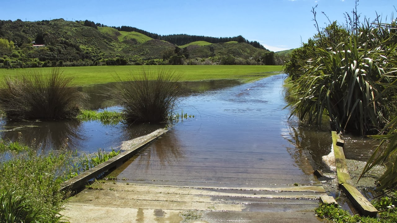
A “lake” on the track! (photo by John)

A quick turn-around to an alternative route led across a bridge over a very swollen stream. This took us to the entrance of the Palmers Garden Centre, in front of which is a large display of Big Mac Slabs Furniture – beautiful garden furniture made from thick slabs of timber. It looks like a garden café, but there’s not a coffee cup in sight anywhere!

We crossed a very swollen stream


Not a cafe setting, but a display of garden furniture!

We rode up Ulric Street which winds through the Plimmerton Industrial Park, from the top of which there is access to the Ara Harakeke Way. It was glorious to pedal along the flat part of the track, and to see flowering broom, swathes of wild purple daisies, and even the delicate white blooms of some early flowering manuka.

Early-flowering manuka

I love it when the purple daisies cover whole hillsides on one side of the motorway, and when the manuka on the other side is in full flower, so that it looks like it’s been snowing. And at this time of the year, the hills in the distance look so soft and such a rich green, like a rumpled velvet counterpane. So beautiful!

Flowering broom and purple daisies, and velvety hills (photo by John)

Before long, we reached Whenua Tapu, from where the track started to climb. To begin with, it runs right next to the motorway, although elevated above it, then it goes through a bushy area which is really pretty.

A pretty bushy area, before the track becomes much steeper (photo by John)

The track became quite steep, but I was determined not to be a wuss this time. I was going to give it my best shot. Most of the way, I did OK. I used my lowest gear, and tried to just keep my legs pumping, while keeping my upper body as still as possible to conserve energy. It seemed to work in all but the steepest bits, where I still had to get off and walk. My legs just couldn’t do the worst of it, and the loading on my heart was just too much (I have a slightly leaky heart valve, which doesn’t help).


It was a struggle up that hill, but I made it! (photo by John)

BUT … I got to the bridge over the railway line at Pukerua without getting grumpy, and I felt pretty chuffed about that.


The bridges over the railway line – one for walkers and cyclists, the other for SH1

At the top of the Pukerua hill there are a few shops, and as always when we go past there, I shuddered at the sign advertising “Le Mer Day Spa”. The French word for “sea” is a feminine word, so it should be la mer, not le mer. And being a picky linguist, it makes me cringe every time I see it.

 
Aargh! It should be La Mer, not Le Mer!

Having reached the shops, we considered stopping for an icecream, but then decided not to. We turned around and whizzed down the hill back to Plimmerton. Wheeee!! Fabulous, the free-wheeling speed, the sun on our backs, and the wind in our hair! Oops, sorry, I just got a bit carried away there. Of course we didn’t have the wind in our hair, we were wearing helmets – but it sounded good …

When we got back to the Plimmerton Domain, there was a group from the local archery club practicing their skills. We stopped for a while to watch them. The bows are quite seriously sophisticated looking instruments. When I commented that it was something I would have been quite interested in learning when I was younger, a man in his fifties came over and said it was never too late to learn anything (I'd agree with that!). Lots of older people were wanting to learn, he said, but there was quite a waiting list to join the club.


Plimmerton archers and their targets (photo by John)


Modern-day archers


Back to Plimmerton, under the station underpass. I was quite taken by the cheerful murals in the tunnel.

Symbols and sights of Plimmerton in the station underpass


A tile and mosaic mural of the seashore in the station underpass
 
We rode past our car, and carried on towards Paremata, where we were planning to have lunch. We popped into a little side street for a look at the beach, which wasn’t there, as the tide was in, and waves covered the whole beach.


The tide was in at Plimmerton Beach (photo by John)

I thought the seats overlooking the beach were rather attractive – made of concrete, but with an artistic touch of paua. Concrete does not have to be ugly, it can be rather beautiful when polished up.


Artistic seats

We rode along the southernmost part of Ara Harakeke, between the water and the railway line, towards Paremata. At Mana Station we went through the underpass – no decorations here – and doubled back towards “Ruby’s”, a café with a nice courtyard, where we had a very satisfying lunch.


Lunch at “Ruby’s” (photo by John)

We still hadn’t had enough of cycling, so after lunch we kept going through the Ngatitoa Domain and Mana Yacht Club. Lots of yachts and pleasure boats were moored at the marina, but out towards the bridge, two fishing boats were anchored off the shore. One of them had an impressive array of masts and tackles and machinery on board, for what was actually quite a small boat.


Fishing boats anchored near the Paremata Bridge (photo by John)

Here we turned around and biked back, through Mana, and Plimmerton, past our car again, and along the foreshore at Karehana Bay. On previous rides in this area we had gone past the boating club at Karehana without stopping, as the gate across the driveway is usually closed. But this time John found a path around the side of a building which allowed us to go onto the wharf, from where there is a great view out towards Mana Island.

Mana is a strangely flat-topped island, which was a base for the Māori chief Te Rauparaha in the 1820s. A decade later, European settlement started there with a whaling station and later, sheep farming. These days the island is administered by DOC (Department of Conservation).

Mana Island (photo by John)

By now a brisk headwind had sprung up, and I thought to myself “this is good practice for when – if! – we get to ride in Holland (where the wind is ever present)”. Taking John to Holland to do some bike touring is one of the items on “my bucket list”.

When we got to the Hongoeka Marae sign, we turned around and rode all the way back to the car on the road, rather than on the foot/cycle path. This was easier, as, being the weekend, there were quite a few people walking on the footpath. Also, I need to extend my “comfort zone”, by riding on the road, rather than dedicated cycle paths, more often.

What with all this riding back and forth, we had managed to cover 25 kms by the time we got back to the car. On the way home, I noticed that the “Prestige Caravans” yard on the corner of Acheron Road had a lot of their caravans and motorhomes open for viewing, so we stopped for a nosey.


$125,000 worth of motorhome! (photo by John)

I love looking inside caravans or motorhomes. I think it would be rather fun to have a holiday in one, even though I’m not a fan of camping. It is quite amazing what they manage to fit into such a small space. All the ones we looked into had not only fully functioning kitchens with stove, microwave and fridge, but also had TV sets, and a toilet and shower squeezed into the tiniest of spaces. That is the main thing that puts me off camping – the fact that you have to tramp across a paddock to get to the ablutions block! Not much fun in the middle of the night, or in the rain!


Inspecting the top bunk (photo by John)

I remember the first time I ever saw inside a caravan. I was nine years old, and we were visiting a Home Show. At the time, my Mum, my sister and I were living in my grandmother’s house along with my uncle’s family and it was all a bit cramped. There was a severe housing shortage in the Netherlands in the 1950s, and a caravan seemed like some sort of solution. We kids thought it was a great idea. But I don’t think Mum did, as we ended up moving into another family’s attic not long after. A great move, as it turned out, as we had a fantastic year there, and our two families became great, lifelong friends.

Having decided that we were not going to sell the house, and we were not going to buy a motorhome, and we were not going to become “grey nomads”, we got back into our little car and drove home, feeling very satisfied with our day.