Here is Part 2 of our recent trip to the South Island. There were two reasons for the trip: one was to attend a three-day Scottish Country Dance school during the Easter weekend in Owaka, in the Catlins; the other was to bike the Clutha Gold Trail, from Lawrence to Roxburgh. We also did a bit of cycling around Owaka, and some touristy drives around the Catlins. On the way down we biked in Christchurch, and on the way back we biked in Dunedin.
We were away for 13 days, so I have written up this story in four parts. Here are the links to
Part 1,
Part 3 and
Part 4.
Friday 19 April – Christchurch to Owaka
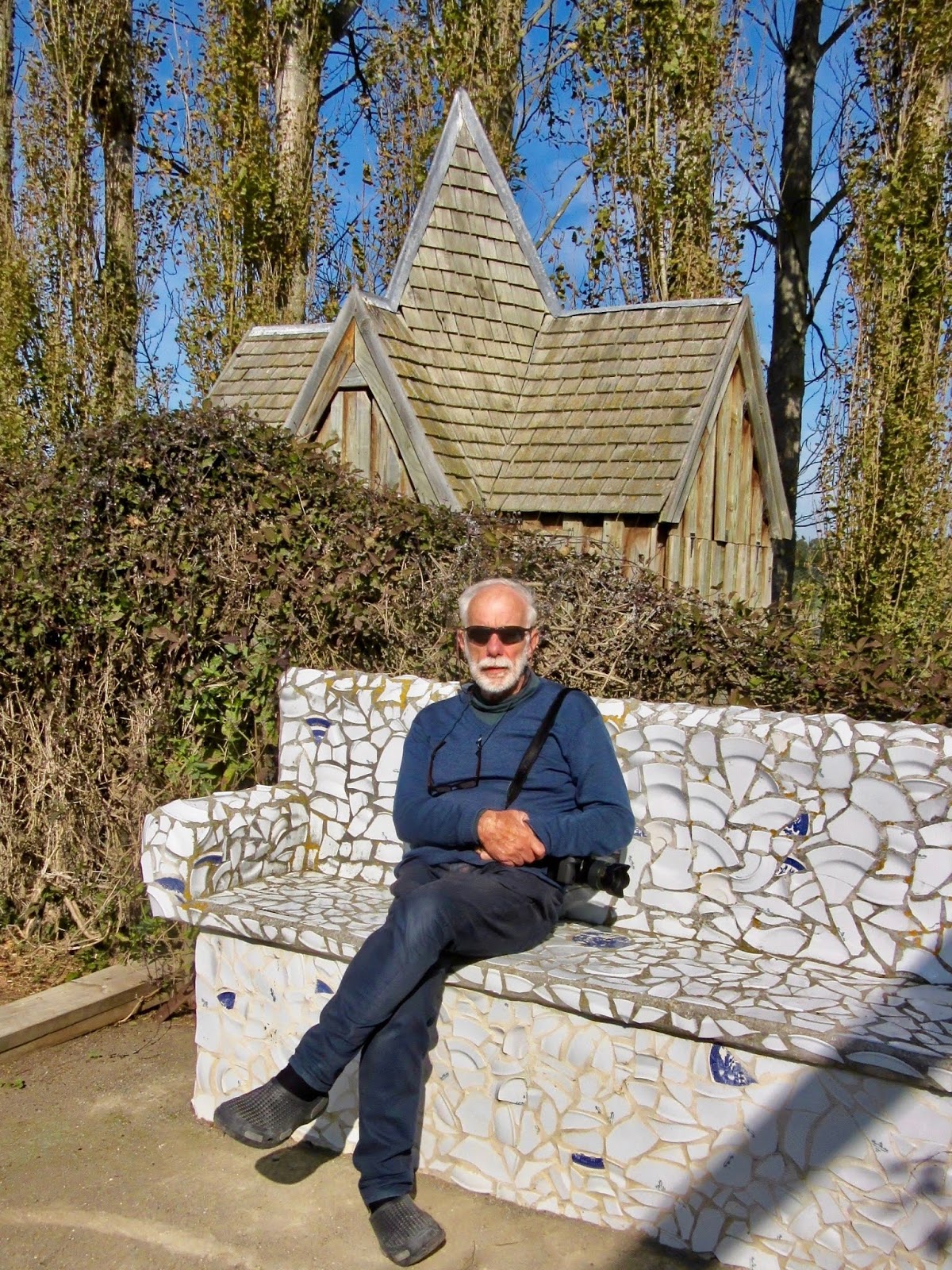
As we were driving from Christchurch to Owaka on Good Friday, a day on which all (most) businesses are closed, I had taken the precaution of booking lunch at The Riverstone Kitchen, on SH1, just south of the Waitaki River (about 20 minutes north of Oamaru). This excellent restaurant was recommended to us by our daughter, after she and her husband visited Dot’s Castle during a NZ Home and Garden tour in February.
“
Dot’s Castle” is the dream castle of Dot Smith, which she achieved after many years of dreaming, planning and hard work. We saw a TV programme about this amazing and highly original woman some time back, and we were intrigued. The restaurant,
Riverstone Kitchen, is on the same property, and is run by chef Bevan Smith, who is Dot’s son.
 |
| We had a delicious lunch (photo by John) |
 |
| Dot’s Castle – there is no moat, but there is a lake … (photo by John) |
After the best meal we’d had since I don’t know when, we took a wander around the impressive potager (fresh vegetables for the restaurant) and flower gardens. Also on the site was a series of little shops selling all manner of “designer” bric-à brac, crockery, dried flowers, artificial flowers, gardening paraphernalia, and masses of “wacky” stuff. I had a lovely browse, while John cooled his heels and took photos.
 |
| A row of little shops (photo by John) |
 |
| I don’t think it’s viable, but it looks good in the garden … (photo by John) |
 |
| The fancy cottage behind John is the chook house |
After this pleasant interlude, we made our uneventful way to Owaka, a small township 35 km south of Balclutha, on the Southern Scenic Route. We were going there for a Scottish Country dancing weekend school, which started with a dance social on the Friday night.
We were staying in a motel in an even smaller settlement called Pounawea, on the edge of the estuary of the Catlins and Owaka Rivers.
Saturday 20 April – Owaka and Pounawea
On Saturday morning we attended the SCD class, and in the afternoon we went for a bike ride. Unfortunately it had rained in the night, and the road we wanted to ride on, to Surat Bay, on the other side of the inlet and estuary, was a muddy gravel road and looked very slippery. We didn’t want to tempt fate this early in our holiday by going for a spill, so we biked on the sealed road from Pounawea to Owaka instead.
We rode alongside a tidal inlet – the tide was in, and it was very still, so there were some lovely reflections.
 |
| Beautiful reflections on the tidal inlet (photo by John) |
 |
| John liked the precision with which these bales of silage had been laid out (photo by John) |
We rode around
Owaka – it really is quite small, with just a handful of streets and only about 300 residents. But it does have a very nice small museum with some interesting displays. Outside the museum is a sculpture of a stylised Māori canoe, as the township Owaka, “Place of the Canoe”, is named after the traditional Māori canoes which were built on the banks of the Owaka and Catlins Rivers.
 |
| A stylised Māori canoe – a sculpture by Russell Beck (photo by John) |
 |
| Information board about the sculpture (photo by John) |
Sunday 21 April – Surat Bay and Jack’s Bay
On Easter Sunday, the SCD class was in the afternoon, so during the morning we first took a walk to the end of the road near our motel, and found a holiday park and camping ground. Being the school holidays, there were lots of families in residence, and lots of kids running around and cycling around the settlement. There was a nice little bushwalk as part of the park too.
 |
| Bushwalk in Pounawea (photo by John) |
Our next destination, Surat Bay, is a beautiful wide beach (while the tide was out), on which there is reputed to be a large colony of sealions at certain times. We went for a short walk on a track through the sand dunes, which ended on the beach. We walked for quite a distance along the beach, out around a point where the beach was very wide. I think John was hoping to see some sealions, but we were out of luck.
 |
| The beach on the estuary of the Catlins River at Surat Bay at low tide (photo by John) |
 |
| The beach is very wide, and a popular place to walk, judging from all the footprints |
After our afternoon SCD class, we diverted off the Pounawea Road to go to Jack’s Bay. It took us over a bridge across the Catlins River. Upstream from the bridge was the Catlins Lake, and downstream the Catlins River (this, according to the names on the map). Upstream, the water in the lake seemed very tranquil, but below the bridge it was making wonderful patterns as it flowed around the bridge piers.
 |
| The bridge across the Catlins River, looking upstream (photo by John) |
 |
| Interesting patterns in the water flowing around the piers (photo by John) |
 |
| Moving water (photo by John) |
Jack’s Bay is lovely beach with holiday cribs (baches) along the foreshore. It is also the starting point of an hour-long walk to Jack’s Blowhole, but unfortunately we didn’t have time to do that, as we had to go back for the SCD formal dinner.
 |
| Jack’s Bay (photo by John) |
 |
| There was a lot of kelp on the beach (photo by John) |
Monday 22 April – Owaka and Nugget Point
The first couple of days in Owaka had been either rainy or overcast, so we were delighted to see blue sky and bright sunshine when we emerged from our final SCD class. Time to become tourists!
First we stopped at Owaka’s own “Teapotland” – a small garden on the main road, absolutely packed with ... yes, teapots! All shapes and sizes – ordinary, extraordinary, pretty, silly and beautiful. Arranged on small terraces, or on posts, and in a display window.
 |
| All manner of teapots – on terraces … (photo by John) |
 |
| … on posts … |
 |
| … and in a window |
Next, we headed out towards one of the most beautiful sites of the Catlins – Nugget Point.
As you get to the coast, the road splits: to the left it goes to Kaka Point and Port Molyneux; to the right it goes to Nugget Point. We first went left, drove through Kaka Point to
Port Molyneux, which was once a thriving port at the mouth of the Clutha River, but after the Clutha changed its course following severe flooding, the settlement died and there is little left of it apart from a few houses and a beautiful beach.
 |
| The beach at Port Molyneux (photo by John) |
Back to Kaka Point, where there was yet another beautiful beach, and we stopped for an icecream, which we enjoyed while looking out at the beach.
 |
| Kaka Point Beach (photo by John) |
From here the road climbed to a high promontory where there was a substantial carpark. There were more tourists here than we’d seen all weekend. From the carpark there was a 10-minute walk to the Nugget Point lighthouse.
 |
| The track to the lighthouse (photo by John) |
Along the way one can look down onto a small cove with a narrow pebbly beach. I stood there for a while, watching the waves come in, hit the sheer rock wall, and wash out again. The retreating water made the pebbles rattle and swish. There was no wind, and the rushing and rattling of the pebbles was the only sound to be heard. It was quite mesmerizing.
 |
| The sound of the waves on the rattling pebbles was mesmerising (photo by John) |
Below the lighthouse was a platform from where one could view the small rocky islands below (the Nuggets) which are home to a colony of seals. We could hear them, but it was too far down to actually be able to see them, even with binoculars.
 |
| The lighthouse, seen from the platform |
 |
| The Nuggets - the seal colony was on the rocks in the shaded foreground of this photo (photo by John) |
 |
| Looking north-east towards Kaka Point in the distance (photo by John) |
On the way back to our motel, through lovely countryside, John’s attention was caught by the patterns on the hill – presumably made during grass harvesting for hay or silage.
 |
| A pretty rural image (photo by John) |
Tuesday 23 April – Purakanui Falls and Lawrence
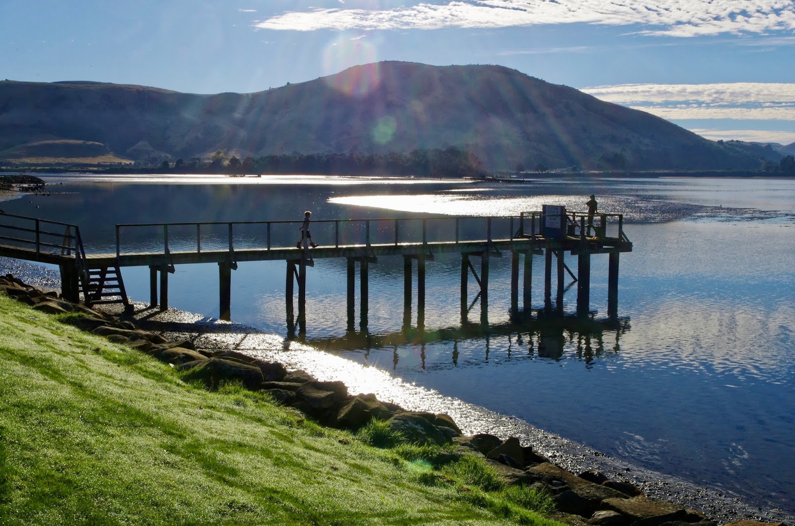
Before we left Pounawea, John took a photo of the estuary just across the road from our motel. The tide was almost in, but you can still see patches of barely covered mudflats beyond the jetty.
 |
| The estuary at Pounawea at nearly high tide (photo by John) |
Today we were travelling to Lawrence, but first we drove to the Purakanui Falls, just a 15-minute drive from Owaka.
From the carpark it was a 10-minute walk on a well-defined bush track to get to the first viewing platform, from where we could see the top of the falls. A further walk down the hill got us to the base of them. The falls have three levels and when in full flood must be quite a sight. However there had not been much rain in the area in recent months, so while still very pretty, they were not as impressive as they might have been.
 |
| The bush track to the falls (photo by John) |
 |
| The three-tiered Purakanui Falls (photo by John) |
A quick stop back in Owaka for a coffee, and we were on our way to Lawrence, our base from where we were going to ride the Clutha Gold Trail. It wasn’t very far to travel, and as we weren’t expected at our accommodation until 2pm, we had a wander around the town’s main street. We saw a couple of “interesting” but not very functional bikes. Signs that Lawrence is making the most of the tourism a cycling trail brings, perhaps.
 |
| Enough to drive you up the wall ... (photo by John) |
 |
| An interesting way to mow one’s lawns – if only the pedals worked! (photo by John) |
One of Lawrence’s claims to fame is that in 1893, a young blacksmith,
Patrick O’Leary built the first bicycle from scratch in NZ (presumably other bikes would have been imported from the “old country”). Not only did he build the bike, but he had to make the tools first!
Lawrence is also the birthplace of the music of NZ’s national anthem, which was composed by local school teacher John Woods in 1879.
We stopped at
Lindy Chinnery’s weaving studio. As a former weaver, that was of interest to me, of course. We were there for quite a while talking about weaving and weavers and looms. She had two large looms, one of them the same as one that I once used to have - a Mecchia Dobby. She had belonged to the Professional Weavers group for a few years, and knew a lot of the people I knew too. I enjoyed browsing her shelves of yarns and her completed work. Her colour preferences are the same as mine - vibrant blues, greens, purples, pinks and reds ... Yum!
 |
| Lindy and her dobby loom – the same type of loom I once used to own (photo by John) |
We called into the Lawrence Museum and Information Office, where we paid our ‘donation’ for the upkeep of the Clutha Gold Trail. A nice little museum to spend some time in. Lots of gold digging implements and photos of the gold rush. Because of course, this is where Gabriel Read discovered gold in 1861 in the gully, just up the road, that now bears his name –
Gabriel’s Gully – giving rise to the Otago Gold Rush. Within six months after reports of his discovery, there were 14,000 hopeful gold diggers in the gully.
After some lunch we headed to our accommodation –
Jail Break Cottage. It was the former town jail – our bedroom was the old prison cell, and the kitchen/lounge must have been the local constable’s office. It was much more comfortable than it would have been back in the day.
 |
| Jail Break Cottage (photo by John) |
After putting our bags inside, we unloaded our bikes and went off to ride to Gabriel’s Gully. A short distance out of town was Gabriel Read's Memorial, which featured a pick and shovel – necessary implements for a goldminer.
 |
| Gabriel Read’s Memorial was erected in 1961, at the centenary of his discovery of gold (photo by John) |
A gentle 4 km ride took us to Gabriel’s Gully. All that is left now of the gold diggings are the hillocks which were once tailings resulting from the search for gold.
We followed the road in the reserve, and found a pretty pond, and picnic area – Greys Dam. In another area there were three huts that we couldn’t determine the use of. They looked like ‘historic’ huts, with a basic bunk and fireplace, and one looked to be in use, perhaps by people looking after the reserve. The doors were open so we could look in.
 |
| The pond at the end of Gabriel’s Gully Reserve (photo by John) |
 |
| We couldn’t decide what these little huts were used for (photo by John) |
 |
| The road back into Lawrence (photo by John) |
When John stopped to take a photo of the gorgeous autumn leaves, I was struck by the silence – the only thing I could hear was a tui, chortling in the distance. It was so quiet that you could actually hear the occasional autumn leaf as it landed on the road!
 |
| Autumn leaves - green turning to gold (photo by John) |


No comments:
Post a Comment