I've been writing up this trip in four parts, and here is where you will find
Part 1,
Part 2 and
Part 4.
Day 6 – Monday 3 December – Cowboy Paradise to Hokitika
We were up at 7:15, and went into breakfast half an hour later. It was another fine day! We couldn’t believe our luck. Breakfast was simple, continental – fruit, cereals, yoghurt, toast with different kinds of jam, Marmite or peanut butter. Mike had said he hoped we wouldn't want a full cooked breakfast as he was without staff! In my booking email, I had also requested a “packed lunch”, but Mike said “just make your own sandwiches from what is on the table”, which was fine.
 |
| Ready to go (photo by Stephen, with John’s camera) |
 |
| One last look at Cowboy Paradise (photo by John) |
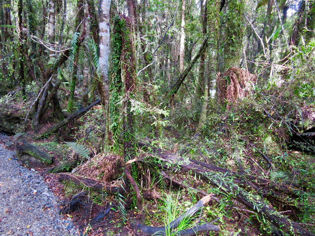
We left Cowboy Paradise at 9:40am. The track first went through about a kilometre of bush. Quite beautiful, with great swathes of moss drooping from the trees.
 |
| So lush and green! (photo by John) |
 |
| A bit eerie too … (photo by John) |
 |
| Great swathes of moss hanging from the branches |
Then we got to the wide, gentle zig-zags that feature on some of the advertising and blogs about the Trail and Cowboy Paradise. We rode down them quite slowly and gently, as John has to watch his balance, but it was nowhere near as challenging as the zig-zag we had done the day before to get into Cowboy Paradise.
 |
| A place to admire the view over the Arahura Valley (photo by John) |
The area was vaguely reminiscent of some places in Switzerland, I thought. There were foxgloves everywhere and lush grass and cattle. This was a working farm, and there were cattle around the track, but they ignored us. We just had to be careful not to fall off the bike if we didn't want to land in a cowpat on the track.
It turns out that Stephen was just behind us, and he took a
video of us riding down the zig-zag. We met him again the next day, and he transferred the video onto John’s phone.
 |
| A cattlestop at the end of the zig-zags (photo by John) |
At the bottom of the zig-zags we ended up near the Arahura River. This river is significant for the local Māori as it is a major source of
pounamu – NZ greenstone.
 |
| The Arahura River (photo by John) |
When we met the track leading alongside the river, there was a sign pointing left to the “Cesspool”– not a very inviting name really, is it? According to the Trail booklet it is a spectacular pool, but it is a very rough 5 km track, with only 2 km rideable, and a good two to three hours’ worth for the return trip. Nah, that’s not us, so we turned right and stayed on the Wilderness Trail.
After a while, we came to the end of this farm property, which was marked by an “interesting” gate. I think it was designed more to keep people out than to keep cattle in.
 |
An interesting gate, improvised a long time ago, it would seem, but probably effective
(photo by John) |
From here we were riding on a gravel road, Milltown Road, and we met one or two cars. One of them slowed down to chat, and the driver said there were two vans following her, with people who were going to do a day’s biking on the Trail. We met her again later in the day, in Hokitika, and she told us she had just come from A&E at the local hospital, as she had done a face-plant in the wet (it rained!), and needed three stitches in her lip! Ouch!
The road climbed for some distance. Mike had warned us there would be one more “big” climb over the hill we could see from his deck (Pyramid Hill), but it was not too bad with the e-bikes. And then it was all downhill after that.
 |
| One last climb … (photo by John) |
On Mike’s recommendation, we side-tracked to Hans Bay, on Lake Kaniere. Here the road was sealed, and it ended up in a place obviously popular for boating, camping and holiday baches/homes. Very pretty, but we didn't linger, as John reckoned it was going to rain. Actually, we were lucky, we didn’t get the rain, but some people behind us did.
 |
| Hans Bay – seen from the boat launching ramp (photo by John) |
 |
| Threatening rain clouds over Hans Bay |
Back to the main road, on a dedicated cycle track alongside it. We
stopped a bit further on to take more photos of the lake – it really
is very beautiful. One of the most beautiful lakes in NZ, they say. The Trail booklet tells us that the lake was formed by a
glacier during the last ice age about 12,000 years ago.
 |
| Lake Kaniere (photo by John) |
 |
| The lake outlet to the Kaniere River |
Just before the Kaniere River Bridge, we crossed the road and we were back in the bush. This was the start of the Kaniere Water Race section. This water race was built in 1875 to supply water for sluicing on the goldfields. At the time, it was 20 km long, but this part of the track followed only 2.5 kms of it.
The forest is absolutely beautiful, but the track was a little hazardous: very narrow, with the water race to the right and a steep drop to the left of us.
Because of its narrowness, the track caused John a few anxious moments, but on the whole he coped quite well. There were warning signs reminding cyclists to keep their distance from other cyclists, and to be careful around the blind corners – it would not do to pile into someone else and fall!
Sometimes the race looked “natural” and in other places it was contained by wooden sides and timber struts across the top, presumably to keep the sides aligned. The water was flowing quite swiftly in the race.
 |
| Sometimes the race was in its “natural” state … (photo by John) |
 |
| … and sometimes it was contained (photo by John) |
 |
| We stopped frequently to take photos |
 |
| There were warning signs in several places along the track |
There were some skinny bridges across the race, and sometimes the race timber boxing formed a bridge across a dip or a wetland.
 |
| There were a few skinny little bridges too (photo by John) |
 |
| The race forms an aqueduct over a wetland |
 |
| This bridge was so narrow, John had to get off and walk |
When we came to the end of the race, there was a shelter, where we stopped to eat the sandwiches we had brought from the Cowboy Paradise breakfast table. Yum, it was a long time since I last had peanut butter sammies!
 |
| Lunch at the shelter by the entrance/exit of the Kaniere Water Race Walkway (photo by John) |
 |
| The Lake Kaniere Reserve is maintained by DOC (Dept of Conservation) |
 |
| The Wilderness Trail was well signposted |
The trail continued through yet more gorgeous bush, before ending up on the main road leading to Hokitika.
 |
| There were quite a few little bridges like this (photo by John) |
 |
| The Kaniere River – I think (photo by John) |
 |
| Towering trees … (photo by John) |
 |
| … and exquisite ferns |
When we got back to the road, from Hurunui Jacks – an accommodation place – there was a cycle track alongside the road, and later a sealed road with a good cycling shoulder, as far as the township of Kaniere.
 |
| A marked cycling shoulder on the Kaniere to Hokitika road (photo by John) |
Then onto a track which was the Kaniere Tramway back in the day. It was built in 1866 to serve the Kaniere Township, and the horse-drawn tram ran on wooden rails. We biked alongside the Hokitika River, and it took a lot longer than I expected to actually get to Hokitika.
 |
| The Kaniere Tramway track (photo by John) |
We went past a big factory, and from the smell, I wondered whether this was a dairy factory. Perhaps it was the factory that our daughter had worked on. John stopped to take some photos, so I cycled back to where I had seen some women inside the factory fence to ask them if this was indeed the dairy factory. Yes, it was. I mentioned that my daughter had designed and commissioned a part of the plant, and she asked what her name was. She recognised it, having seen it on some of the technical specification documents. Cool! A nice proud Mum moment ...
 |
| The Westland Milk Products dairy factory (photo by John) |
We made it into Hokitika, and found our cottage on Beach Street by 1:00pm. It was a lovely cottage – one among a whole row of early pioneers’ cottages. It was very nicely done up, and as a bonus, it had an enclosed, lockable porch at the back, which was ideal for storing our bikes.
We unloaded the bikes, then biked into town – not far, in fact we need not have taken the bikes – to try and find somewhere to have coffee. We were amazed to find the place very quiet. The whole town seemed to be closed early! Most shops and cafés were closed, even though it was Monday. “What a bunch of slackers!”, we thought. It turned out that it was actually Westland’s Anniversary Holiday. We eventually found a café that was open and enjoyed our coffee and scones under a brolly on the pavement.
 |
| We eventually found a café that was open (photo by John) |
Thus fortified, we returned the cottage. We put the bikes in the porch, and the batteries on charge, and then went for a walk. Hokitika is an early NZ town which owes its existence to the discovery of gold on the West Coast in 1864. There are a number of interesting old buildings in the town.
 |
The Carnegie Building (1908). Originally built as a library, it now houses the Hokitika Museum
(photo by John) |
Then along to the beach, with the big driftwood “Hokitika” sign. I wonder if they keep rebuilding it every time it gets destroyed by the wind and tide? We watched some guys swimming in the surf, and when they emerged I asked if the water was cold. No it wasn’t, they said, quite warm, in fact.
 |
| The driftwood Hokitika sign (photo by John) |
 |
| The “T” was decorated with an animal (pelvic?) bone |
 |
| Two people in the surf (photo by John) |
 |
A replica of the schooner Tambo, which was wrecked on the notorious
Hokitika Bar in 1866,
now adorns the far end of the beach (photo by
John) |
After some dinner in town, we went back to the cottage, and while John downloaded photos onto his laptop, I started reading
“The Luminaries”, the Man Booker Prize winning book by NZ author Eleanor Catton, which was on the bookshelf in the cottage.
The novel is set in Hokitika in 1866, at the time of the goldrush, and I had noticed that the town map of Hokitika, which we picked up at the i-Site, highlighted several
“Luminaries” sites – streets and buildings mentioned in this book. So I thought it would be relevant to start reading it. The book had not appealed to me up to then, and I did find it a bit slow for the 30 or so pages I managed to get through. I thought maybe I would acquire or borrow a copy when I got home, maybe not. (Note: I was given a copy for Christmas, and having started reading it this week, I am still trying to get through the first chapter …)
 |
This building is on the corner of Revell and Camp Streets, both of which
are “Luminaries” sites
according to the town map (click to enlarge) (photo by John) |
At 8pm we went to the beach to watch the sunset. We walked to Sunset Point – the place where the beach ends up at the mouth of the Hokitika River – but the sunset didn't happen because of the clouds. However we were very impressed with the waves crashing around the point and into the river. It must have been very scary to come over the bar and into the river mouth in a small boat, as most of the goldminers had to do at the time of the goldrush.
 |
| Waves crashing around Sunset Point |
 |
| The entrance to the Hokitika River (photo by John) |
 |
| Where the wave from the sea meets the water coming down the river (photo by John) |
We stayed there for quite a while, as did a lot of other people, hoping to see a sunset, but at dusk we walked back to the cottage.
We had booked to stay here for two nights. Originally, I had thought we would have an extra day here so we could take a tour to the Hokitika Gorge and other touristy sights, before doing the final stretch of the Wilderness Trail to the town of Ross. But when we changed our plans because we couldn’t get a shuttle back from Ross, we decided to use the spare day to visit the Tree Top Walk, which is on the Wilderness Trail, and then instead of continuing on to Ross, we would return to Hokitika, and take the bus to Greymouth the following day.
Day 7 –Tuesday 4 December – Tree Top Walk and Lake Mahinapua
The forecast was for rain. When we got up at 8:30 it was overcast and just spitting. We walked to the Bakery for breakfast – not very inspiring …
We started biking at 9:30, wearing parkas because of the slight rain. It was very windy on the bridge, as we were crossing the Hokitika River, on a separated cycle track. The cold wind was coming in off the sea, straight into the river mouth, and trying to swipe us off the bridge. Just as well we had good barriers on either side of us, but even so, John couldn’t keep his balance and walked all the way – a whole kilometre! I biked very slowly behind him and took some photos, but it was difficult to keep the camera still. I would always rather bike than walk, as apart from sore feet, I always get attacked by my bike pedals when I walk.
 |
| The bridge, seen from Sunset Point, the previous day. It is 1 km long! (photo by John) |
 |
| Looking out towards the Hokitika Bar from the bridge |
Having survived the bridge, we found ourselves on a track beside the highway, and then on a narrow, sealed road beside a golf course, until it crossed the road and went into the Mahinapua track. This meandered along the side of the road and around a lagoon, then across an old, former rail bridge.
 |
| We crossed a former rail bridge, which had been restored for the Wilderness Trail |
By this time, the weather had started to clear. We stopped to talk to a guy manoeuvring a flat-bottom boat in the lagoon. He was getting ready to take some tourists for a tour into the swamps, lagoons and river. He said the track we were about to ride was finished only two months ago.
The track was beautiful - gorgeous rainforest, very green, very primeval looking, with fallen trees jumbled over each other and everything that had fallen, immediately colonised by other plants.
 |
| More beautiful rain forest (photo by John) |
 |
| This tree is covered in kiekie, a NZ native climber |
 |
| Jumbled rain forest floor – everything that falls is immediately colonised by other plants |
 |
| Beautiful mosses |
Later we arrived at a bridge across a lagoon and then a boardwalk across a swampy area. Quite beautiful. John didn’t like the boardwalk – it makes him feel unsafe with his balance. I had to go ahead of him without stopping, so he wouldn’t have to stop. But once at the end, I parked my bike and went back to take some photos. We saw a white heron – kotuku – in the distance, and I was able to get a photo of it by using the tele-lens.
 |
| The lagoon (photo by John) |
 |
| The bridge across the lagoon (photo by John) |
 |
| A kotuku – white heron – picks its way through the swamp |
 |
| View from the boardwalk (photo by John) |
After the boardwalk, the track was quite narrow, stony and bumpy, with lots of little boardwalk bridges. John had quite a bit of trouble with his balance that day, so he didn’t want to bike across the bridges, but every time he got down to walk across and then wanted to start biking again, his balance would mess him about. He did lose his rag a few times, poor man.
 |
| The track was narrow and quite stony and bumpy |
 |
| The little bridges messed with John’s balance |
We made it to the
Tree Top Walk at 12:00. This is an aerial walkway that takes you through the canopy of the tallest trees of the rain forest. It runs for nearly half a kilometer and features a 40 m high tower, which boasts fabulous views over Lake Mahinapua.
 |
| A map of the Tree Top Walk (source) |
I was keen to take this walk, but John wouldn’t have a bar of it. It would play havoc with his balance. But he was happy for me to go, while he waited in the café.
But first, we had lunch. And when I went back to my bike to get something, there was Stephen, who had just arrived. Of course we invited him to join us at our table, while he had his lunch. He told us he had made a
video of us as we were going down the zig-zags after Cowboy Paradise. He showed it to us and copied it onto John’s phone.
He said he had put it on Facebook, and one of his Aussie friends had commented
“I know them, I’ve been following their blog for years”! How about that? We were feeling quite chuffed. (Note: follow the link, and read the comments on the right "How people reacted")
Stephen wasn’t interested in seeing the Tree Top Walk either, so I left the two of them to talk and set off. It was a walk up a steepish driveway, quite pleasant in the sunshine. Along the way, there were information panels about native plants, in front of the relevant plant or tree, so I took quite a few photos of both the panels and the plants. While I am not a botanist, or even a keen gardener, I am quite interested in plants – I like to identify them and know their names. Often, while biking in the forest, I wonder what this or that plant or tree is called, so I found these panels quite helpful.
 |
| One of the information panels – this one for the miro … |
 |
| … and the beautiful trunk of the miro |
 |
| The beginning of the Treetop Walk |
The walkway was 450 metres of enclosed steel walkways, 20 metres high, among the canopy of the big Rimu and Kamahi trees. It was quite amazing to be so close to the canopy of the trees, but also stomach-churningly high to look down to the undergrowth.
 |
| So close to the canopy … |
 |
| … and so high above the ground! |
 |
| This enormous rimu towers above everything else |
 |
| Information panels were displayed on the sides of the walkway |
The walkway swayed very slightly, especially when a family of six people were also on the same stretch of bridge. There were information panels which referred to numbers on a map, but I didn't have a map. I asked the other group where they had got the map from, and they kindly offered me one of theirs.
At the end of a long walkway was the tower, with a staircase spiralling around it. Although I don't generally like heights – they give me the heebie-jeebies – I decided to try climbing to the top, as the view over Lake Mahinapua is supposed to be amazing from up there.
 |
| The tower is supposed to have fabulous views from the top |
But I only got to about two-thirds of the way to the top, before I completely freaked out and couldn’t go any further. My heart was beating in my throat, and the adrenalin was pumping. So I sat down on a step, before heading back down. I had to sort out where I was going to keep my phone, my camera and my map without losing them over the side or anything dropping out of my pocket, as I would need both my hands to hold on to the rails, so I couldn’t hold on to my camera. Once sorted, I climbed down, ever so slowly and carefully, and heaved a sigh of relief when I got to the bottom of the tower.
 |
| But I did manage to take this photo from about half-way up .. |
Then a little further along, there was the cantilevered bit, sticking out over the trees below. That was also a freak-out moment. I couldn’t make myself go to the end of it, thinking it was only held up by two cables with no support underneath. Nah, I wasn’t going to go to the end …
 |
| The cantilevered bit … |
 |
| … seemed to be held up by only two cables. Aargh! |
I gingerly made my way back to the safety of the supported walkways and admired the forest below and the closeness of some of the canopy.
 |
Interesting to see the different “layers” of the forest –
the tree ferns, the medium height trees, and the giant rimu |
 |
Amazing to be able to see, at such a close range, all the epiphytes, mosses and lichens
that grow at the top of the trees |
When I returned to the café, Stephen was just about to depart. After waving him off, John and I had another coffee – I needed it!
 |
| Stephen was about to depart. His clothing left nothing to chance – rain or shine! (photo by John) |
We left Treetops at about 2:30. We continued on the trail until we got to the highway at Ruatapu. The official Wilderness trail turns left here, to carry on towards Ross, but we turned right, to go back to Hokitika.
 |
| The last Wilderness Trail distance marker before we left the Trail |
From here we were riding on SH6. We diverted onto a loop road that went to the Lake Mahinapua DOC Camping ground. We didn’t get as far as the campground, but we did find the lake. Here in the shallow, swampy area along the edge we saw four kotuku - white heron - so beautiful. I managed to get a few photos of them.
 |
| Lake Mahinapua |
 |
| Two of the kotuku |
 |
| The kotuku – what a magnificent bird! |
When we got back to SH6, the sky was looking a bit dodgy, and we put on our parkas. None too early, because within minutes, the rain came down – it absolutely hosed down! Huge big raindrops that stung our faces. We turned up the assist level to 5 (John to 4) as we now had a strong headwind as well. We got absolutely drenched in the half hour it took us to bike back to Hokitika. It was quite an experience riding on the 1 km-long bridge across the Hokitika River in those conditions! We were back at the cottage by 4pm.
We put the bikes in the closed-in porch – thank goodness for that! – and got out of our wet clothes. I put everything in the washing machine to spin out the worst of the water, and brought the drying rack inside to hang things on it, while John discovered that the fancy Dyson fan was actually also a fan heater, so we set it up to blow onto the rack, and wet bags and shoes. Luckily the weather had got cooler, so it was quite nice to have the heater on.
 |
| Drying our gear after getting drenched |
Soon after we got back, the storm really let rip, with thunder and lightning, and driving rain clattering against the windows. It was violent, but relatively brief. By 7pm, we were able to go out to the “Fat Pipi Pizza” to have dinner. It rained again as we were walking back to the cottage.
 |
| The bikes safely stored in the porch, while the storm raged outside! |
In the evening we watched TV for a while, until the wind caused the image to go off, as the satellite dish had been jiggled. Oh well, back to my book.
We have been incredibly lucky with the weather on this trail. Though each day some rain was forecast, we managed to dodge it every day, except this time. Seeing how very wet we got in just half an hour, it would have been a nightmare if we’d had rain all along the way. Not only actually getting wet, but more importantly, getting things dry again for the next day. And fortunately we did not have our bags with us on this day, or everything we had might have got wet too!
Day 8 – Wednesday 5 December – Hokitika to Greymouth
It was still raining when we got up. We had to leave the cottage by 10 am, and didn’t have to go to the i-Site for our bus to Greymouth until 11:45, so we waited out the rain, packed up the bikes, tidied the cottage, and left at 10, to have breakfast at the same bakery as the day before. I would have preferred to try a different place, as the fare was not very exciting, but this place had the advantage that we could keep an eye on the bikes from the window seat. Its rained again while we were having breakfast, but it didn't last.
 |
| We were able to keep an eye on the bikes from the window seat (photo by John) |
We sat there for quite a while, as we had more than an hour and a half to fill before the bus, but at 10:45 John was getting titchy, so we walked our bikes through town.
We wandered along to the i-Site from where the bus would be leaving, and John folded the bikes and put them into the bags. We parked the bagged bikes and our blue bags on the pavement by the bus stop, and carried our front bags with the shoulder straps.
 |
| All packed up and ready for the bus (photo by John) |
I went into the i-Site to look around, while John stood and talked to a man (Tony) on a very fancy mobility scooter. I found a display folder of photos of Hokitika history, that related to the narrative of Eleanor Catton’s book
“The Luminaries”. Very interesting.
 |
| John spent quite a while talking to this gentleman about his fancy mobility scooter (photo by John) |
The bus was a little late but we arrived in Greymouth right on time - 1:15 pm. We unloaded our bikes and bags, and soon had the bikes back together and the bags loaded on. We biked down to the Holiday Park where we had left the car. We went on the “Trail”, but John took a shortcut which cut the distance by 2 km. However, as I found out later, we got onto the stop bank track a bit too far along and missed the “official starting point of the trail”. A pity – it would have been nice to have had a photo of it.
We had the same unit as we had before we did the trail, and John went to get the car from where it had been parked while we were away, while I unloaded the bags off the bikes.
We spent the afternoon by going into town for a while and generally pottering around. John was trying to fix a new mirror onto his bike as he had lost his somewhere along the way.
At 8:40 it looked like the sky was clearing and there would be a good sunset, so we went down to the beach. It was a little too late, the sun was already below the bright sky and obscured by low-level cloud. But the beach was an amazing sight. It has been very windy today, and the sea was really quite rough. All along the beach there was a huge amount of
froth – about a meter deep in places – being pushed ashore by the waves crashing onto the beach. It looked like gigantic creature, writhing and squirming, breathing in and out. Fascinating. Lots of driftwood on the beach too, that looked as if it had been deposited recently.
 |
| The beach in the afternoon – no sign of any froth (photo by John) |
 |
| By evening, this is what it looked like (photo by John) |
 |
| One might think this was one of John’s Antarctica photos! |
 |
| It looked just like dirty snow |
 |
| It pulsed and writhed with each successive wave coming in |
 |
| We did get a sort of sunset, but the froth was more interesting (photo by John) |
* * * * * * * * * * * *
So this was the end of the West Coast Wilderness Trail. Would I do it again? Yes, I think I would like to do it again one day, as the scenery is absolutely stunning and the trail is easy to ride, but I would do it differently. I found the first two days' cycling disappointingly short, and the accommodation in Kumara and Cowboy Paradise was not particularly wonderful. I would probably do the Greymouth to Cowboy Paradise stretch in one day, and perhaps stay in a different place overnight. I would want to complete the stretch to Ross, which we missed out on this time. And I would probably want to spend more time in Hokitika and do that tour to the Hokitika Gorge and the lagoon, and spend time in the Hokitika museum.
Food for thought. Perhaps in the autumn or winter, when the weather is supposed to be quite good on the Coast. Maybe next year, or the year after, if we are still capable of such a trip by then. Who knows …


The article is so huge that at first when I saw the length, I decided not to read it till the end. However, I enjoyed reading about the entire west coast trip so much that I read it till the end.
ReplyDeleteHello, I'm glad you enjoyed it.
ReplyDelete