Thursday, 13 July 2017

Folding Goldies ride – Pukerua-Whitby-Porirua


On Wednesday 5 July, we went for another Folding Goldies ride. The plan was to take the train to Pukerua, then ride down Te Ara Harakeke to Mana, cross to the Camborne Walkway and head to Pauatahanui’s Ground Up Café for coffee/lunch. Then through Whitby and Bothamley Park to Porirua, and home.

It was a beautiful, frosty day – clear and calm, but very cold. So we wrapped up warm – long trousers instead of short, and I had four layers on under my jacket, plus my neck warmer. My body was toasty warm most of the day, but my hands were very cold in my fingerless biking gloves. They did warm up as the day wore on.

It was the biggest group we’ve had so far. Our neighbour Sue met us at Takapu Road station. Luckily it was a long train with two carriages that could take bikes. Alastair, Nigel and Paul were in the back carriage, so we hopped on the front one. Some poor chap with a bike (not a FG) at Mana station missed out. The guard wouldn't let him on, as each carriage is only allowed to take three bikes. We could have folded up one of our bikes, but the train departed before we could negotiate that with the guard.

Waiting for us at Pukerua were people who had come in from Kapiti: Lynn, Doff and Neil, Frank; Colin, who had biked up, and two new people, Heuchan and Richard. Thirteen people in all.

A big group, about to set off from Pukerua Station (photo by John)

Doff on the Pukerua footbridge over SH1 (photo by John)

Down Te Ara Harakeke (photo by John)

It was very cold coming down the hill – in shady areas there were patches of frost still in the grass alongside the track, but fortunately not on the track itself. The ride went well until the Camborne Walkway. On the unsealed, somewhat slippery track that runs along behind the boat sheds, we had to keep well to the left to make room for a couple of women with pushchairs. While keeping to the left, and looking to the right to make sure I avoided the pushchairs, I slid into the gutter, and then into a hole. The bike stopped, I kept going and went flying. Crash! I’m afraid I let go of some choice expletives.

One of the women came to my aid to lift the bike off me. It is quite heavy, and my right leg was folded underneath me and the bike, so I had trouble getting up. I ended up with a fist-sized bruise above my right knee, and bruising all around my left knee as well. But generally, I was OK, and so we carried on.

On the Camborne track – note muddy knees and shoes from my fall … (photo by John)

When we got to Grays Road, we rode for a short distance on the road, before crossing to a new boardwalk through the wetlands. We had seen the flags marking out the proposed track the last time we were there (in September), but it was now completed, as far as just past the bridge.

The proposed track, in September 2016 (photo by John)

On the new boardwalk, coming up to the bridge (photo by John)

The wetlands at low tide

It was great to be able to divert onto the boardwalk, as that bit of road is quite treacherous – winding, no shoulder, and prone to impatient drivers. However, the fun was short-lived as we had to go back on the road for another short distance before we got to Motukaraka Point.

The end of this stretch of boardwalk – and back onto the road

The peloton riding at Motukaraka Point (photo by John)

Riding at the back of the group, I was struck at one stage by the colourful combination of all the yellow, red and orange jackets as they were riding past a tall clump of red-hot-poker flowers (Kniphofia). It would have made a great photo, but the moment was gone before I could get my camera out.

We got to the Ground Up Café at 11:15. Just a bit too early for lunch, but I had soup anyway, and it was very nice. After lunch we headed towards Whitby.

Ready for take-off after lunch (photo by John)

Taking a breather at the top of the steepest climb of the ride in Whitby (photo by John)

Waiting for the stragglers (us!) in Bothamley Park (photo by John)

I was not the only one in the wars that day. John had a couple of mishaps (slow falls, he called them) on slippery ground. His compromised sense of balance does not help in these situations. Fortunately he was not hurt.

John in on the Bothamley Pathway

At the end of the Bothamley Pathway, there is another track that skirts the Kenepuru Stream through Cannon’s Creek. But this track was closed – I believe one of the bridges had been damaged. Actually, I was relieved to find we had to stay on the road instead. This track is quite narrow and can be muddy, even boggy, and I didn’t want either of us to do any more slip-sliding around.

We were lagging behind a bit, and some of the time the others waited for us to catch up. But at the end, I suppose they must have made a run for it so they could catch the train back to town from Porirua. They got there just in time. We arrived at the station underpass just as it was leaving.

We didn't need the train. We were able to just bike back to Takapu Road on Te Ara Tawa. We did 35 km all up.


Saturday, 1 July 2017

A book launch


On Tuesday 20 June, John and I attended a book launch at Vic Books – the bookshop on the Kelburn Campus of Victoria University. The book to be launched was entitled “You Do Not Travel in China at the Full Moon: Agnes Moncrieff’s Letters From China 1930–1945”, edited by Barbara Francis, and published by Victoria University Press. 

The cover of the book (source: Victoria University Press)

This wonderful book is a collection of letters by a New Zealand woman, who was posted to China by the YWCA during the turbulent years of the Second Sino-Japanese War. The title refers to the fact that whenever there was a full moon, there would always be Japanese air raids.

The editor, Barbara Francis, who knew Nessie well, spent a decade reading, transcribing and researching her friend’s letters which had been lodged with the Alexander Turnbull Library

Six years ago, I was introduced to Barbara by a mutual acquaintance, when she was looking for someone to help with the copy-editing and formatting of the manuscript, in preparation to having the letters formally published.

I was immediately fascinated by this project, as it dealt with China in the mid-1940s, which was a time when my father was passionately interested in China. In fact, he was posted to China as a Netherlands diplomat in 1948 (along with my mother and one-year-old me). However we spent only a couple of years there, before being evacuated ahead of the arrival of the Communists.

It was a real privilege for me to be involved in a small way in Barbara’s long journey towards publication. John got involved too, when some of Nessie’s photos and documents had to be converted to a suitable format. So attending the launch of her book, was pretty special for both of us.

Waiting for the launch (photo by John)

The book was launched by Michael Powles, former NZ Ambassador to China and currently President of the NZ-China Friendship Society. The publisher, Fergus Barrowman, looks on proudly (photo by John)

With Barbara Francis – getting my copy of the book signed (photo by John)

The following Saturday, there was a very interesting interview with Barbara on Kim Hill's radio programme. Well worth a listen.

                                                      * * * * * * * * * * * *

On a separate note, I had not been to the new premises of Vic Books, and I was quite gobsmacked about the changes at Victoria University. After the book launch, we had a little wander around the new spaces.

Of course, big changes were to be expected since I was a young student there half a century ago (really? is it really that long?). But even when I went back there for a course in the mid-1990s, the space between the Easterfield and Rankine-Brown (library) Buildings, was still just a windswept uninviting open space. And all this new development has happened since John retired from working at the university in 2009.

Now the quad has been covered in, a new floor built, the library extended to join Easterfield, and there is a café attached to the bookshop. There are pleasant seating areas, and great study desks – all with power for the students’ laptops, and presumably they have wi-fi throughout. I was seriously impressed.

Library space between Easterfield and Rankine-Brown (photo by John)

View over Wellington from Victoria University (photo by John)


Saturday, 24 June 2017

Mana to Pukerua


Last Monday, 19 June, we took a ride from Mana to Pukerua Bay. It was fine but cold, however there was little wind. We parked the car at the Ngati Toa Domain in Mana, and biked along the foreshore to Plimmerton.

The rocky foreshore, looking across to the Whitireia Peninsula and Mana Island beyond (photo by John)

Looking the other way, towards Plimmerton (photo by John)

We biked up Te Ara Harakeke from Plimmerton to Pukerua, where we used the pedestrian overbridge to cross SH1, so we could explore the “other” side of Pukerua. We have lived in Wellington for over 50 years, and have driven through Pukerua a gazillion times, but we had never explored that area.

After crossing the railway line at the station, we headed to the left, towards a track that looked promising. However it was the track leading to the Escarpment Track. This is the steep 10 km track that clings to the side to the Paekakariki Hill. It was opened last year, and is part of the Te Araroa Walking Trail which runs the length of New Zealand, 3,000 km, from Cape Reinga to Bluff.

While I am full of admiration (no, actually, I think they're completely bonkers!) for the many people who are bold and keen enough to walk this track, there is no way at all that I will ever attempt it. Not on foot, and not by bike (which is not possible anyway). I stick to the assertion that I am a “flatlander” – I don’t “do hills” if I can help it.

The sign at the start of the Escarpment Track is full of warnings (click to enlarge), but it doesn’t seem to put off hundreds of people who enjoy walking it – but it’s not for me! (photo by John)

This part of Pukerua Bay is a pleasant suburban area, where some of the streets have gorgeous views out towards Paraparaumu and the Tasman Sea.

Some streets had great views (photo by John)

We came across a house which was a work of art in progress. Three-quarters of the façade had been painted with a view, which I imagine will be like the view they get from the windows on the other side of the house. Or perhaps, as John suggests, it could be the view one gets from Plimmerton. The lower right quadrant is yet to be painted. We will have to come back next summer to see if it has been completed.

The painted house (photo by John)

We biked all around the streets, and arrived at the old, now closed, Muri Station. The Escarpment Track skirts this area. We continued on the path alongside the station, but it petered out at a grassy slope, and we ended up pushing our bikes up it (thank goodness for the “walk assist” on our bikes) to get back to the street above.

After a good explore around the streets, we saw that clouds were gathering, and we didn’t want to get caught in the rain, so we headed back. We stopped at Plimmerton’s Big Salami Café for coffee and one of their delicious pizzas. We’d had a pleasant ride, exploring a "new" area, and John had managed it OK, despite some health concerns a few days earlier. We had done 22 km.

The foreshore track between Plimmerton and Mana (photo by John)


Folding Goldies Ride – Whiteman’s Valley


I’m getting very much behind on my blog posts. I must write up our last Folding Goldies ride, as the invitation for the next ride has already arrived in our inbox. So here goes …

On Wednesday 7 June, the Folding Goldies ride took us to Whiteman’s Valley. Alastair, the organiser, described the ride like this, on Meet Up: “Whiteman's Valley is one of the nicest rides in the Wellington region – the word 'bucolic' was invented for places like this”.

The weather had not looked promising all week, but on the day, it was OK-ish. Still overcast, but at least not raining. As the day wore on, more and more blue sky appeared, and while riding down the valley it was actually sunny. But it was COLD!

We took the train to Wallaceville from Petone. Alastair, Nigel and Colin were on the train already. Doff and Neil met us at Wallaceville. They live in Waikanae, so they drove down to meet us at the station.

Waiting for the train at Petone (photo by John)

We all met up at Wallaceville Station – from left: Nigel, Désirée, Neil, Doff, Colin, Alastair
 (photo by John)

From Wallaceville, it was straight up the hill towards Whiteman’s Valley. On our e-bikes John and I got there well before the others, so we had to wait for them to catch up.

Wallaceville Road is quite steep in places (photo by John)

All caught up (photo by John)

The valley is lovely but I didn't enjoy it as much as I had on previous occasions – mainly because it was so cold. Also, when you are talking with others, and keeping a look-out for them, you don't take quite so much notice of the surroundings, or get as much enjoyment from them.

Doff on Whiteman’s Valley Road. The sky gradually cleared from grey to a more pleasant blue
 (photo by John)

John and Neil. Note John’s two cameras, one on his handlebar, and one underneath his saddle
 (photo by Alastair Smith)

As we rode past, we got a whiff of the distinctive, somewhat sour smell emanating
from the polythene-wrapped bales of silage (photo by John)

Whiteman’s Valley Road comes to an end at the junction with Johnsons Road and Blue Mountains Road. The Short Straw Café on Johnsons Road was not open, so we hurtled down Blue Mountains Road to have lunch at the Silverstream Bakery and Café at the bottom. Riding down the hill – for about 7 km – was great, but very hard on my gammy hands, as I have to bring my thumbs around on the handlebar so I don't loose my grip on the brakes, but I can't keep that position for very long – it hurts!

At the bottom of the hill (photo by John)

Lunch at the bakery was very pleasant – as Alastair said “It’s another place to put on our Folding Goldies’ list of cafés”.

Lunch at the Silverstream Bakery and Café (photo by John)

Afterwards, Alastair and Nigel took the train back to Wellington, Doff and Neil took the train back to Wallaceville (where their car was), and Colin, John and I rode down the Hutt River Trail back to Petone, where we had parked the car. All up, we did about 38 km. Colin, however, decided he would ride home from there, all the way to Titahi Bay. Fortunately he was riding an e-bike.

It was very, very cold coming down the Hutt River Trail, as the southerly had got up. I never warmed up all day, until I had sat by the heater at home for half an hour with a hot cup of coffee in my hand.


Monday, 22 May 2017

Folding Goldies ride – Te Ara Kapiti


Last Wednesday 17 May we went on another Folding Goldies ride. Dubbed “Kapiti: Expressway and Espresso” by leader Alastair Smith, the plan was to take the train to Waikanae, bike to Peka Peka for coffee at Harrison’s, then ride the cycling and walking trail alongside the Kapiti Expressway to Raumati and Te Ara o Whareroa to Paekakariki, from where we would take the train back to Wellington.

During the week leading up to FG day, I was eyeing the weather forecast, and dreaded what was coming. On the day, we woke to pelting rain, and my reaction was “Forget it, I’m not going”. Several other people who had said they would be coming along, let the group know by email that they weren’t coming after all because of the weather. John and I argued back and forth about whether to go, but then, just before 9 am, the sky seemed to be clearing somewhat, so we headed to the train. “If it is really awful up there, we can just have a coffee and come straight back on the train” John said. There were five of us on the train, and a few more joined us at Waikanae.

At Waikanae station – I don’t know why everyone is looking at me … (photo by John)

Alastair suggested we could ride to Peka Peka on the “old” SH1, which does not have a lot of traffic on it now that the Expressway takes most of it. It wasn’t raining when we got to Waikakane, but by the time we had met everyone (several new people), chatted a bit, and started off, the rain really set in. Parka on, glasses off, hood on under the helmet, gloves on to stop my hands from sliding around on the wet handlebar. Within minutes we were saturated.

Fortunately it didn’t take terribly long to get to Peka Peka, less than half an hour. As expected, there was not a lot of traffic, but we did get doused by a big truck hurtling past.

At Harrison's, we all crowded into the small inside area for our coffee and eats – sitting outside was not an option today.

The rain had abated somewhat when we took to our bikes again, but had not stopped completely. John did instal his waterproof camera on his handlebar, so was able to get some photos.

The rain had abated, but it was still pretty miserable (photo by John)

The track between Peka Peka and Paraparaumu is not sealed, and it was quite muddy and riddled with puddles. Those people who did not have mudguards on their bikes got very mucky indeed, with mud spatters on their legs and all the way up their backs. Our bikes, which John had cleaned just a few days earlier, were all muddy again, despite having mudguards.

The track was rather muddy (photo by John)

By the time we got to Waikanae, the rain had stopped and soon after we even saw some blue sky.

The track diverts from the Expressway for a short distance near the Grace family wāhi tapu land

Waiting for others to catch up at the entrance to Te Ara o Whareroa (photo by John)

From here, where there is a side track overlooking the beach, we could hear the thunder
of the surf (photo by John)

Back at Paekakariki, we took the road along the waterfront to get back to the township. The surf was rolling in strongly. We stopped to take photos.

John waits while his rear-mounted time-lapse camera (under his saddle) takes a photo of Kapiti Island

Kapiti Island and the surf

We stopped at the Perching Parrot Café for lunch and/or more coffee. Lately this café, which used to be closed on Wednesdays, has been opening every day as demand has increased. It was pretty busy, and we moved an extra table to a spot right outside the post office, blocking the PO boxes. A couple of locals came to clear their boxes, and had to ask to be let through …

We scored a table right outside the post office … (photo by John)

… but had to get an extra table to make room for all nine of us (photo by John)

Tucking in to lunch (photo by John)

We took the 2:15 pm train back to Wellington, having biked 35 km – very satisfying, despite the rather wet start.

Sunday, 21 May 2017

A biking trip to Hawke’s Bay


Well, we finally did it. We went away for a few days’ cycling in Hawke’s Bay, from Friday 5 to Tuesday 9 May. The weather forecast looked favourable, and we were able to book our favourite accommodation near Hastings for four nights, at short notice. We stayed at “Arbor Vitae” where we had stayed twice before, and loved it. The cottage is separate from the main house in its own little garden, and looks out on a small orchard/paddock with half a dozen sheep, and a view towards Te Mata Peak. Quite idyllic.

Half a dozen sheep in the paddock/orchard. Te Mata Peak in the background


We travelled to Hastings on Friday 5 May, over the Rimutaka Hill Road, because the more usual route was not usable. The Manawatu Gorge road had been closed a couple of weeks earlier by a huge slip, that will take many weeks to clear. 

It was a lovely day and we had a smooth journey, stopping a few times along the way, and arriving at the cottage in the late afternoon, just as Mark, our host, arrived home from work. It was two years since we had last been here, and we were amazed at how much the olive trees in the cottage’s garden had grown.

After an evening enjoying some old sitcoms on Sky TV (which we don’t have at home, so this was a rare treat), we had a comfortable night’s sleep, and were ready nice and bright the next day for a long bike ride.


Saturday 6 May

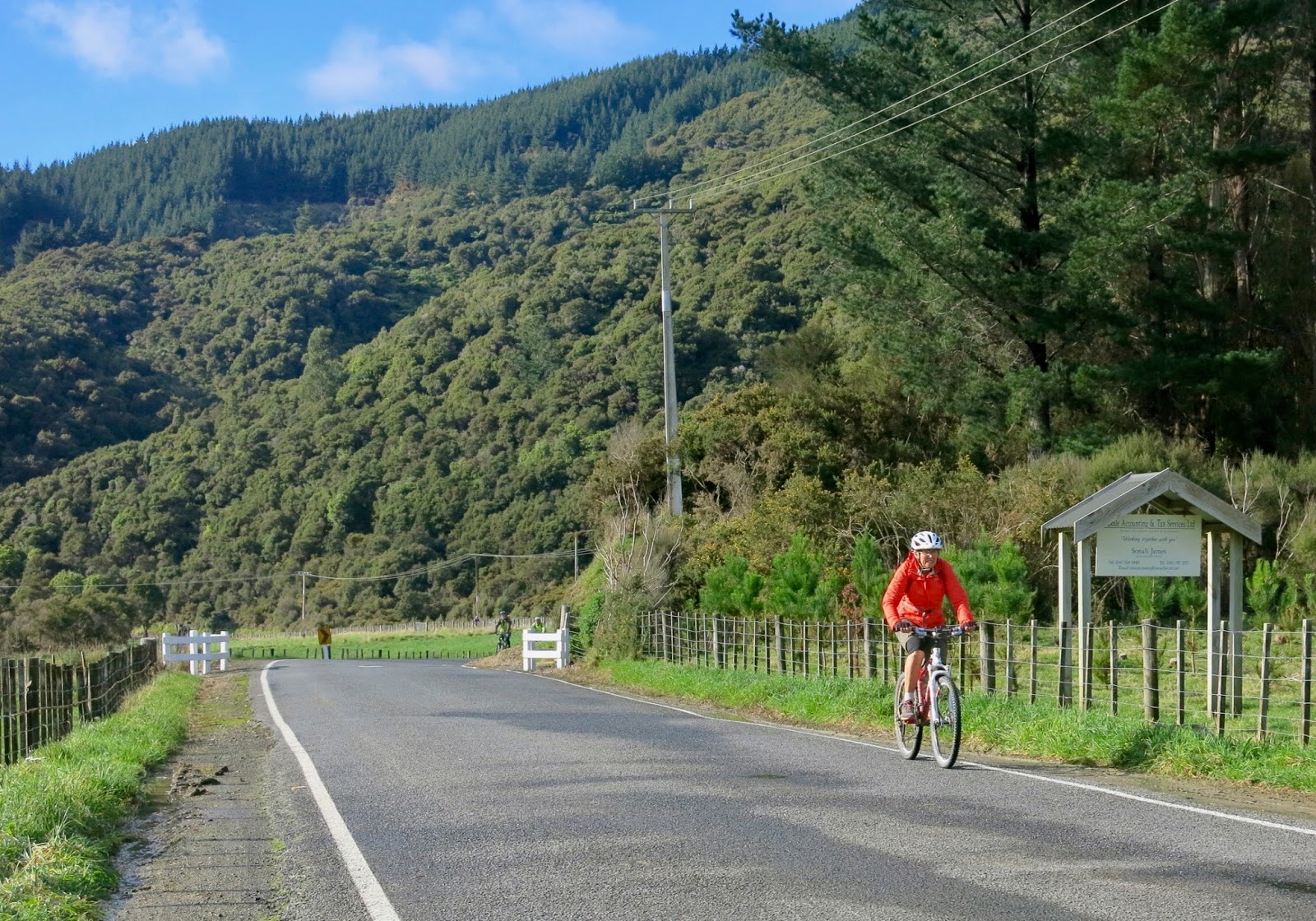
It was a perfect, crisp morning as we set off on our bikes from the cottage towards Havelock North. We planned to bike to Clifton, 30 km away on the coast, and back. Havelock Road has beautiful wide shared foot/cycle paths on both sides of the road. We stayed on the sunny side, as it was quite chilly in the shade. The trees along the road were glowing in their autumn colours, and fallen leaves were scattered on the path.

There are lovely wide shared foot/cycle paths on both sides of Havelock Road (photo by John)

At the first roundabout in Havelock, we wrongly took the first road to the left, Napier Road, instead of the second, Te Mata Road. A bit of a detour, but we got to see a bit more of the suburb. We discovered a pretty link track between main roads, which eventually got us to Te Mata Road.

The link track (photo by John)

At the bottom of Te Mata Road, we stopped at the Chalk’n Cheese Café. This is now run by Origin Earth, a small cheese factory next door. The last time we were here it was called the Tandem Café, and the time before that it was the Tuki Kitchen. We enjoyed our coffee and scones at a table in a sunny spot in the courtyard.

The Chalk ‘n’ Cheese Café

A bit further along from the café is the start of the cycle track on the stopbank, alongside the Tukituki River. It’s a nice wide track of firmly packed lime sand, pretty smooth to ride on.

The track on the stopbank is wide and smooth (photo by John)

On the left of the track were vines and orchards. Most of the apple orchards were empty of apples, but some had drop cloths under the trees – to catch fallen apples, I presume.

Drop cloths under the apple trees (photo by John)

A few orchards still had some apples on the trees and lots of fallen apples on the ground beneath. In one orchard there were bins full of apples but nobody working. Do they not work on Saturdays, even when there is harvesting to be done?

Apples in the bins and under the trees

The vines had all been harvested and the leaves were going yellow or brown. There were a few former vineyards that were empty, posts and wires still in place but no vines growing, not even pruned stumps – nothing. Some places had been given over to pasture, and some even to weeds. We recognised the place where the Vineyard Bivvy was, a lovely place with a coffee caravan where we stopped on our previous visits to this area. But of course it was not there now, since the summer is over. In fact, I wonder if it would have been there this last summer, as the wooden picnic tables were not there, and the very next field was no longer in vines either. Has it been a bad year for vines?

The field next to where the Vineyard Bivvy used to be had been given over to weeds

On the right of the track there were trees, pasture, a few cattle, a large puddle or two, and the Tukituki River beyond, out of sight.

A few cattle on the river side of the stopbank (photo by John)

Some large puddles bear witness to recent heavy rains (photo by John)

Soon after the Bivvy, we got to Black Bridge, beyond which the track to Haumoana and Clifton started, through some wetlands and then alongside the beach. There had been a fairly brisk southerly when we started out biking, but when we were on our way back after lunch, the wind had turned to the north west.

The wetlands near Clive, and the sea beyond (photo by John)

After the wetlands, we rode through Haumoana residential roads, then along on a beachside track. Here we had quite a few midges flying into our faces, which was a bit unpleasant. But soon we got to the Clifton Café, where we stopped for lunch.

Bunny tail grass (Lagurus ovatus) in front of Clifton Café (photo by John)

John was quite taken by the swathes of bunny tail grass (Lagurus ovatus) (photo by John) 

We rode back the same way we had come. But now, the midges along the foreshore of Haumoana and Te Awanga were fairly relentless on the track by the beach – flying at my face, around my glasses, into my nose and once into my mouth. Not nice. So we crossed and continued on the road instead, which was a bit better.

The track along the beachfront at Te Awanga, where the midges were at their worst (photo by John)

Back on the stopbank, we paused briefly at the seat overlooking the Bivvy, ate a couple of wedges of apple that I had brought along, and carried on. I was getting rather saddlesore by this stage. When we got back to Havelock, we stopped at the supermarket to get some bread, and other bits and pieces. Then back to the cottage, going down the wrong road for a distance, but we soon turned around to find the correct road. We got back to the cottage having done 60.5 km in 4.5 hours (excluding our stops), and feeling pretty tired but quite satisfied with our ride.


Sunday 7 May

We planned to ride along the Napier waterfront, and then continue past Westshore, to ride the part of the “Water Ride” that we missed riding last time we were in Hawke’s Bay.

It was late morning when we headed towards Napier (by car), but we first stopped briefly at the Hastings Farmers’ Market. It’s obviously very popular, as there were lots of people there. We did a loop of the market, but didn’t buy anything. While I perused the local produce on offer, John took some photos of a pond alongside the stalls.

The Hastings Farmers Market (photo by John)

The stall selling plant seedlings was right beside the pond (photo by John)

Then on towards Napier. We parked about 5 km south of Napier’s i-SITE. The weather was glorious, not a cloud in the sky (until late afternoon). The concrete walking/cycling path was beautifully smooth. There is a lot of new development along the parade, as you get closer to central Napier. A large area for a children's playground – sensibly fully fenced all the way round, presumably to stop kids wandering off and heading for the treacherous beach. Within the fence were a couple of shaded areas with picnic tables, for the adults watching their kids.

Where Marineland used to be, there is now a skate park. The grandstand is still there, and overlooks a "roller hockey" area. Just like ice hockey, but on in-line skates (or roller blades). They were using pucks, and the concrete looked very smooth.

“Ice hockey” but on in-line skates and no ice (photo by John)

We stopped briefly at the i-SITE to see if they had any updates on the cycling map that we had from last time, but the one they offered us was exactly the same. So on we went. We thought of having coffee near Ahuriri, but it was so busy, we decided to flag it. Of course, it was Sunday, and half of Napier was on the move — families with kids riding their bikes, people biking, and walking, having coffee or brunch, and generally enjoying a sunny weekend.

It was busy, with lots of people walking or cycling (photo by John)

Another new structure is the Napier Viewing Platform, which juts out over the beach, and affords great views back towards the city. Apparently it has come in for some criticism from locals. It’s been called a “pier to nowhere” because it does not go far enough into the sea. "You can't even fish off the end" some said. In fact, its purpose is to aesthetically cover an ugly two-meter diameter storm drain that goes into the sea. I actually think it is quite a beautiful structure, and we did take some nice photos from there.

The Napier Viewing Platform

A very stylish canopy (photo by John)

The locals think the “pier” does not go far enough into the water

We carried on towards Westshore and eventually made it to the Snapper Café, where we had lunch. There is a lovely garden but it is shaded by a lot of trees, which would be very welcome in the summer, but not now that it is getting cooler. We picked a table with a tiny bit of sun on it, but moved to a table in a sunnier spot when it became available.

The garden at the Snapper Café (photo by John)

There were lots of cyclists there, mostly “old”, like us. And quite a few of them on e-bikes. John had a chat with one couple who had full-size SmartMotions. And when we left, I noted that another couple also had e-bikes. The woman said that she wouldn't have been able to ride all this way without the electric help.

To return to Napier we rode the “Water Ride” track, which goes through wetlands and farmland. We had some encounters with black cattle, a big flock of geese, and of course lots of sheep.

The start of the “Water Ride” track (photo by John)

A gaggle of geese made their noisy way across the track (photo by John)

And of course lots of sheep (photo by John)

The track meanders about quite a bit, skirting around the wetlands. It goes past the airport, and eventually gets back to Westshore. On one lonely stretch of roadway, we cranked the assist up to 5, and blatted along. Yeehaa! Actually, I was getting rather saddlesore, and wanted to get home.

The track skirts around wetlands …(photo by John)

… and the back of the airport (photo by John)

A lovely spot, but sadly there was no seat on which to linger (photo by John)

At Ahuriri we stopped for an ice-cream. I sat on a low wall and watched the world go by, while John walked down towards the water to take some photos on the beach.

A dramatic shot of the beach (photo by John)

Once past the i-SITE area, there were few people on the track at this time of the afternoon, so we cranked up the assist again, and sped along on level 4, back to the car, stopping only to take pictures of an amazing mural of a huge octopus on the wall of the National Aquarium. We had biked 45 km.

The mural on the wall of the National Aquarium (photo by John)

The eye of the octopus and some of its tentacles


Monday 8 May

Having biked over 100 km in the past couple of days, we decided on a shortish ride today – the “Puketapu Loop” – just 18 km all up. This is a lovely ride, through quite varied landscapes. Starting from Taradale, it goes up one side of the Tutaekuri River to Puketapu, and back down on the opposite side.

We parked near the Pettigrew Green Arena in Taradale. The track starts on the stopbank, but soon it goes through a lovely wooded area.

A nice wooded area (photo by John)

Skirting a pretty stream (photo by John)

More orchards and pastures, and then a deep throaty sound drew attention to the fact that we were passing a deer farm. A stag was roaring to assert his dominance over his flock of hinds, but they didn’t seem to take particular notice.

A roaring stag and his hinds (photo by John)

I was quite pleased with this photo of another stag in a paddock a bit further along

Farm gates (photo by John)

Before long, we arrived at Puketapu. There is a pub where we had thought of having lunch, but it was closed. The lady at the shop next door told us that on Mondays, the pub doesn’t open until 3 pm. So we made do with muffins from the shop.

A new feature opposite the shop is a large picnic table under a canopy, and the provision of plenty of bike racks. Obviously this area is popular with cyclists, but today, we were the only ones there.

The picnic shelter at Puketapu (photo by John)

This was the mid-point of our ride. The return journey took us through more lovely wooded areas, vineyards and orchards on a meandering track.

Another wooded area … (photo by John)

… and a meandering path (photo by John)

We were back at our cottage quite early in the afternoon, and just relaxed in the peaceful rural surroundings. We were amused by the antics of the sheep in the orchard next to the cottage, where they took turns at having a great scratch against an old plum tree and a stump next to it. First one side against the tree, then the neck against the stump. Then turn around and do the other side. The owner of the cottage said that because the sheep have quite a bit of fleece on them at this time of the year, they get hot and sweaty when it is sunny, so they enjoy a good scratch.


One sheep is having a good scratch against the tree, while the other waits her turn

The next day, Tuesday 9 May, we were on our way home. This time, instead of driving through the Wairarapa and over the Rimutaka Hill, we drove the Saddle Road over the Ruahine Range, which is the alternative route when the Manawatu Gorge Road is impassable. It is a winding road, but it is in good condition, and though there were quite a few trucks, it was not too harrowing to drive.

The countryside is beautiful – rolling hills of very lush, green farmland, and a view of the Te Apiti Windfarm. The 55 huge wind turbines are a dramatic sight along the top of the ridge. As you get to the top of the hill, you get quite impressive close-up views of the windmills, and of course we stopped to take some photos.

Just a few of the 55 wind turbines along the ridge at Te Apiti Wind Farm (photo by John)

After an uneventful drive, we got home by 2 pm, having had a very enjoyable short break, during which we biked a total of 120 km.