Last Monday we made a snap decision to take a train ride to Upper Hutt and bike down the Hutt River Trail back to Petone. It was blowing quite a strong nor’-westerly wind, and this way we would have a tailwind for most of the way.
It was a matter of scrambling to get out of the house and down to Petone to catch the 1:17pm train. Even though it was not brilliantly fine, we thought we’d better get some biking in before the weather deteriorated again, as it is forecast to do for the next week or so.
We’ve ridden this track quite a few times now, in every season, but spring has to be the loveliest. Everywhere there was evidence of new growth. Kowhai and cherry trees in flower, the willows greening up, the yellow of flowering broom, and shrubby trees covered in little white flowers (hawthorn?). And then there was the pungent smell of onion weed and the fragrance of freshly mown grass.
 |
| The trees are greening up and the onion weed thrives beneath them (photo by John) |
 |
| The track goes through a stand of beautiful mature trees close to the River Road Bridge (photo by John) |
As we were getting close to the Silverstream twin bridges, there is an area where willow poles had been planted during the winter months – part of a flood protection scheme, I think. These poles are now starting to sprout at the top. Isn’t nature magical? There are big holes by the piles of soil and rocks, but I don’t know what they are for.
 |
| The willow poles are starting to sprout (photo by John) |
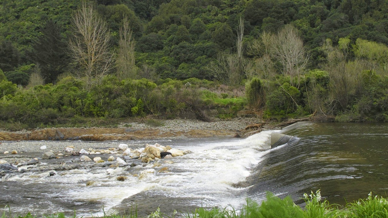
A short distance further on, there is a weir across the river. I was surprised by the white rocks in the stream below it, as they somehow did not seem to “belong”, being quite different from any other rocks in the river. From a distance they looked as if they were coated in a whitish scum. There was also a nasty smell from the small sewerage pumping station nearby.
 |
| The white rocks surprised me, they don’t seem to “belong” (photo by John) |
Where the track skirts the Eastern Hutt Road, it becomes a narrow gravelly path through a bushy area. But here the track was closed because of work being done somewhere up ahead. So we had to climb up another path that took us up to the road. It went past the top end of the waterlevel recorder from where we had a nice view over the river and the Manor Park golf course on the opposite bank.
 |
| The Daleks are coming! (photo by John) |
 |
| Looking across at the Manor Park golf course (photo by John) |
 |
| This is why we couldn’t use the path. I wonder what the drilling is for? (photo by John) |
Further along, while riding on the stopbank above Taita Drive, we saw several crews resurfacing the road. The rest of the ride was uneventful. And we returned to our car in Petone, having biked 34 km.
 |
| Resurfacing Taita Drive (photo by John) |
 |
| I love those greens! (photo by John) |
Uneventful? Well no, not entirely ... When we got back to the car, we discovered that John’s camera was not on its handlebar bracket, as usual. Oh crumbs! Did it fall off somewhere along the way? Or perhaps John left it on the table at Janus Bakkerij when we stopped there for some coffee?
A phone call soon established that that was the case. Thank goodness there was still someone there to answer the phone. By now it was nearly 5pm, and the café was closed, but they were still cleaning up. Luckily we were able to drive back rather than having to bike back to collect the camera. Phew!
No comments:
Post a Comment