As previewed in earlier posts, John and I went on a BIG ride in the Nelson area. John has been wanting to do something like this for quite a while. We no sooner got home from our Mackenzie Country trip in January, than he asked me, “when do you want to take the bikes to Nelson?”.
About 20 years ago, when he was young(-ish) and fit, John did a “roadie”, biking from Picton to Blenheim, where our daughter was living at the time, and then to Nelson, Golden Bay and Collingwood, and back to Picton. He even rode over the fearsome Takaka Hill (a 791m climb) in both directions – a source of much pride for him.
Now, with more years on us than we would want to acknowledge, but with electric bikes, we (he!) decided to do something similar, but not as long, and no Takaka Hill!
Nowadays, the Nelson/Tasman area prides itself on the “
Great Taste Trail” . Designed for cyclists, with much of it on dedicated cycle paths, it makes a great loop south via Wakefield and Woodstock, and back to Nelson along the coast. We decided to do just the coastal section of the trail. But we had to get from Picton to Nelson first!
Our plan was to leave the car at home, take the bikes on the ferry to Picton, then ride to Nelson over two days. From there we would “take it easy”, riding to Mapua, Motueka and Kaiteriteri and back to Nelson over the next five days. And from Nelson we would fold the bikes up and take them on the bus back to Picton.
Because we had to carry our luggage on our bikes, we had to plan very carefully what to take and – perhaps more importantly – what not to take. The less we had to carry, the better. We each had a lightweight carry-all, which, once packed, weighed about six kilos. Minimal clothes – but we did need to take a complete change of clothes and cold weather gear in case of foul weather; and no laptops or other gadgetry – the only electronic items were our iPhones, and the bikes’ battery chargers. And our cameras of course.
We did not take a tent or cooking gear or food. I’m not a camping sort. I like my creature comforts – a decent bed and, above all, our own bathroom, are non-negotiable. And as I detest cooking at the best of times, I just don’t wish to cook when on holiday. So we either made do with bread and cheese, or we had our meals out – and some very nice meals we had too!
The first three days of the trip are described below. The next five days are
here.
Day 1 – Johnsonville – Picton – Pelorus Bridge
On Wednesday 11 March, at the bleary-eyed time of 6 am (we’re not normally early risers!), we pedalled in the dark to Johnsonville station to take the train down to the Bluebridge ferry for our 7 am check-in. Fortunately our lovely e-bikes have excellent front and back lights.
 |
| Johnsonville railway station in the very early morning (photo by John) |
The Cook Strait crossing was smooth and we arrived in Picton in time for an early lunch. We needed to fuel up for the 63 km ride to Pelorus Bridge, where we had booked our overnight accommodation.
 |
| Overlooking the Picton ferry terminal from the start of Queen Charlotte Drive (photo by John) |
The first leg was Queen Charlotte Drive to Havelock. Despite the hills, and occasional cars going past us, this was a lovely ride. The road winds around the edge of Queen Charlotte Sound, up and down over the hills. Bush on either side of us, the smell of pines, the sound of the cicadas. Every so often, we got glimpses of glorious views over the water, far below us, and the bush-clad hillsides opposite.
 |
| Queen Charlotte Sound |
Once over the first major hill, we stopped briefly at Ngakuta Bay. Several campervan couples were organising lunch or going for a swim. Over the next hill, not quite so high, to Aussie Bay, and then to Grove. This small settlement seems to specialise in quirky letterboxes. We saw some shaped as cars or trucks, some with paintings of birds on them, some in the shape of houses or animals. Very creative!
 |
| Quirky letterboxes in Grove (photo by John) |
Then, a complete change of scenery, as we rode along a flat road between the Queen Charlotte and Pelorus Sounds, past a community appropriately called Linkwater. Dairy farms, a flock of white dairy goats, a couple of brown billy goats, tethered to stakes by the road side, a roadkill pukeko – the things you notice as you ride a bike!
As we climbed up another hill, we encountered several stretches of road works. I think they are widening the road to add a better shoulder for us cyclists! At one of these, we chatted to the woman working the Stop/Go sign – it was her first day on the job and she was loving it. With the bright sunshine, it wasn’t a bad day “at the office”!
After biking for nearly three hours, we arrived in
Havelock, the small town that styles itself as the “
Greenshell Mussel Capital of the World”. Apparently there was to be a Mussel Festival there a few days later. We weren’t sorry to miss it, as we don’t eat mussels. Instead we stopped for an ice cream at the local café, opposite a block of shops with an impressive painting of a
tuatara across the top floors.
 |
| An impressive tuatara (photo by John) |
From Havelock we joined SH6. This was quite different cycling from the relaxed country road we had been riding on thus far. Here the speed limit was 100km/hr, and there were a lot of logging trucks with trailers hurtling past us. Quite scary, really. Much of the way, there was a reasonable shoulder, so we kept well to the left, of course, and fortunately the trucks seemed to give us enough space not to be too much of a threat. The trucks coming from the other direction, however, were surprisingly unsettling. As they sped past, they caused a vortex of air behind them, that would hit you full on. The first time it happened, it nearly blew my helmet off. After that, I learnt to dip my head when I saw a truck coming, and the next time we stopped, I tightened the chin strap.
I was glad we had got ourselves some bright yellow hi-viz vests before we started on this journey. And the e-bikes definitely came into their own. By cranking them up to a level 4 assist, we were able to beetle along at about 25 km/hr, reducing the difference in speed between us and them.
After biking nearly 60 km, with tired legs, a tender behind, and knees that by now seemed to “squeak” as they pushed the pedals round, I was really looking forward to arriving at Pelorus Bridge. A little way before the bridge, we stopped at the Totara Flat picnic area. It overlooked the Pelorus River, not far from the place that Peter Jackson used as a film location for "The Hobbit: The Desolation of Smaug” (which we haven’t seen!).
I laid my bike down – the stand wouldn’t keep the bike upright on the uneven grassy surface because of the weight of my bags – and I lay down on the grass myself. Ah, bliss! Looking up at the blue sky through the rustling leaves of a treebranch overhead, how peaceful. I could have stayed there much longer, but the sandflies found us, and made things unpleasant!
 |
| Totara Flat picnic area (photo by John) |
We made our way to the
Pelorus Bridge Café and Scenic Reserve camping ground, where John wanted to show me where he had camped on his “roadie” 20 years ago. The track led through a stand of original bush. According to Wikipedia, “t
he forest contains a mixture of beech and broadleaf species, as well as mature podocarps such as rimu, kahikatea and totara towering over the canopy”.
 |
| The track through the bush in the Pelorus Bridge Scenic Reserve |
 |
| The sun highlights a punga fern in the Scenic Reserve (photo by John) |
Our accommodation at
Bridgewater Cottage was another two kilometres further along, on the Maungatapu Road. Our kind hosts invited us for a drink before dinner, which was very pleasant indeed. They were amazed that we had biked from Picton that day, and even more that we were planning on biking to Nelson over the Rai and Wangamoa Saddles the next day. “You’re going to bike over the Wangamoas? Wow!”
 |
| Bridgewater Cottage on the left, with the main homestead beyond |
 |
| A beautiful sunset, seen from the cottage |
As the café at Pelorus was closed by the time we got there, Clare had provided a dinner of cold chicken and salad, and a delicious fruit crumble for dessert, for us to have at our leisure in the cottage. Very nice…
Day 2 – Pelorus Bridge to Nelson
Thursday 12 March. Next morning, we headed down the Maungatapu Road, back to Pelorus Bridge to continue the journey to Nelson. Cows in paddocks followed us with their stares as we pedalled past. John spotted an interesting artwork in another paddock – a bright yellow piece of agricultural machinery, “pulled and driven” by corrugated iron horses and figures.
 |
| Rural art (photo by John) |
Back at Pelorus, we watched a large truck crossing the narrow bridge. Absolutely no room for a bike beside that! The previous day, I had found the foot/cycle path – tacked along the outside edge of the bridge – a bit of a mission to negotiate, because the sticky-out green struts left precious little room to guide my heavy bike past. My shins kept getting clobbered either by the struts, or by the bike pedals.
 |
| Pelorus Bridge (photo by John) |
It was a mostly flat 10 km ride to Rai Valley, where we stopped for coffee at a bakery as this would probably be the last settlement before we got to Nelson, nearly 50 km away. Thus fortified, we tackled the first of the hill climbs – the Rai Saddle. A climb of 220 m over about five kilometres. Actually, it wasn’t too bad. With our bikes set at 2 or 3 level assist, we just steadily plodded to the top. And it is so worth it, when you get to whizz down again on the other side!
After the Rai Saddle there was a stretch of mildly undulating hills, and we stopped at a roadside picnic area – the Graham Stream Reserve. Despite the fact we needed a break, we didn’t stay too long, as the sandflies were rather voracious!
 |
| The gentle bit between the Rai and Wangamoa Saddles (photo by John) |
 |
| A break at Graham Stream Reserve (photo by John) |
Next, we had to climb 400 m over a distance of about nine kilometres to get to the top of the Wangamoa Saddle. What a climb! The e-bikes did really well, and so, I reckon, did we. I used the level 3 assist for most of the way, occasionally getting a bit of extra oomph from level 4. It is a good road, with a fair bit of traffic, but a good shoulder kept us out of trouble.
All the same, it was a hard grind. I thought of the advice that a café keeper on the Otago Rail Trail gave me when we had to go up Tiger Hill – “
Look around and enjoy your surroundings, don’t look ahead and think of how much further you have to go”. The scenery certainly was spectacular: steep bush-clad hills, so green and lush, some hillsides given over to pine forests, a myriad of different shades of green, the grey road snaking its way to the top. Magnificent. And when we got to the top – what a buzz! We’d done it! Phew!
Then came the exhilarating 10 km downhill on the other side. Glorious! Sweeping around the curves of the winding road was just amazing. Then I had to stop to look back at where we had been, and I was seriously impressed with our achievement.
 |
| Yes, we climbed to the top of that! |
 |
The speck on the road beyond the tall trees on the left – that’s me! (photo by John)
(click to enlarge) |
 |
| Sweeping round the curves of the downhill was so exhilarating! (photo by John) |
When researching what we would be letting ourselves in for on this trip, I came across the following elevation diagram of the Picton to Nelson route on
this website. Obviously the heights look more dramatic because the distances have been “squished” and are not in proportion, but it does show the contrasting country we were covering.
We were very pleased to discover that there was a shop at Hira, the small settlement at the bottom of the Wangamoas. We stopped for a well-deserved ice cream. The call of nature diverted us to a small camping reserve, where the only public toilet was located.
 |
| A true-blue NZ long-drop! (photo by John) |
 |
| The Hira Reserve (photo by John) |
From Hira it was about another 12 km to Nelson, not a huge distance, but funnily enough it seemed to take forever to get to the nice shared walking/cycle path at Atawhai, just outside of Nelson. It was lovely when we finally got there, with a view on the
Boulder Bank in the distance.
 |
| The start of 5 km of shared walking/cycle path into Nelson (photo by John) |
We rode through Miyazu Park, where the
Eastern Gateway sculpture caught our attention. It was created by Spanish artist Juan Jose Novella, and its title is “
Welcome to My Safe Home, My Sheltered Haven”. It reminded me of a piece of tree coral my mother had many years ago.
 |
| Eastern Gateway Sculpture by Juan Jose Novella (photo by John) |
 |
| Interesting shadows (photo by John) |
It was nearly 3 pm when we arrived in central Nelson, and we treated ourselves to a leisurely late lunch and a glass of wine. Then came the search for Lynton Lodge, where we had booked our overnight accommodation. The map function on our iPhones came in handy.
 |
| Lynton Lodge, in Nelson (photo by John) |
Lynton Lodge was a quaint, funny old place. A large house, divided up into self-contained studios, up on the hill overlooking the town and Cathedral. It was a bit like a time-warp – very 1960s or 70s, and in need of an update. But the host was very friendly and helpful, and he happily stored our bikes in his garage for the night.
 |
| Knackered! (photo by John) |
Having settled in, and admired the view from our balcony, we went for a walk in town. We looked into the Cathedral, which has some rather nice stained glass windows.
 |
| One of the stained glass windows in Nelson’s Christ Church Cathedral (photo by John) |
We visited South Street with its historic workers’ cottages, dating from the 1860s. These cottages have been restored and are now available as self-contained accommodation. Some years ago, my sister and I took my mother to stay there for a wonderful weekend, not long before she died. It remains a beautiful memory.
 |
| Biddle Cottage, in South Street, where we stayed with my Mum (photo by John) |
In the evening we met up with John’s cousin Jenny, whose partner is a seriously committed fisherman (or should that be “angler”?) who makes all his own flies. He showed us all the wonderful bits and paraphernalia for creating some beautiful little artworks. Seems a shame to throw them in the water to catch fish with! He assured us that the wild salmon that he catches bears absolutely no resemblance to the salmon we buy at the supermarket. Its flavour is vastly superior!
 |
| Jim and his fly-tying paraphernalia (photo by John) |
Day 3 – Nelson to Mapua
Friday 13 March. Having done the hard yakka of getting to Nelson, we now had a few days on which we were not going to bike great distances. Today we were going only as far as Mapua, about 33 km of cycling on the
Great Taste Trail. Our host gave us directions to get to the start of the Old Railway Route, which would take us to Richmond. This was a pleasant, gently undulating, shared path through Nelson suburbia. When it finished, we rode on uninspiring Richmond roads to the underpass that took us to the coastal cycle path.
 |
| The Old Railway Route (photo by John) |
The smooth gravel path skirts the edge of the Waimea Inlet. The tide was out, and there seemed to be miles of mudflats, some quite featureless, some dotted with clumps of reeds. Some sections of the track were on boardwalks or bridges; one section of the trail had been severely damaged in a storm the previous week, and we had to divert via the main road for a couple of kilometres.
 |
| Miles of mudflats (photo by John) |
 |
| Bridging the watery gaps on the coastal trail (photo by John) |
 |
| An attractive swing bridge (photo by John) |
At Appleby, as the track crossed a road, we saw a sign pointing the way to a winery/restaurant. As it was nearly midday, what better place to stop for an early lunch. Seifried Estate’s restaurant,
Petite Fleur, had a wonderful outdoor area in the shade of mature trees, where we enjoyed a platter of delicious fresh breads and dips, and of course, a nice glass of wine. We lingered for quite a while, so I had time to scribble in my diary-notebook.
 |
| Lunch at Petite Fleur on Seifried Estate (photo by John) |
 |
| An interesting use of a car past its use-by date (photo by John) |
Lunch over, we headed back on the road towards
Rabbit Island. This sandy island is connected to the mainland by a causeway and bridge. It is covered in pine plantations, and has a network of tracks suitable for walking and biking. There is a safe swimming beach on the northern shore, with toilets and changing sheds, complete with outdoor showers, in a couple of places. Obviously popular, judging from the number of cars parked along the way.
It is a delightful place to cycle – the surface of most of the track is good, though in places there are tree roots to watch out for, and there is a beautiful fragrance from the pines. An area at the western end is currently being logged, and here the track is rather rougher than the rest of it.
 |
| Rabbit Island, heading north towards the beach track (photo by John) |
 |
| Rabbit Island is covered in pine plantations (photo by John) |
 |
| The track alongside the beach (photo by John) |
At the end of the rough logged area, there is a steep little track down to the ferry landing. While waiting for the ferry, we chatted to a couple from Christchurch, who were staying at the Mapua camping grounds, and had come across to Rabbit Island for a bike ride.
 |
| The ferry landing on Rabbit Island |
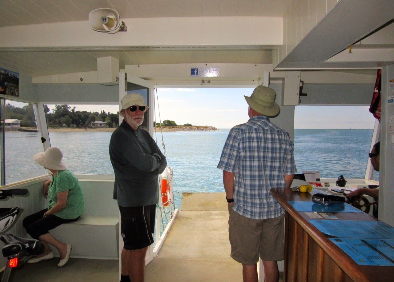
The Mapua Ferry was specially designed to carry cyclists and their bikes across the estuary between Mapua and Rabbit Island. You wheel your bike on board from the beach, and park it in one of the on-board bike racks, for the ten-minute (if that!) journey across. The ferry took a little detour down river to deliver the Christchurch couple to the motor camp, before taking us to the Mapua Wharf.
 |
| Bike racks and passenger seating on the Mapua Ferry (photo by John) |
 |
| Heading towards the Mapua camping ground |
 |
| The ferry at its landing on the Mapua side (photo by John) |
It was only 2:30 pm when we arrived in Mapua. We were not able to go to our accommodation until 4:30 (when our
airbnb host would be home from work), so we had to amuse ourselves until then. First we stopped at Hamish’s Ice Cream Parlour – of course – and wandered around the Mapua Wharf area. There are several eateries, a couple of bike hire places, and some craft and gift shops.
 |
| An amazing tree by the ferry landing, and a not-very-seaworthy dinghy (photo by John) |
 |
| This bike rack, made of old bike bits, appealed to me |
We went for a ride around the township – it’s not very large – went over a causeway that seemed promising, but it only led to the camping ground, where a sign told non-residents to stay out. We checked the way to our accommodation, which was just 300 m up the road from the wharf. Then we returned to the wharf, to sit in the sun, and wait for the text message from our host to let us know she was home.
 |
John “stalked” these seagulls, taking a series of photos, getting ever
closer to them.
They were not at all perturbed (photo by John) |
Later, we walked down to “
The Appleshed” for dinner. It is a very popular restaurant, and we weren’t able to score a table by the window, as they were all booked. But we could still see the lovely view of the estuary, and the end of the wharf where a group of schoolboys was having a great time challenging each other to jump into the water.
 |
| The view from the restaurant |
 |
| As expected, dinner was superb – steak for John and salmon for me (photo by John) |
 |
| A beautiful sky, as we walked back to our accommodation after dinner (photo by John) |


