Showing posts with label Pencarrow. Show all posts

Tuesday, 1 May 2018

Pencarrow


Sunday 18 March was a perfect day – fine and calm – to bike to Pencarrow. We parked near the Eastbourne Wharf and biked the three kilometres to Burdan’s Gate, which is the start of the road to Pencarrow.

Since it was such a beautiful day, the Burdan’s Gate Bike Shed was doing brisk business, with many people hiring bikes. This even caused a bit of a queue at the gate itself.

There is a gate across the road entrance, but it is kept locked for ordinary mortals. You need special permission to be able to drive on the Pencarrow Road. So walkers and cyclists have to gain access through a narrow gate at the side.

It really is a silly gate – very narrow, with a springloaded mechanism that keeps wanting to shut on you. It is so narrow, that you have to raise your bike on its rear wheel to get the handle bars over, rather than through, the gate. People with lightweight bikes did the smart thing by lifting their bikes over the main gate, but with the electric bikes (at 25 kg) this is not practical.

It was a lovely ride. All along I kept thinking that we Wellingtonians are so lucky to have such a lot of different environments for biking, right on our doorstep, as it were. It is such a beautiful part of the coast — in fine weather, of course!

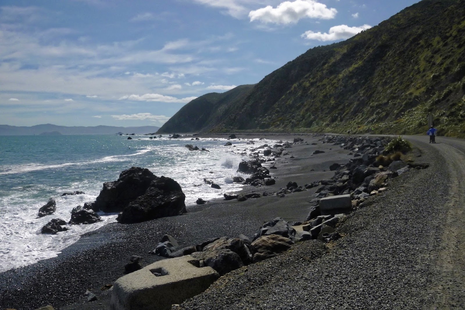
As the road winds in and out of the many bays, we enjoyed the views of the different beaches. Some strewn with driftwood, some with just lots of seaweed, and some with beautiful but dangerous rocks.

Beaches strewn with driftwood (photo by John)

Nature’s sculpture

Rocks and seaweed (photo by John)

The two Pencarrow lighthouses and the incoming ferry (photo by John)

We rode beyond the lower lighthouse, and found that there was a new information panel that we hadn’t seen before. It provides details about some of the birds in the area – the dotterel and the oyster catcher – and warns visitors not to disturb these birds’ habitats on the sandy beaches along this part of the coast.

A new information panel (photo by John)

We went as far as the entry to the Porangahau Lakes. The gate was locked, and there was no way to go up there unless you lifted the bikes over the gate. And the road ahead was very sandy, which makes it very skiddy, so we didn’t carry on any further.

We’re not sure what the black framework is or was for, but it makes for a dramatic photo
(photo by John)

When we were on our way back and looked around, back at the lighthouse, we noticed that there was a big tourist bus pulling up at the lighthouse. We think it must have been a tour for people off the enormous cruise ship in port that day, The Ovation of the Seas.

I felt slightly offended at the idea of a tour bus bringing hordes of tourists here

The Ovation of the Seas at the cruise ship terminal in Wellington, on the other side of the harbour
(photo by John)

Such a beautiful coast! (photo by John)

I thought that if we timed it right, we could waltz through the gate behind the bus instead of having to use the stupid bike gate. Then I thought, we should get to the Chocolate Dayz café before the bus disgorged all its passengers for lunch. But they took a long while at the lighthouse – perhaps they had a picnic lunch or something as part of the tour – and when the bus eventually sailed past us as we rode into Days Bay, it didn't even stop there. So we were able to score a table at the café.

After lunch we biked back to Eastbourne, where we had parked, and stopped at the dairy for an ice cream. While we were eating it in the sun, Gordon, a member of the Folding Goldies, stopped by us, and said he had just biked Pencarrow, right up to the end where the big rocks are, using my blog from November 2013 as a guide. It made me feel quite chuffed!

We got home at 2pm, having done 24 km, and I reached well over my 6,500 km on my bike. Yay!


Saturday, 13 August 2016

Folding Goldies Ride to Pencarrow


On Wednesday 20 July, John went on a major escapade – a Folding Goldies ride to Pencarrow, and though the plan had been to take the train back from Petone, he ended up biking back all the way back to Churton Park, up the Ngauranga Gorge – on his (non-electric) Giant. I was unable to go on this ride, as we had our grandchildren staying with us during the school holidays, or I might have tried to dissuade him from doing that!

John took the train into town and met up with the others for the 10 am sailing of the East by West Harbour Ferry. Alastair had arranged with the ferry crew to be able to use a ramp to wheel the bikes onto the top deck at the Wellington end. Because of the difference in height of the individual wharves, passengers normally board the ferry on the lower deck in Wellington, but disembark from the top deck at Days Bay. The stairs between the two levels are rather steep, which presents a bit of a problem when you have to carry your bike up. Not too bad in the case of a regular bike, but rather harder with an e-bike, which is much heavier. And Alastair and Sue were riding e-bikes, though John wasn’t this time.

On the Harbour Ferry wharf - from left: Sue, Alastair, Gottfried, Frank, Daryl (photo by John)

Friday, 16 October 2015

Petone to Eastbourne


On Tuesday 29 September, we decided on an easy ride from Petone to Eastbourne. Although the ride was all on the flat, we took the electric bikes, as there was a brisk breeze.

We parked at the motorway end of Petone and biked to Days Bay without stopping. There is a bit of a cycle lane on the seaward side of the road in most places, but at times we had to cross and ride on the road. We stopped for coffee and a scone at the Chocolate Dayz Café.

Fortified by coffee at Chocolate Dayz (photo by John)

It was a pleasant ride round the bays to Eastbourne. It seemed to us – but we may be mistaken – that the shape of the beach had changed since were last there. It seemed more ‘scalloped’ somehow.

We thought the beach had changed shape (photo by John) 
The same stretch of beach, seen from the other end (photo by John)

We biked to the end of the road, stopping at Burdan’s Gate, the starting point to the Pencarrow Lighthouse track. We did not want to bike there today – in any case, the silly gate which gives pedestrians and cyclists access to the track is too awkward to manoeuvre the e-bikes through. And these bikes are too heavy to lift over the main gate across the road.

Coming back through Eastbourne, we took a little detour onto the wharf.

The Eastbourne wharf (photo by John)

As we were riding along the riverside track at Seaview, we saw, up ahead, the little yellow tug Kowhai pushing along the dredging barge with a digger on the top. John raced along to catch up with it so he could take a photo.

The tug Kowhai, and the dredging barge (photo by John)

On the Waione Bridge across the Hutt River, there are always people fishing, causing a bit of an obstruction on the narrow foot/cycle path. Sometimes they have a bike or paraphernalia near them on the footpath, so you have to dismount to get past. This time, when we rode past one of the anglers, something wet and slimy hit me on the side of the face. I don’t know what it was, it didn’t hurt but it was pretty icky! At least it didn’t smell!

The rest of the way back to the car was uneventful. We had done 33 km – a reasonably respectable ride.

Wednesday, 29 April 2015

Wellington Waterfront and Pencarrow


Last week, we went for two rides – one short and easy along the Wellington waterfront, the other a bit longer, out to Pencarrow and beyond.

On Thursday, 23 April, we went for a short, easy-peasy 10 km ride on the Wellington waterfront. In the morning, I had been to a fairly strenuous class at the gym – 52 minutes straight of “cardio” – and Thursday is one of our Scottish Country dancing nights, so I didn’t want to do anything too vigorous. But it was such a lovely calm day, that we didn’t want to waste the opportunity of going for a bike ride. As winter is starting to make itself felt, we have to make the most of the fine days when we can.

It was a ride we’ve done many times before – it has become our “standard” ride if we want to do something short, sweet and easy. So there’s nothing new to tell, but John took some nice photos that we’d like to share.

Lovely reflections in the boat harbour (photo by John)

There was a cruise ship in port, Radiance of the Sea, which must surely be the last of the season? There were also two navy ships tied up at Queen’s Wharf – one French and one New Zealand – here for the Anzac Day commemorations. The French frigate Vendemiaire had arrived from Vanuatu, where its crew had been assisting with the clean-up after cyclone Pam. The other was the HMNZS Wellington.

The cruise ship Radiance of the Sea is reflected in the windows of the Westpac Stadium (photo by John)

Two navy ships are tied up at Queen’s Wharf (photo by John)

Tracks made by the beach grooming machine contrast with the light on the water at Oriental Bay (photo by John)

                                                      * * * * * * * * * * * *

The next day was even more perfect – fine and calm – and we thought of several possibilities for the day’s ride. It was a toss-up between the Rimutaka Rail Trail, Whitemans Valley, or Pencarrow. We decided on Rimutaka, however, when we got to the Hutt Road, we noticed the clouds trying to get over the hills from the Wairarapa. We thought it might not be so nice further up the Hutt Valley, so Pencarrow would be a better option.

We parked the car in Eastbourne, and biked to Burdan’s Gate, from where there is (awkward) access to the Pencarrow road. We have ridden this track quite a few times now, and we noticed that the beaches that faced south or south-east had got a beating in the last few storms. Lots of debris on those beaches, and a lot of sand and gravel had been tossed up onto the road by the waves. A grader had pushed the sand to the edges.

Debris on the beach (photo by John)

The sand thrown up by storms has been pushed to the sides of the road (photo by John)

It seems to be getting easier each time to get to the lighthouse. When we did this ride for the first time, it seemed like a major achievement. Now we say “Let’s go a bit further”.

Pencarrow Lighthouse

The rocks by the lighthouse (photo by John)

We carried on past the lighthouse towards the lakes, but we didn’t go up into the hills. We had intended to keep going on the coast road until it became too rough, but we came to a closed gate with a sign saying “Private Property”. On previous rides, this gate had been open, and I believe that it is still OK to go beyond the gate – so long as you keep to the road and act responsibly, of course – but we decided to turn around here.

Lake Kohangatera (photo by John)

On the way back we saw the Interisland ferry heading into the harbour. Suddenly John put on a big burst of energy, and rushed ahead. For a few minutes I tried to keep up with him, then I twigged – he wanted a shot of the ferry as it came past the lighthouse! He got there in time.

The Interisland ferry Aratere steams past the Pencarrow Lighthouse (photo by John)

Water, sun and rocks (photo by John)

It was a lovely 25 km ride, with perfect weather, followed by lunch at the Chocolate Dayz Café in Days Bay.

Lunch at the Chocolate Dayz Café (photo by John)


Friday, 20 February 2015

Six rides since the Mackenzie trip


Well now, we haven’t been slacking since we returned from our Mackenzie Country trip on 25 January. In fact we have done six rides, a few of them fairly substantial. However, they were either rides we’ve done before, or we’ve just “gone for it” without taking too many photos.


Thursday 29 January – Whitby and Pauatahanui


This ride to Pauatahanui was much longer than any we’ve done to that area before – 42 km in fact – as we did a much larger loop. It was windy, and we knew we would encounter hills, so we took the e-bikes. We started from the Takapu Road end of Tawa along Ara Tawa, a nice smooth track, to Kenepuru Station. From there we rode on a fairly rough track beside the railway line to Porirua Station.

We went down the tunnel under the railway line to get to Champion Street, from where we eventually got to the track through Bothamley Park. It was a bit of trial and error, as we’d only done this track in the other direction once.

Bothamley Park (photo by John)

Fortunately John’s sense of direction is pretty good, and we didn’t get lost – not too much at least. We found our way through Whitby along some of the streets and mostly along some of its lovely walkways.

Whitby Walkway (photo by John)

We emerged from Whitby near Pauatahanui, where we stopped for lunch at the Ground Up Café. Then we rode back to Porirua, via the Camborne Walkway, Paremata and Aotea.

Near Aotea College we were hailed by a young man asking if we had a bicycle pump, as he had a flat tyre. Yes, John had one. Pumping it was not enough though, as the tyre had a puncture. So John to the rescue – and patched the tyre for him. He was a Tawa College student, his name was Jimmy, and he told us he had been biking up Colonial Knob every other day during his school holidays. Phew, hard work! He was very pleasant and polite, and grateful for John’s help.

John patching Jimmy’s tyre


Sunday 8 February – Ciclovía and beyond


Today was the first of three Miramar Peninsula Ciclovías, organised by Cycle Aware Wellington, with support from the Wellington City Council.  During these events – on Sundays 8 and 15 February and 8 March – the road between Shelly Bay and Scorching Bay is closed to motorised traffic so that the whole road can be used by walkers, cyclists, scooters, skaters and skateboarders.

Putting up signs for the Ciclovía (photo by Alastair Smith)

It was fine, but there was a strong northerly wind. I suggested to John that we should use the e-bikes, but he deemed that unnecessary. All the same, I used my e-bike and he used the regular bike. The wind was so strong that he had a struggle in some places, while I had fun being able to whizz past him with my electric assist!

John struggles against the strong northerly. Note the choppy harbour!

At the pointy end of the Miramar Peninsula, we found Alastair Smith taking photographs of people riding past. He is one of the main organisers of this event (as well as the instigator of the Folding Goldies group). He was thrilled with the response – apparently over 2300 people took the opportunity to walk/bike/skate the route that day, despite the windy conditions!

Hitting the full blast of the northerly as they come around the point! (photo by Alastair Smith)

We had parked at Greta Point and carried on beyond the stretch of Ciclovía to Seatoun. From there we headed up through the Pass of Branda (which was much less high and less steep than I had feared) to Breaker Bay and on towards Moa Point. The breakers on the rocks out there were quite impressive thanks to the strong wind.

Impressive waves crashing over the rocks (photo by John)

On the way back we spotted this little family near Karaka Bay – Mum and Dad pedalling a tandem bike, and the young miss riding the clip-on bike at the back.

A bicycle built for three (photo by John)

This was quite a long ride – 35.5 km – and John was feeling a little the worse for wear, having struggled against the wind for quite a bit of it.


Tuesday 10 February – Petone to Taita


Only two days later, with John still feeling a little tired, but with a fine, calm day that demanded a ride, we took the e-bikes out to Petone foreshore, and rode to Seaview and then up the Hutt River Trail as far as Taita. It was a lovely steady ride, without any stops for photos. We did stop when we got close to Taita for a breather, and a snack of sliced apple.

A breather near Taita. The grass is very brown, thanks to the current drought (photo by John)

Somewhere along here, John reached a 500 km milestone on his e-bike. That figure will be different from mine, because he sometimes does long rides without me.

The odometer on John’s e-bike shows he’s done 500 km on it (photo by John)

A community art project on the Petone foreshore, near where we stopped for an ice cream (photo by John)


Wednesday 11 February – Pencarrow


My sister and I were planning to have lunch at the Chocolate Dayz Café in Days Bay, so naturally I suggested a bike ride as well – since she is now an intrepid cyclist too. We biked from Eastbourne to the Pencarrow Lighthouse and back first (14 km) and had lunch afterwards.

I still think that the gate to get onto the Pencarrow track is an absolute pain. There is no room to get the bike through other than upending it onto its back wheel. And even then it’s a squeeze. It’s time the local council did something about this.

Aimée at the Pencarrow Lighthouse

Close-up of the Lighthouse

Though it was a calm day, the waves were reasonably boisterous

On the way back we spotted two oyster catchers in some sort of screeching contest. Not being very knowledgeable about birds, we didn’t know whether this was a mating ritual or a squabble about territory, but we were surprised at how noisy and unmelodious their squawks were.

Two oyster catchers being watched by a shag on the rock

While Aimée and I were out lunching, John took the e-bike for a long loop around Ohariu Valley, to Makara Beach, and back through Karori and Wilton – about 47 km. Wow!
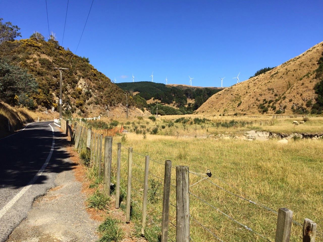
Ohariu Valley (photo by John)

The Makara Stream (photo by John)


Sunday 15 February – Second Ciclovía and beyond


We rode the second Ciclovía event, but went a little later in the day. Perhaps it was the time of day, or maybe it was the southerly wind, but it was not as busy as it had been on the first Ciclovía day.

Again we started from Greta Point, but this time, we wanted to go much further round the coast, as we wanted to take a look at the Island Bay Festival, and were interested in seeing the “Blessing of the Boats” ceremony, which was due to start at 2:30 pm.

It took us an hour-and-a-half to bike the 25 km to Island Bay on our e-bikes, and got there in time for the ceremony – we thought. But it turned out that it had been postponed till the next Sunday, because the conditions on the water in the bay were too rough to have lots of boats in close proximity to each other. That was disappointing, but we had a browse around the stalls and other activities that were happening in and around Shorland Park.

Then we headed back into town, stopping off at the Blue Belle Café on The Parade for some coffee.

The e-bikes parked outside the Blue Belle Café in Island Bay (photo by John)

We wended our way through Island Bay and Newtown to get back to our car at Greta Point. It would have been easy to go from Newtown through Kilbirnie, but John decided we would go over the top of Mt Victoria.

I could have done without that, because even though we were riding our e-bikes, my legs had done a lot of exercise that day, and I was starting to feel a bit the worse for wear.

The road up Mt Victoria from the Newtown end (photo by John)

Nearly at the top (photo by John)

View over the city from the top of Mt Victoria (photo by John)

By the time we got back to the car, we had biked 38 km – but it felt like more!


Tuesday 17 February – Wellington Waterfront


After that long ride on Sunday, I didn’t want to bike again for a few days, but Tuesday was such a lovely day – sunny and calm – that we could not waste an opportunity for a nice gentle ride. We did 16 km along the Wellington Waterfront on our regular (not electric) bikes. We stopped at Karaka Café for some iced coffee. We noticed that they have recently installed bike racks – an excellent move!

The newly installed bike racks outside the Karaka Café (photo by John)

The new “fashion” of serving iced coffee in jam jars! Apparently “Mason jars” is the technical name …
(photo by John)

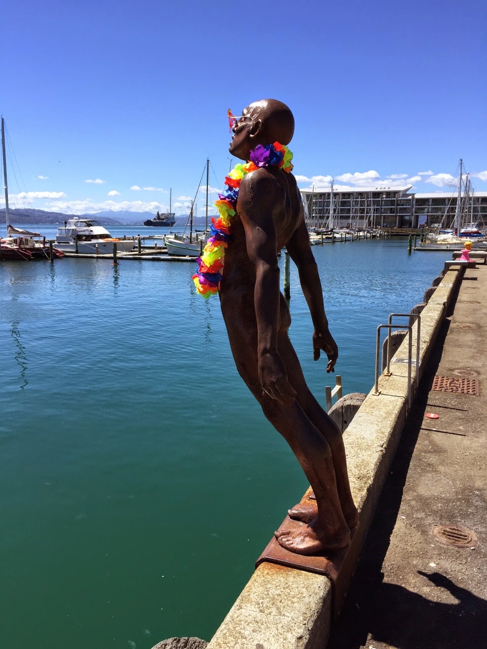
Solace in the Wind” (by Max Patte) has acquired a lei and sunnies! (photo by John)

As I needed to do 10 km to get to a new milestone, we biked along to Kibirnie and back as well. So somewhere during this ride I had clocked up a total of 3000 km, cycled in just under two years. Not too shabby, methinks …


Thursday 19 February – John’s ride in Ohariu Valley


While I was doing other things, John took his Tarini mountain bike for a ride in Ohariu Valley and on the Old Coach Road, which eventually leads back into Johnsonville.

Rifle Range Road (photo by John)

The Old Coach Road (photo by John)

John’s 20-year-old Tarini mountain bike (photo by John)