Thursday 10 February 2022

South Island Trip - Nov/Dec 2021 - Part 3


Part 3

Arrowtown, Franz Josef, and home

This is the third part of the holiday we had in the South Island in November/December 2021. Part 1 is here, and Part 2 is here.

Monday 30 November

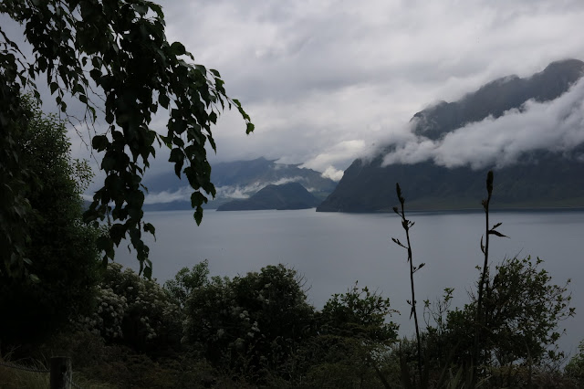
We were going on the Earnslaw cruise today, and we parked on the foreshore, beyond all the hideous hotels, in a small carpark on  a promontory. The sign said four hours max, and we were going to be there for about six hours, but we just took a chance (no ticket happened). We walked the kilometre or so to the area near the Earnslaw Wharf, where we had ‘breakfast’ at “The Pier” - actually just coffee and muffins, because we knew we would get a big lunch.
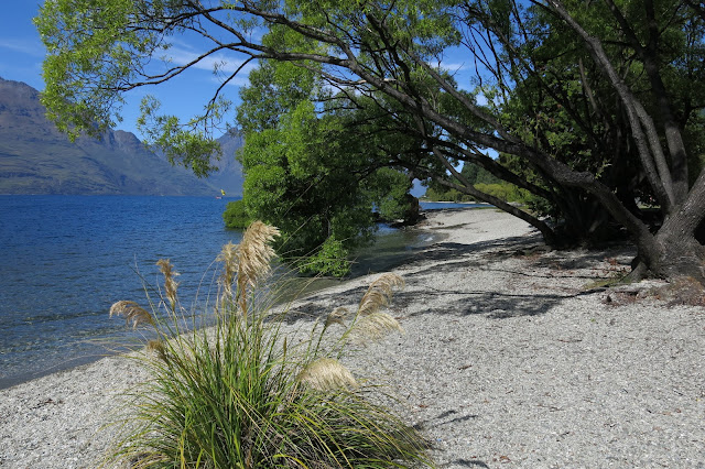
Along the foreshore

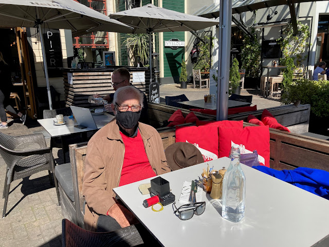
Waiting for our coffee at “The Pier” (DP)

We had another hour or so to kill before we had to report at the Earnslaw at 11:40, so we walked along the foreshore, and back. John likes ducks, and he stopped to take a lovely close-up photo of one.

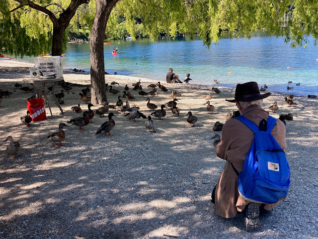
John crouches down to take photo of a duck

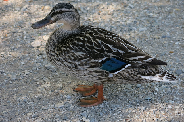
The duck - beautiful plumage

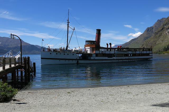
At 11:30 we boarded the Earnslaw, and found a seat on the front deck. It was another gloriously hot sunny day. The cruise was smooth, and it took about 40 minutes to get to Walter Peak Station, where we would be having our barbecue lunch.

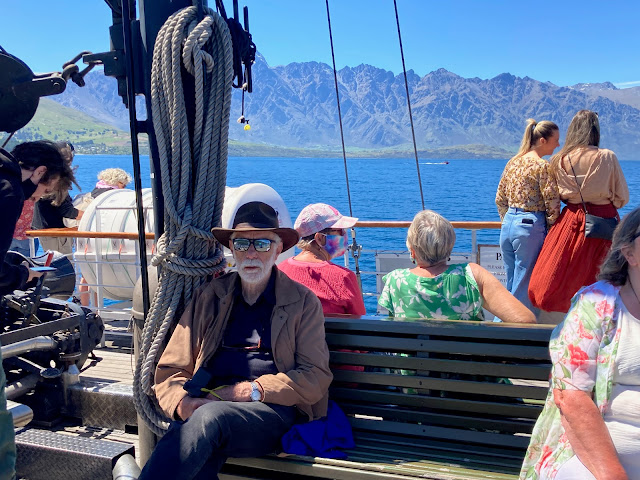
We sat on the front deck (DP)

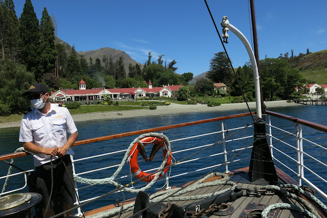
Arriving at Walter Peak Station

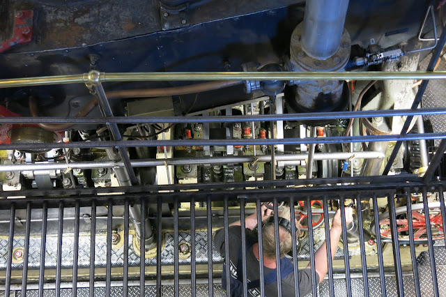
A view into the workings of the steamship on our way to disembark

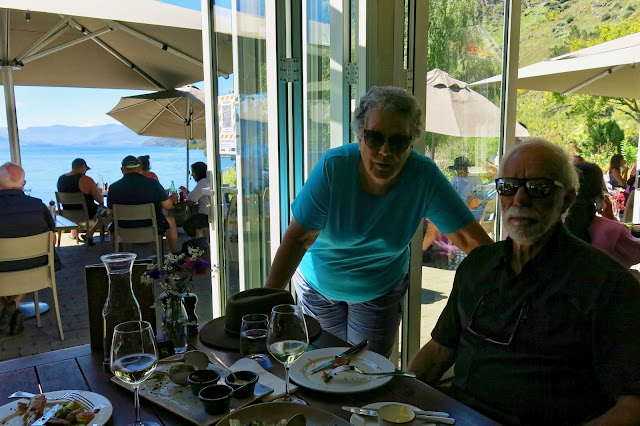
The lunch was brilliantly organised. We were directed to a table with our name on it. It was just inside the edge of the building, by the flung-open doors, half in the sun, but we shifted it about a foot into the shade. Other people were on the terrace under huge sun umbrellas.
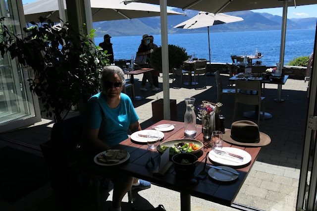
Table number 8

Breads and two types of salad were already on the table. Someone came to ask if we wanted a drink, and we had a glass of Riesling each. After a while, a plate with several types of meat and sauces was brought to us and a plate of roast vegetables. Because of Covid Level 2, food had to be delivered to tables, rather than people getting up to get their own, which was perfect, as we didn't need to queue up at the barbecue.

All the food was excellent - best I’ve had so far on this trip. To finish, there was a selection of small sweet items for dessert, and coffee. The serving staff were incredibly busy - and friendly and helpful. When we commented on how busy they were, our waitress said they were short-staffed and over-booked. But she was still very happy to take our picture a couple of times.

That was an excellent meal!

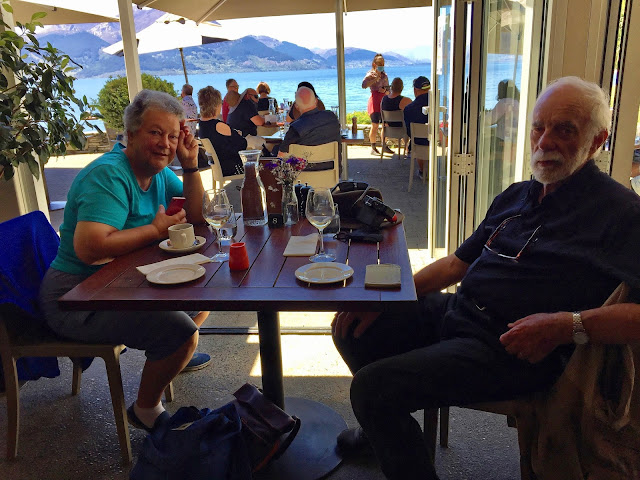
After coffee and dessert

After lunch, I went to watch a demonstration of a sheep dog bringing some sheep down off the hill, by a young woman with her dog - very impressive, and well presented. John stayed somewhere near the homestead, as “he’d seen that sort of thing before”. He was actually not feeling very well, but he still took some great pictures.


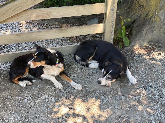
The farm dogs, resting in the shade before their working demo (DP)
 

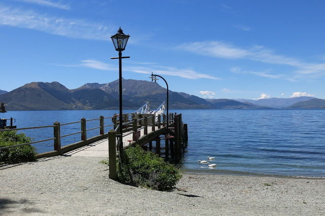
The wharf awaiting …

… the return of the Earnslaw

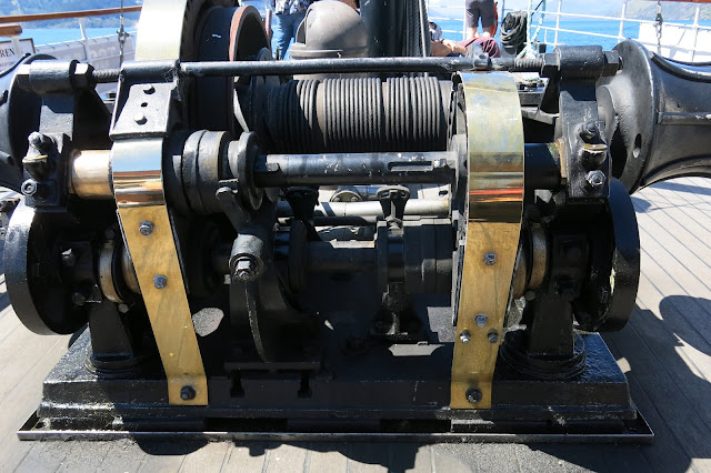
Some of the machinery on board - a steam-driven winch

Before long, it was time to return to the Earnslaw. We got back to Queenstown at about 4pm, and rather than doing other things (we thought of going up in the Gondola, but it didn’t look as if it was running), we just came back to the cottage. John zonked out on his bed, and I dozed a bit too in the lounge, before watching the news, and then having a dinner of toast and coffee.

In the news today - There is a new Covid variant, dubbed “Omicron”, which developed in South Africa, and the experts are still trying to figure out whether it is more or less virulent than Delta, it seems to be more transmissible. Meanwhile, the new “Traffic Light” system will be coming into force on Friday, whereby you have to show your vaccination certificate to enter premises. Interesting times …


Tuesday 1 December

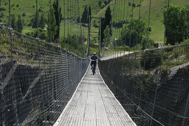
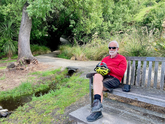
Today we biked the Arrow River Bridges Trail. We did this on our non-e bikes on our first biking trip eight years ago. It was another brilliantly sunny day, though it was a bit chilly to begin with, as the track runs in the shade under trees, alongside the river, but it was lovely when we got out into the open.

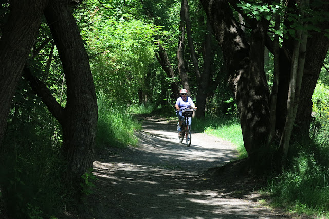
The track ran under the trees at first

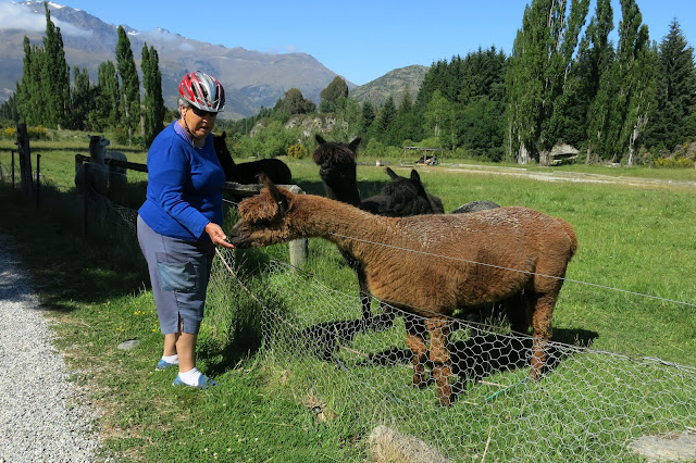
The sheep nuts to feed the alpacas were provided in a container tacked to a fence post

There were quite a few ups and downs, and we had to cross two big suspension bridges. John biked across the shorter one, but walked the longer one. The first, shorter, bridge I biked across gave me the scares - I did not dare look down, I just had to look straight ahead to where I was heading. The ravine, or gorge, under the bridge is very deep and the river very swift and noisy below. I think I am getting worse, with the primal fear of falling into a void, or ditch (dating back to a childhood event). It is a very real and terrifying, breath-stopping fear - I just can’t help it.

The second bridge did not affect me too much

John was not feeling all that well, which expressed itself in the fact that he hardly took any photos. He really needs to concentrate on what he is doing, or he will fall. Mind you, we’d been here before …

The Kawerau Bungy Bridge was only 13.5 km away. The place was open, and two guys were checking equipment at the Bungy jump-off station, but nobody was taking the plunge. In the building, there were only about half a dozen visitors - for coffee - and I think I saw someone signing up to jump, but we didn't wait to see that happening.

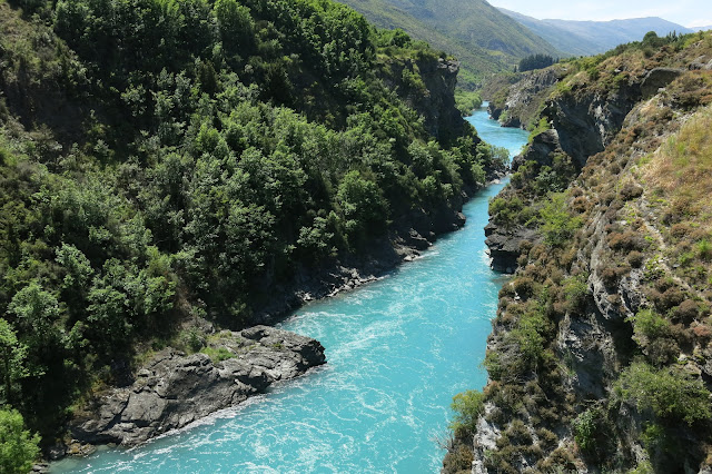
The Kawerau River - such an amazing colour!

Not a lot of people in the Kawerau Bungy building (DP)

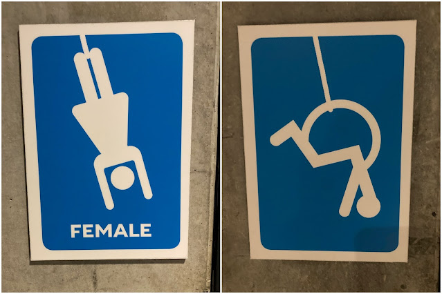
I was amused at the signs on the toilet doors (DP)

We had some coffee and a cookie, and then we were on our way back. When we got back to Arrowtown, we stopped at the Patagonia ice cream shop, for a well-deserved ice cream, and sat in the shade enjoying it.

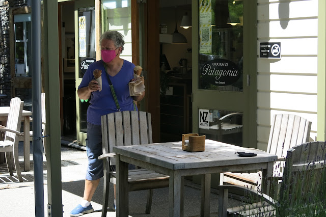
You have to remember that you’re wearing a mask, so you don’t try to lick the melting icecream as it dribbles onto your hand!


Wednesday 2 December

We decided to try biking around Lake Hayes. It is an 8 km loop around the lake, and is supposed to be an easy intermediate track. We sort of knew in which direction to go, but stopped at a place hiring out bikes and asked for directions - the young man was very helpful and gave us a map.

The track took us through the Millbrook Resort - a rather gorgeous, flash-looking place - ‘luxury’ cottages, a huge golf course, dozens of golf buggies all lined up, lovely landscaping, several attractive ponds - all very nice. Then we had to go down ‘Christine’s Hill’, which was gravelly and very steep, so we walked down rather than rode. There was no way I wanted to come back by the same route - pushing a heavy, reluctant bike up that hill - nope!

We found our way to the lake, and as suggested (in some leaflet), we tried going in an anti-clockwise direction, but it wasn’t long before we saw that the track was going up a steep bit. We stopped at a seat by the water, before the hill, had some chocolate and were entertained by watching a mother duck and her five ducklings.

By the shore of Lake Hayes
 
Peaceful setting (DP)

The track beyond is going uphill (DP)

We did not want to attempt that hill, so we tried going around the other way. After a car park, the track went down a steep bit - which meant having to climb back up coming back - so we piked out and went back to Arrowtown by the road. We came across a lovely café/winery called Akarua, which looked very tempting. We had some delicious waffles - all decorated with caramelised banana, berries and flowers - for brunch (too early to call it lunch) in a garden setting.

These waffles were magnificent (DP)

After that, we turned off the main road, and rode on a ‘school bus route’, which was smooth, quiet, and pretty. It eventually took us back to the Bridges track. John steered us to Patagonia again, as we came back into Arrowtown. He felt the need for an ice-cream. I didn’t, so I just sat with him while he had his.

Before going ‘home’ we biked to the Chinese village nearby - the reconstructed remains of the Chinese pioneer miners’ cottages - tiny, made from slabs of stone, with thatched roofs (or corrugated iron now). 

The ground near there and on the Queenstown trail was covered in very fine fluff from the poplars - rather like kapok or cotton. It looked like it had been snowing.

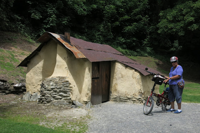
One of the reconstructed dwellings in the Chinese Village

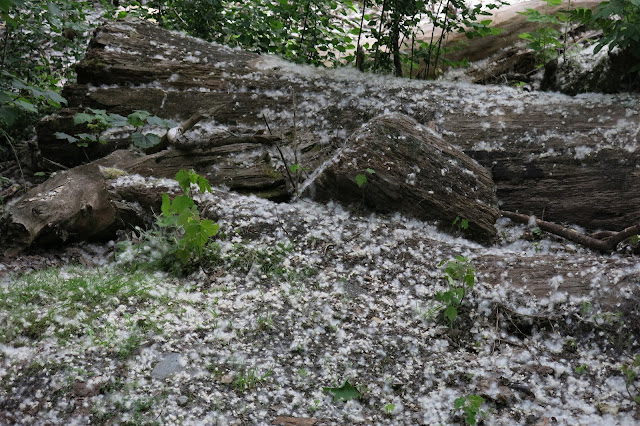
Fluff from the poplars made it look as if it had been snowing

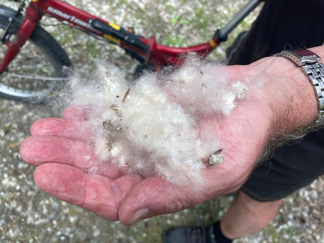
A handful of poplar fluff (DP)

We made our way back to the cottage, and just pottered, started packing some of our stuff, as we were leaving the next day. The plan was to drive to Franz Josef despite the threat of rain. It was to be a long drive, with the only opportunity for a charge top-up in Wanaka, so we needed a full charge. John put the car on a long slow charge, to top it right up.

In the late afternoon we took a wander into the village and spotted an Italian place where we had a very nice pizza - an actual Italian pizza. It restored our faith in pizzas, which had been severely dented by that horrible take-away pizza in Twizel. At the time, I thought that I wouldn’t want to eat pizza again for a very long time. But this was nice, with a glass of wine and some affogato for dessert.


Our faith in pizzas restored!


Thursday 3 December

We left Arrowtown at about 9:30. We took the road to Cardrona over the Crown Range. A very good road, through quite impressive landscape, but I found Cardrona itself oddly disappointing, somehow. It did not take long to get up to the top/pass, much longer to get back down.

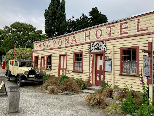
The ‘iconic’ Cardrona Hotel

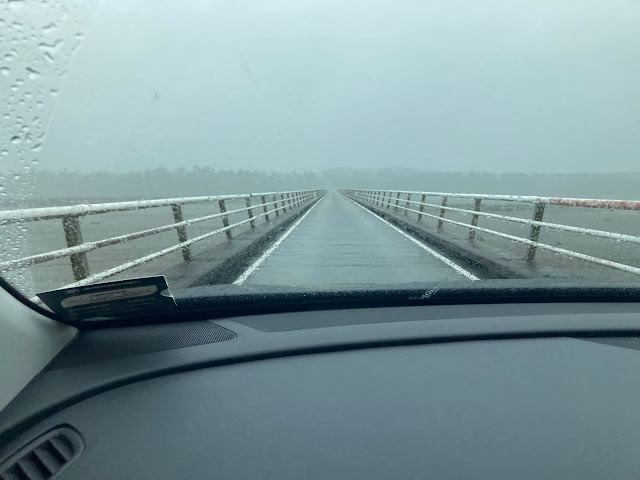
In Wanaka we stopped at a café along the foreshore and had coffee and scones. It was the first time we had to show our vaccine pass, with the new Covid “Traffic Light” system having come into force today. After this we stopped at the i-Site just a few doors along to find out about the weather and road conditions on the West Coast, as we were still vacillating about whether to go up the West or up the East of the divide. The weather map showed rain forecast for both sides, and all the roads were open. So off we went to the West Coast.

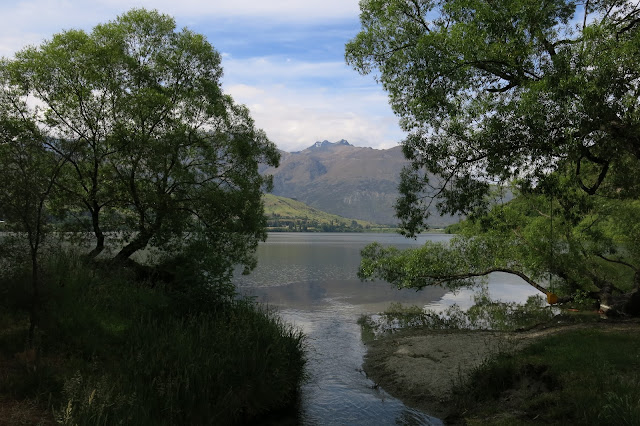
Soon after Hawea, the rain set in, and unfortunately, it got steadily worse as the day wore on. We were still seeing lots of lupins, but once past The Neck - the bit between Lake Hawea and the top of Lake Wanaka - we started seeing foxgloves (just like we saw on our West Coast Wilderness trip). We took some photos there, and managed to get some ‘passengers’ along - sandflies - sneaky little critters, that I eventually was able to deal with.

Lake Wanaka from “The Neck”

We didn’t stop for many photos, but I took some from the car, as we were crossing bridges. I remembered the bridge over the Haast River - from the last time we were there, 48 years ago, in a VW Beetle with four adults and two babies! Those were the days!

I think this was across the Paringa River (DP)

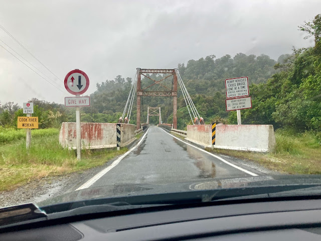
The Cook River - getting close to Fox Glacier (DP)

It is pretty wild country, beautiful but wet, and there is nothing much in the way of habitation - nowhere for a coffee. But we found a ‘miracle’ place, in the middle of nowhere, a salmon farm with café attached, which was actually open! The place even provided a covered path from the carpark to the café so we didn’t get too wet. Obviously the place was deserted and there were just a few items in the cabinet, but we had coffee and muffins. Also, a toilet stop! What a godsend.

We drove past signs pointing the way to Lake Matheson (famous for its perfect reflections of the Alps in its still waters) and Okarito (famous for its habitat of kotuku, white heron), and it would have been great to be able to go and see these, but not in this weather.

It was a long day’s driving, and we got to Franz Joseph about 4:30, and found the charging post for the car, quite near the Scenic Franz Josef Hotel where we were staying. The hotel was very nice, but deserted - I think there were only three other couples staying.

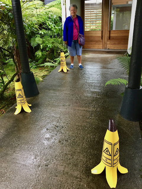
John was amused by these banana skin-shaped signs warning of a slippery surface


Friday 4 December

It rained all night, and it was still raining hard when we had breakfast at 8:30 am. We pressed on and stopped briefly at Ross, where there is a small museum that we took a peek at.

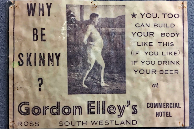
We saw this amusing advert in the Ross Museum

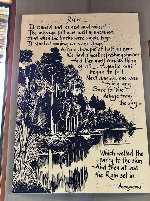
This poster in the Hokitika café says it all!

We got to Hokitika by about 10:30. By this stage it was still hosing down, so we checked at the i-Site, and found out that there was less likelihood of rain on the other side of the divide, so we decided to cut our losses, cancelled our hotel booking in Westport and headed towards Arthur’s Pass.

The road over Arthur’s Pass was lovely, though wet. We stopped for photos of the Otira Gorge, and got to the Otira Viaduct, just as the cloud made the view very marginal.
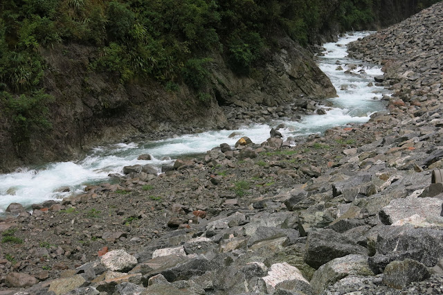

The Otira River

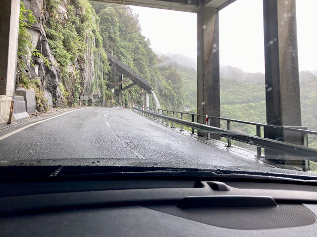
Tunnels protecting the road from water and rocks

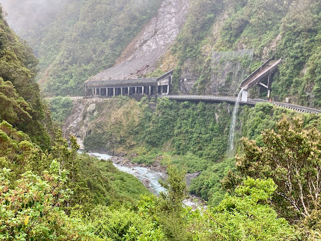
Seen from the lookout

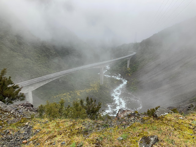
The Otira Viaduct, just before it disappeared into the cloud

Almost as soon as we were over Arthur’s Pass, the rain abated. The scenery was beautiful, very dramatic with high mountains and great shingle slides. And soon we were seeing a bit of blue sky.

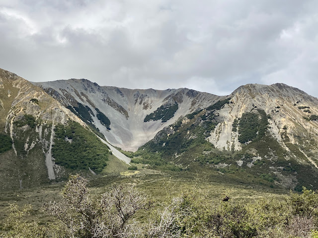
Dramatic high mountains with great shingle slides (DP)

Once over the divide, we decided to push on until Kaikoura. I managed to book a motel for the night, online, on my phone and we got there by 6:30. The motel was very basic, but it was opposite the beach, and we enjoyed a lovely sunset.

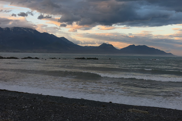
Sunset on the beach at Kaikoura


Saturday 5 December

John woke me at 6:45 am! Much too early for a night owl like me. He decided we would not have breakfast, we would have it somewhere along the road and we left at 7:15. Of course there was nowhere open at that time on a Sunday morning, at a time with very little tourist activity. “Oh, that’s OK, we will have breakfast at Kekerengu”, said John. We got there at 8:30, and it was not open.

So on we pushed, and got to Picton at 9:30. We went straight to the Bluebridge office, expecting it to still be closed too, but we were in luck. The woman at the counter was very helpful and was able to change our 7:15 pm booking for one on the 2pm sailing. Excellent, report at 1 pm.

Off to have some ‘breakfast’ at last. At a foreshore café, we had coffee and scones, then went for a walk, around, and around, the place while the weather was trying to rain, but never quite making it.

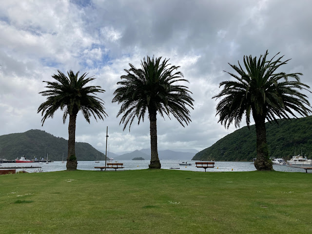
Picton foreshore (DP)

In Picton

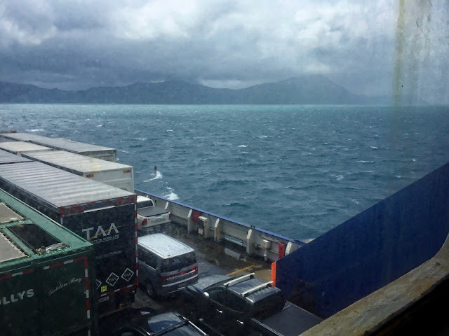
Coming into Wellington Harbour - nearly home!

It was a smooth sailing, no swell, but it was raining and blowing when we got to Wellington.

It had been a great holiday, and we were really lucky with the weather, with only one day of rain.

After we got back, there was very heavy rain overnight, which caused flooding in various places around the Wellington Region. How lucky we were to have escaped such deluges while away. And now, we were quite happy to stay home.


Wednesday 9 February 2022

South Island Trip - Nov/Dec 2021 - Part 2

Part 2

This is the second part of the holiday we had in the South Island in November/December 2021. Part 1 is here, and part 3 is here.
 

Clyde to Arrowtown

Saturday 27 November

The small house we had booked in Clyde was a throwback to the 1950s. Its style was very similar to the Ministry of Works house where we lived in Christchurch in the early 70s - same kind of kitchen cupboards, same kind of interior doors and joinery. We could really imagine ourselves back five decades, as there was no TV, no microwave, and no internet. A minor inconvenience, but there was a shelf of books, and in the three evenings, I managed to get through the best part of a good novel. 

It had turned quite cold overnight, and there was a threat of rain, so we thought Alexandra would be our best bet to avoid the rain. So we decided to ride the Clyde to Alexandra 150th Anniversary River Track. This is an alternative way to ride the first section of the Otago Central Rail Trail. When we biked the Rail Trail, way back in 2013, on our original, non-electric, folding bikes, we decided to take the easier, more level option to get from Clyde to Alexandra. 

As we discovered today, that had definitely been the right decision back then. The track is certainly very pretty, but I think we would not have enjoyed it very much that early in our first biking adventure. As it was, John wasn’t feeling the best today, and he found the track a bit challenging.

It’s a very pretty track, but quite tricky, quite narrow in places, and also lumpy-bumpy some of the time. Quite a few ups and downs, lots of little bridges with the track running beside it in a big dip.

The track was undulating …

... and a bit rough in places
 

This area was gold mining country in the early 1900s, and there is still evidence of the tailings in the shape of the land with its ridges.  

A reminder of the gold mining day

The impressive roots of a pine tree growing on the tailing ridge

The track skirts the mighty Clutha River/Mata-Au, sometimes it runs quite near the Clutha River, sometimes it is a bit higher up among the gold digging tailings. Lots of yellow lupins and viburnums in flower, and huge willows, some of which reached right over the track. 

The mighty Clutha (DP)

Trees growing over the track

In one place we came across some kayakers perfecting their turns on a practise course set out on an inlet.  

A kayaking practise course (DP)

Practising their turns
 

John was having quite a bit of trouble with his balance, and was generally feeling rather fragile. He said he needed a coffee, but we had to bike another 10 km before we could get one. He would stop at all the little bridges and walk across. Some of the bridges had no water flowing under them, so we could remain on the track in the dip next to the bridge.

John walked across all the little bridges (DP)

Circumventing the little bridge on a dry track

The last bit of the track, just before the bridge into Alexandra, was very steep and lumpy, and we both had to step off half-way, and walk the rest of the way. We cruised around the streets for a bit, until we found a café that was open (many were not), and John was able to get the coffee he so needed. 

The bridge into Alexandra. Note the pedestal of the original bridge in the background

As we were leaving the café, it started to rain, gently at first, but it soon became more persistent, so we put on our parkas which we had brought along in a pannier.

John had brought his rain-proof camera

We went back via the Rail Trail, as it was straight, smoother and shorter. At one stage we chose to ride on the road, rather than the track to make faster progress, as it was getting rather unpleasant with the rain. When the road diverged away from the track, we went back to the track. After a while the rain eased, and it had stopped raining by the time we got to the Trail Journeys place in Clyde that we had started from when we did the whole trail all those years ago. A bit more, and we were ‘home’.

The start of the Rail Trail - but the end of the ride for us today
 

Later, before and after dinner at the local pub, The Post Office Bar and Café, we took a walk through the lovely town of Clyde. The streets are wide and quiet, the houses old and quaint, and the gardens pretty, with masses of roses, at this time of year. 

Gardens full of roses

Luscious roses

Sunday 28 November

The day dawned fine, and we planned to bike the easy bit of the Lake Dunstan Cycle trial. But we started with a bit of drama. 

Breakfast, and getting ready. Got your house key? No, where is it? Key with an orange tag - I dive into my handbag, yes, here it is. I don’t take my handbag when I go biking, I take the “baggie”. I carefully place the key in my biking baggie. Off we go. About 5 km out of Clyde, I realise I have left my phone, sitting on charge. Bugger. We have to go back to get it. 

Two kilometres on the way back, I realise, to my horror, that the key with the orange tag is NOT the house key - it’s a different type of key. But what is this key then? Later it dawns on me that its is in fact the key to the inside door of our garage at home, that I put in the zipped side pocket in my handbag where I always keep the car key and my house key (our home house key). But now, we don't have the key to get into the Book-a-Bach house. Not only that, but my phone, with all the details about contacts, is in the house - that we can’t get into! AAARGH!!!! So what to do?

We get back to the house, John tries to fiddle with the lock on the ranch slider at the back of the house. Meantime, I have found the name of the contact for the house by searching Book-a-Bach on John’s phone, and I find that his name is C... . But no phone number - I could email but he may not answer today or even tomorrow! He may not even be in Clyde …

Perhaps the neighbours know who and where he is. I try knocking on the door at the two houses opposite, where there are cars on the property, so there must be someone around, but there’s no answer to my knocking.

John is still fiddling with the ranch slider door - he’s got all his tools out, and he has half the lock dismantled, but he can’t get at the catch.

So I drive down to the bike place, “Bike it Now”, where we had enquired about the track to Alexandra yesterday, and the lady was very helpful. I explain the pickle we are in. Did they know the contact, C...? No, but they know someone called R...(same surname). One of the ladies offers to ring around, only to find out that R... has died and his son C... lives in Invercargill. She tries to ring C ... in Invercargill (from the White Pages), but there’s no reply. So they ring Craig, the local locksmith, who luckily is in Clyde. He’ll be there in 15 minutes! Ah, bless you ladies, thank you so much.

I drive back only to find that John has managed to pick the ranch slider lock, and Craig will come in vain. I sit on the front doorstep waiting for him. Luckily, he’s a nice guy, and laughs when we tell him that John has already managed to pick the lock. “All thanks to your mis-spent youth, eh?” I offer to pay him for the call-out, on a Sunday morning too, but he won't hear of it. ”I wasn’t going to charge you anyway”, he says, and with a smile, he’s on his way.

Now, where is the bloody key!?! Another search of my handbag, and there it is, in the phone pocket on the front of the bag. Relief! “Now, attach it to your car key!” says John irritably.

I do as told, gather up my phone, and we can get going - first back to the bike shop to thank the ladies for their help, then to Dunstan House for coffee and a cinnamon roll, that we sorely needed. Then, finally, we are on our way.

I had thought we could park at Bannockburn Bridge, as we had already biked from Cromwell to the bridge a couple of days ago, but John was reluctant to leave the car there, he thought it would be safer in Cromwell, with other cars around. So we parked by the Heritage Precinct.

The early part of the track, that we did a couple of days earlier, is really lovely. John felt he needed the “easy” part of the track to get himself “stabilised” as he was feeling quite wobbly at first.

Looking across to where the track climbs to the Carrick Winery

The bridge has a separate track below and to the side of the road deck for cyclists and walkers. We crossed and turned left towards Cornish Point.

The cycle track below the Bannockburn Bridge

I did not like this very steep bit with a sharp switchback to get down to the bridge track
 

Now the track becomes more up and down and winding. We have to negotiate some switchbacks to get to the Carrick Winery, where there is a cafe/restaurant and bike racks provided. The track actually goes through the winery property, but we don’t stop. Lots of bikes are already parked there.

After Cornish Point the scenery becomes wilder, more rocky, and we are in the gorge, where the track gets very narrow, and the rocks loom above us, and the drop is steep on the other side. Some bits I don't much like, steep and narrow, and I worry about John on the narrow bits. There are quite a lot of other cyclists too, in both directions (this being Sunday).

The scenery becomes wilder …

… and steeper 
 

There are areas where you are not supposed to stop, for fear of rock falls. And we get to the famous sections where the track becomes a boardwalk clinging to the sheer rock wall. Amazing, what a feat of engineering! Despite its apparent precariousness, it feels sturdy and safe.

A feat of engineering (DP)

The boardwalk clings to the rock wall

Eventually we arrive at “Coffee Afloat” - a floating café, in two small boats, moored in a small inlet. A brilliant venture, 20 km from Cromwell, this is the only place to get a coffee on this 55 km trail. They started with just the coffee boat, and they recently added the food boat, and on a day like today - a brilliant Sunday - they’re doing a roaring trade. There are a good couple of dozen people who have stopped there for coffee and the Belgian waffles and burgers that the second boat is offering.

“Coffee Afloat” - what a welcome sight!

The second boat offered burgers and Belgian waffles
 

We try to order some waffles, but we are told they have just sold their last one, so we settle for coffee and a muffin. There is not a lot of room, people sit on the grassy edge, but we manage to score one of the benches while we have our coffee. I prepare to take a photo of John standing by the coffee boat, and a kind chap offers to take a photo of us both. Nice!

We manage to find a seat to enjoy our coffee

A kind stranger offered to take a photo of us both

After this pleasant interlude, this is where we turn around to go back. The rest of the track ahead climbs steeply and skinny over the rocks - and the track becomes a Level 3, which we are not prepared to tackle.

Ready for the return trip

You were not allowed to stop on the boardwalk - for fear of rockfalls

Some of the bits that had seemed scary on the way out, were not so bad going back. But it was hot, and by the time we got to Carrick Winery we decided to stop and have a cool drink. I was feeling hot and bothered, and got quite crabby when I had trouble parking my bike so it wouldn’t run downhill. Then, when I wanted to lock it, I found I didn’t have my bike key. AAARGH! More key trouble! John was not impressed, but fortunately he had a spare key.

We went to the caravan selling drinks, and of course this is a winery, so I felt silly asking for lemonade, but they did have it - in bottles, like beer - no glass offered, how barbaric!

The two tables with actual chairs in the shade were occupied, so in order to be able to be in the shade, we had to sit on beanbags - hard enough to get down into, damn near impossible to get out of! And then, as John finished his drink before me, he wandered off, leaving me to struggle to get up out of the beanbag. I could have done with a hand up. I felt cast - like a blooming pregnant ewe!

We finally made it back to the car, by 4:15, having biked 39 km. I was feeling pretty grumpy. Though the bike ride had been great, I do remember this as rather a ‘fraught’ day. 


Sunday 29 November

Today we were heading to Arrowtown, where we would be staying for the next four nights. SH 8, between Clyde and Cromwell runs on the opposite side of the Cromwell Gorge from where we were biking the day before, and it was interesting to see the boardwalks clinging to the sheer rocks from this angle.

The boardwalk we had biked on the previous day

Further along, we stopped at the Dunstan Gold Rush Memorial, a plaque paying tribute to the miners, who had discovered gold here in 1862.

The Gold Rush memorial plaque

It was not very far from Clyde to Arrowtown, and as we could not get into the cottage we had rented until later in the day, we drove to Glenorchy. It’s a beautiful drive, with glorious views over Lake Wakatipu, and out towards the snow-clad mountains. We had a brief stop at Wilsons Bay for a closer look at the lake.

Wilsons Bay

We stopped at a place called Bennet’s Bluff Lookout, where there is a beautiful, HUGE, brand-new carpark, with room for dozens of cars, and several buses, and a nice little track up to the lookout - all for the almighty tourist boom ... that never happened! It was completed just before Covid kicked in, overseas visitors were banned, and we entered the first lockdown. In the past two years, it has barely been used. There were two cars when we pulled in, and by the time we left there was nobody around anymore.

The huge carpark at Bennett’s Bluff Lookout

By the time we left, there were no other cars

The views over the lake and towards the mountains in the distance were sublime. This lookout is well worth a stop. We were lucky to see it without having to fight our way through masses of overseas tourists!

What a fantastic view towards the mountains. The islands are called Pig Island and Pigeon Island

Looking across the lake

Down at lake level
 

Glenorchy was very quiet, the one decent café - where we had lunch on our last visit here, eight years ago - was all closed up. Another victim of Covid restrictions. But we managed some coffee and lunch at a little place further along. We went for a lovely amble around the foreshore, John took lots of photos. It is such a beautiful place. Someone took a photo of us on the jetty, and we did the same for them.

On the Glenorchy wharf

The well-known Glenorchy shed was originally built for the NZ Railways as a goods shed for freight carried on the steamers between Queenstown and Glenorchy

The famous willows growing in the water

Here too, lupins abound

So many different shades of green!

Back in Queenstown, we were horrified at the way the town has developed since the last time we were here. It is quite awful. There are roadworks everywhere, blocked-off streets being made into pedestrian areas. The hotels along the foreshore must have been competing to be the ugliest in the universe!

And it was quite busy in town really, despite all the tales of woe we have heard in the media about how tourism is down and businesses are going to the wall. I hate to think what it must be like when there are actually lots of tourists in town - like full season, with overseas tourists. It must be hell!

We walked around town for a bit, we dropped into an i-Site, and I booked a cruise on the Steamship Earnslaw with barbecue lunch at Walter Peak Station, for tomorrow.

Looking up into a huge sequoia near where we parked

John really liked this tree
 

We got to our cottage in Arrowtown about 4-ish. We settled in, then went for a walk to find a supermarket. We should have driven, as it was further than I thought - especially as I thought it was this-a-way, and John thought it was that-a-way, and he said OK, you go your way and I’ll go mine. It took me an awful long time to get there, because of course he was right, and I got lost. He had the map, and I had to invoke my phone map. My feet were sore, and it was so hot in the sun …

When it came to going out to dinner, I refused to walk to the pub, even though it really was not very far.  Dinner at the pub was quite nice, in a shady courtyard. After eating, we walked into the main shopping street and around for a bit - all closed by now of course - then went back to the cottage.

The quiet main street in Arrowtown